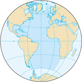
The Atlantic Ocean is the second largest and deepest ocean of the Earth after the Pacific Ocean , located between Greenland and Iceland in the north, Europe and Africa in the east, North and South America in the west and Antarctica in the south.
| Atlantic Ocean | |
|---|---|
 | |
| Specifications | |
| Square | 91.66 million km² |
| Volume | 329.66 million km³ |
| Deepest | 8742 m |
| Average depth | 3736 m |
| Location | |
The area is 91.66 million km², of which about 16% is in the seas, bays and straits. The area of the coastal seas is small and does not exceed 1% of the total water area . The volume of water is 329.66 million km³, which is equal to 25% of the volume of the World Ocean . The average depth is 3,736 m, the greatest is 8,742 m ( Puerto Rico trench ). The average annual salinity of the ocean is about 35. The Atlantic Ocean has a highly rugged coastline with a pronounced division into regional water areas: the sea and the bays.
The name comes from the name of Titan Atlas (Atlanta) in Greek mythology .
Etymology
The name of the ocean first occurs in the V century BC. e. in the writings of the ancient Greek historian Herodotus , who wrote that "the sea with the pillars of Hercules is called Atlantis ( ancient Greek Ἀτλαντίς - Atlantis)". The name comes from the myth of Atlanta , a titan holding the celestial vault on its shoulders in the extreme western part of the Mediterranean, known in ancient Greece . The Roman scholar Pliny the Elder used the modern name Oceanus Atlanticus ( Latin Oceanus Atlanticus ) - “Atlantic Ocean” in the 1st century. At different times, parts of the ocean were called the Western Ocean , the North Sea , and the Outer Sea . From the middle of the 17th century, the Atlantic Ocean became the only name referring to the entire water area [1] .
Physical-geographical characteristic
| The oceans | Square surface water, million km² | Volume million km³ | Average depth, m | The greatest ocean depth m |
|---|---|---|---|---|
| Atlantic | 91.66 | 329.66 | 3736 | Puerto Rico Trench (8742) |
| Indian | 76.17 | 282.65 | 3711 | Sunda Trench (7209) |
| Arctic | 14.75 | 18.07 | 1225 | Greenland Sea (5527) |
| Quiet | 178.68 | 710.36 | 3976 | Mariana Trench (11,022) |
| World | 361.26 | 1340.74 | 3711 | 11 022 |
General Information
The Atlantic Ocean is the second largest. Its area is 91.66 million km², the volume of water is 329.66 million km³. It extends from subarctic latitudes to Antarctica itself [3] . The border with the Indian Ocean passes along the meridian of Cape Agulny (20 ° E) to the coast of Antarctica ( Queen Maud Land ) [4] . The border with the Pacific Ocean is carried from Cape Horn along the meridian of 68 ° 04 'h. or by the shortest distance from South America to the Antarctic Peninsula through the Drake Strait , from Ost Island to Cape Sternek. The border with the Arctic Ocean passes through the eastern entrance of the Hudson Strait , then through the Davis Strait and along the coast of Greenland to Cape Brewster , through the Danish Strait to Cape Reidinupyur on Iceland , along its coast to Cape Gerpiri, then to the Faroe Islands , then to Shetland islands and 61 ° north latitude to the coast of the Scandinavian Peninsula [5] . Sometimes the southern part of the ocean, with the northern boundary from 35 ° south. sh. (based on the circulation of water and the atmosphere) to 60 ° S. sh. (by the nature of the bottom relief), attributed to the Southern Ocean .
Seas and bays
The area of the seas, bays and straits of the Atlantic Ocean is 14.69 million km² (16% of the total ocean area), the volume of 29.47 million km³ (8.9%). The most famous seas and main bays (clockwise): Irish Sea , Bristol Bay , North Sea , Norwegian Sea , Baltic Sea ( Gulf of Bothnia , Gulf of Finland , Gulf of Riga ), Bay of Biscay , Mediterranean Sea ( Alboran Sea, Balearic Sea , Ligurian Sea , Tyrrhenian Sea , Adriatic Sea , Ionian Sea , Aegean Sea ), Sea of Marmara , Black Sea , Sea of Azov , Gulf of Guinea , Riiser-Larsen Sea, Lazarev Sea, Weddell Sea , Scotia Sea (the last four are sometimes referred to the Southern Ocean ), Caribbean e Sea , Gulf of Mexico , the Sargasso Sea , the Gulf of Maine , the Gulf of St. Lawrence , the Labrador Sea [2] . They also distinguish the Irminger Sea (between Greenland and Iceland), the Celtic Sea , the Iroise Sea , watts off the coast of the Netherlands and other parts.
| Ocean View from Newfoundland Island ( Canada ) | Elba Island in the Mediterranean | Beach on the island of Cuba near the city of Varadero | Glacier on Bouvet Island in the South Atlantic |
Islands
The largest islands and archipelagoes of the Atlantic Ocean: the British Isles ( Great Britain , Ireland , Hebrides , Orkney Islands , Shetland Islands ), the Greater Antilles ( Cuba , Haiti , Jamaica , Puerto Rico , Juventud ), Newfoundland , Iceland , the Archipelago of Tierra del Fuego ( Fiery Land , Navarino ), Marajó , Sicily , Sardinia , the Lesser Antilles ( Trinidad , Guadeloupe , Martinique , Curacao , Barbados , Grenada , St. Vincent , Tobago ), Falkland Islands (Malvinas) ( East Falkland (Soledad) , West Falkland (Grand Malvina) ), Bahamas ( Andros , Grand Inagua , Grand Bahama ), Cape Breton , Cyprus , Corsica , Crete , Antiquity , Canary Islands ( Tenerife , Fuerteventura , Gran Canaria ), Zeeland , Prince Edward , Balearic Islands ( Mallorca ), South Georgia , Long Island , Moonsund Archipelago ( Saaremaa , Hiiumaa ), Cape Verde Islands , Evia , Southern Sporades ( Rhodes ), Gotland , Funen , Cyclades Islands , Azores , Ionian Islands , South Shetland Islands , Bioco , Bijagos Islands , Lesbos , Aland Islands , Faroe Islands , Elan d , Lolland , South Orkney , Sao Tome , Madeira , Malta , Principe , St. Helena , Ascension , Bermuda [2] .
Ocean Formation History
The Atlantic Ocean was formed in the Mesozoic as a result of the split of the ancient supercontinent Pangea into the southern mainland of Gondwana and northern Laurasia . As a result of the multidirectional movement of these continents at the very end of the Triassic led to the formation of the first oceanic lithosphere of the current North Atlantic. The rift zone formed was the western continuation of the rift rift of the Tethys ocean . At the early stage of its development, the Atlantic Basin was formed as a junction of the two large ocean basins of the Tethys Ocean in the east and the Pacific Ocean in the west. Further expansion of the depression of the Atlantic Ocean will occur at the expense of reducing the size of the Pacific Ocean. In the early Jurassic, Gondwana began to split into Africa and South America, and the oceanic lithosphere of the modern South Atlantic was formed. In the Cretaceous, Laurasia split, and the separation of North America from Europe began. At the same time, Greenland, shifting to the north, broke away from Scandinavia and Canada. Over the past 40 million years and up to the present, the development of the Atlantic Ocean basin continues along a single rift axis located approximately in the middle of the ocean [6] . Today, the movement of tectonic plates continues. In the South Atlantic, the African and South American plate diverge at a rate of 2.9–4 cm per year. In the Central Atlantic African, South American and North American plates diverge at a speed of 2.6-2.9 cm per year. In the North Atlantic, the spread of the Eurasian and North American plates continues at a rate of 1.7–2.3 cm per year. North American and South American plates move to the west, African to the northeast, and Eurasian to the southeast, forming a compression belt in the Mediterranean region [7] .
Geological structure and bottom relief
Submarine continental margins
Large areas of the shelf are correlated with the northern hemisphere and are adjacent to the shores of North America and Europe . In Quaternary times, most of the shelf was exposed to continental glaciation , which formed relict glacial relief forms . Another element of the relic relief of the shelf is the flooded river valleys found in almost all shelf areas of the Atlantic Ocean. Relict continental sediments are widespread. Off the coast of Africa and South America, the shelf covers smaller areas, but in southern South America it expands significantly (Patagonian shelf). Sandy ridges are formed by tidal currents, which are the most widespread of modern sub-earthen landforms . They are very characteristic of the North Sea shelf, they are found in large numbers in the English Channel , as well as on the shelves of North and South America. In equatorially tropical waters (especially in the Caribbean , in the Bahamas banks , off the coast of South America), coral reefs are diverse and widely represented [3] .
The continental slopes in most regions of the Atlantic Ocean are expressed by steep slopes, sometimes with a stepped profile and deeply dissected by submarine canyons . In some areas, the continental slopes are complemented by marginal plateaus : Blake , São Paulo , Falkland on the American submarine margin ; Podkupayn and Goban on the underwater outskirts of Europe. The block structure is the Farrero-Iceland threshold , stretching from Iceland to the North Sea. In the same region, Rokkol Hill is located , which is also the submerged part of the submarine part of the European subcontinent [3] .
The continental foot, on the most part of the stretch, is an accumulation plain lying at a depth of 3-4 km and composed of a thick (several kilometers) layer of bottom sediments. The three rivers of the Atlantic Ocean are among the ten largest in the world - the Mississippi (solid flow of 500 million tons per year), the Amazon (499 million tons) and the Orange (153 million tons). The total volume of sedimentary material carried annually to the Atlantic Ocean basin by only 22 of its main rivers is more than 1.8 billion tons. In some regions of the continental foot, there are large discharge cones of turbid currents, among them the most significant removal cones of submarine canyons of the Hudson , Amazon , Rhone (in the Mediterranean), Niger , Congo . Along the North American continental margin, giant accumulative relief forms are formed along the continental foot in the south due to the bottom flow of cold arctic waters (for example, “sedimentary ridges” of Newfoundland , Blake-Bahamas, and others) [3] [8] .
Transition Zone
The transition zones in the Atlantic Ocean are represented by the following areas: the Caribbean, the Mediterranean, and the Scotia Sea Region or the South Sandwich Region.
The Caribbean region includes: the Caribbean Sea , the deep-water part of the Gulf of Mexico , island arcs and deep-sea gutters. The following island arcs can be distinguished in it: Cuban , Cayman - Cera Maestra , Jamaica - Southern Haiti , the outer and inner arcs of the Lesser Antilles . In addition, the submarine elevation of Nicaragua , the Beata and Aves ranges are distinguished here. The Cuban arc has a complex structure and has the Laramii age of folding. Its continuation is the northern cordeler of the island of Haiti. The folded structure of Cayman — Sierra Maestra, which has a Miocene age, begins with the Maya mountains on the Yucatan peninsula , then continues as a submarine Cayman ridge and a mountain range of the South Cuba Sierra Maestra . The Little Antilles Arc includes a number of volcanic formations (including three volcanoes, for example, Montagne-Pele ). The composition of the products of the eruption: andesites , basalts , dacites . The outer ridge of the arc is limestone . From the south, the Caribbean Sea is flanked by two parallel young ridges: the arc of the Leeward Islands and the mountain range of the Caribbean Andes , passing east to the Trinidad and Tobago Islands. Island arcs and submarine ridges divide the bottom of the Caribbean Sea into several depressions that are aligned with a thick layer of carbonate bottom sediments. The deepest of them - the Venezuelan (5420 m). Here there are two deep-sea troughs - Cayman and Puerto Rico (with the deepest Atlantic ocean at the most - 8742 m) [3] .
The areas of the Scotia Ridge and the South Sandwich Islands are borderlands - areas of the continental submarine fragmented by tectonic movements of the earth's crust. The island arc of the South Sandwich Islands is complicated by a series of volcanoes. From the east it is adjacent to the South Sandwich deep-sea trench with a maximum depth of 8228 m. The mountainous and hilly relief of the Scotia Sea bottom is connected with the axial zone of one of the branches of the mid-oceanic ridge [3] .
The Mediterranean continental crust is widespread in the Mediterranean. The suboceanic crust is developed only in spots in the deepest depressions: the Balearic , Tyrrhenian , Central and Cretan . The shelf is substantially developed only within the Adriatic Sea and the Sicilian threshold. The mountain folded structure connecting the Ionian Islands , Crete and the islands to the east of the latter constitute an island arc, which is bounded from the south by the Hellenic Trench , in turn, from the south, framed by the rise of the Eastern Mediterranean shaft. The bottom of the Mediterranean Sea in geological section is composed of salt-bearing strata of the Messinian layer ( Upper Miocene ). The Mediterranean Sea is a seismic zone. Several active volcanoes have survived here ( Vesuvius , Etna , Santorini ) [3] .
Mid-Atlantic Ridge
The meridional Mid-Atlantic Ridge divides the Atlantic Ocean into eastern and western parts. It begins off the coast of Iceland called the Reykjanes Range . Its axial structure is formed by the basalt ridge, rift valleys in the relief are poorly pronounced, but active volcanoes are known on the flanks. At latitude 52-53 ° c. sh. The mid-oceanic ridge crosses the transverse fault zones of Gibbs and Reykjanes . Behind them begins the Mid-Atlantic Ridge with a clearly defined rift zone and rift valleys with numerous transverse faults and deep grabens . At latitude 40 ° c. sh. The mid-ocean ridge forms the Azores volcanic plateau , with numerous surface (forming islands) and underwater active volcanoes. To the south of the Azores Plateau in the rift zone, under basal silts with a thickness of 300 m, basalts lie, and under them is a block mixture of ultrabasic and basic rocks. In this area there is a modern violent volcanic and hydrothermal activity . In the equatorial part, the North Atlantic Ridge is divided by a large number of transverse faults into a number of segments that experience significant (up to 300 km) lateral displacements relative to each other. Near the equator with the deep-sea faults is connected the Romansh depression with depths up to 7856 m [3] .
The South Atlantic Ridge has a meridional strike. The rift valleys are well expressed here, the number of transverse faults is less, therefore this ridge looks more monolithic in comparison with the North Atlantic ridge. In the southern and middle parts of the range, volcanic plateaus of Ascension , the islands of Tristan da Cunha, Gough, Bouvet are distinguished. The plateau is confined to active and recently active volcanoes. From the island of Bouvet, the South Atlantic Ridge turns to the east, rounds Africa and, in the Indian Ocean, joins the West Indian median ridge [3] .
Ocean
The Mid-Atlantic Ridge divides the bed of the Atlantic Ocean into two almost equal parts. In the western part, the mountain structures: the Newfoundland Range , the Barakuda Range , the Ceará and the Rio Grande Rises divide the ocean floor into basins: Labrador , Newfoundland , North American , Guiana , Brazilian , Argentine . To the east of the mid-ocean ridge, the bed is divided by the underwater base of the Canary Islands , the rise of the Cape Verde Islands , the Guinean Rise and the Whale Ridge on the hollows: West European , Iberian , North African , Cape Verde , Sierra Leone , Guinea , Angola , Cape . In the basins, flat abyssal plains are widespread, composed mainly of the calcareous biogenic, as well as terrigenous material. On most of the area of the ocean floor rainfall is more than 1 km. A layer represented by volcanic rocks and compacted sedimentary rocks was found under sedimentary rocks [3] .
In the areas of depressions distant from the submarine margins of the continents, abyssal hills are distributed along the periphery of the mid-oceanic ridges. About 600 mountains are located within the ocean floor. A large group of seamounts is confined to the Bermuda Plateau (in the North American Basin ). There are several large submarine valleys, of which the most significant are the Hazen and Mori valleys in the northern part of the Atlantic Ocean, stretching on both sides of the Mid-Ocean Ridge [3] .
Bottom sediments
The sediments of the shallow part of the Atlantic Ocean are represented mostly by terrigenous and biogenic sediments, and occupy 20% of the ocean floor. Of the deep-water sediments, limestone foraminiferous silts are the most common (65% of the ocean floor area). In the Mediterranean and Caribbean seas, in the southern zone of the South Atlantic Ridge, pteropod deposits are widespread. Deep-sea red clay occupies about 20% of the ocean floor and is confined to the deepest parts of the oceanic depressions. Radiation sludge is found in the Angolan Basin. In the southern part of the Atlantic, siliceous diatom deposits are present with an authigenic silica content of 62–72%. A continuous field of diatom silt , with the exception of the Drake Passage, is being pulled in the Western Winds Flow Zone. In some hollows of the ocean floor terrigenous aleurites and pelites are significantly developed. Terrigenous deposits at the abyssal depths are characteristic of the North Atlantic, Hawaiian, and Argentine basins [3] .
| Crack along the Mid-Atlantic Ridge in iceland | Eruption of the Soufriere Hills Volcano on the island of Montserrat . Lesser Antilles | Hurricane Katrina . View from space. August 28, 2005 | Routes of all hurricanes recorded from 1851 to 2005 |
Climate
The variety of climatic conditions on the surface of the Atlantic Ocean is determined by its large meridional length and circulation of air masses under the influence of four main atmospheric centers: the Greenland and Antarctic maxima , the Icelandic and Antarctic minima. In addition, two anticyclones constantly operate in the subtropics: the Azores and the South Atlantic . They are separated by the equatorial region of reduced pressure. This distribution of baric regions defines the system of the prevailing winds in the Atlantic. The greatest influence on the temperature regime of the Atlantic Ocean is exerted not only by its large meridional extent, but also by water exchange with the Arctic Ocean, the Antarctic seas and the Mediterranean Sea. Surface waters are characterized by their gradual cooling with distance from the equator to high latitudes, although the presence of powerful currents causes significant deviations from zonal temperature regimes [9] .
On the expanses of the Atlantic are represented all climatic zones of the planet. For tropical latitudes, slight seasonal fluctuations in temperature are observed (the average value is 20 ° C) and heavy rainfall. To the north and south of the tropics there are subtropical belts with more noticeable seasonal (from 10 ° C in winter to 20 ° C in summer) and daily temperature fluctuations; precipitation here falls mostly in summer. A frequent phenomenon in the subtropical zone is tropical hurricanes . In these monstrous atmospheric eddies, the wind speed reaches several hundred kilometers per hour. The most powerful tropical hurricanes are rampant in the Caribbean: for example, in the Gulf of Mexico and on the islands of the West Indies. West Indian tropical hurricanes form in the western part of the ocean in the region of 10–15 ° C. sh. and move to the Azores and Ireland. Further to the north and south there are subtropic zones, where in the coldest month the temperature drops to 10 ° C, and in winter cold air masses from polar low-pressure regions bring abundant precipitation. In temperate latitudes, the average temperature of the warmest month is kept within 10–15 ° C, and the coldest one is –10 ° C. It also notes significant daily temperature drops. For the temperate zone, precipitations are fairly evenly falling (about 1000 mm) during the year, reaching a maximum in the autumn-winter period, and frequent fierce storms, for which southern temperate latitudes are called “roaring forties”. The isotherm of 10 ° C defines the boundaries of the North and South circumpolar belts. In the Northern Hemisphere, this boundary extends in a wide band between 50 ° C. sh. (Labrador) and 70 ° c. sh. (coast of northern Norway). In the southern hemisphere, the circumpolar zone begins closer to the equator — approximately 45–50 ° S. sh. The lowest temperature (-34 ° C) was recorded in the Weddell Sea [9] .
Hydrological regime
Surface water circulation
Powerful carriers of thermal energy are circular surface currents located on both sides of the equator : these are, for example, North Passat and South Passat currents that cross the ocean from east to west. The Passat current at the Lesser Antilles is divided: the northern branch continues north-west along the shores of the Major Antilles (the Antilles Current ) and the southern branch extends through the Straits of the Lesser Antilles to the Caribbean Sea, and then flows through the Yucatan Strait into the Gulf of Mexico , and out of it through the Florida Straits , forming the Florida Current . The latter has a speed of 10 km / h and gives rise to the famous Gulf Stream . The Gulf Stream, following along the American coast , at 40 °. sh. as a result of the influence of the western winds and the force of Coriolis, it acquires an eastward, and then northeastern direction, and is called the North Atlantic Current . The main flow of the North Atlantic Current flows between Iceland and the Scandinavian Peninsula and flows into the Arctic Ocean , softening the climate in the European Arctic sector. Two powerful streams of cold desalinated water flow out of the Arctic Ocean — the East Greenland current running along the eastern coast of Greenland and the Labrador current enveloping Labrador , Newfoundland and penetrating south to Cape Hatteras , pushing the Gulfstream off the coast of North America [9] .
The South Passat current partly enters the northern hemisphere , and at Cape San Roque it is divided into two parts: one of them goes to the south, forming the Brazilian current , the other turns north, forming the Guiana current , which goes into the Caribbean Sea . The Brazilian current in the region of La Plata meets the cold Falkland Current (an offshoot of the Stream of the Western winds ). Near the southern end of Africa, the cold Benguela Current branches off from the stream of the West winds and, moving along the coast of South-West Africa, gradually deviates to the west. In the southern part of the Gulf of Guinea, this current closes the anticyclonic circulation of the South trade-wind current [9] .
In the Atlantic Ocean there are several tiers of deep-sea currents. Under the Gulf Stream there is a powerful backflow, the main shaft of which lies at a depth of up to 3500 m, at a speed of 20 cm / s. Counterflow flows in a narrow stream in the lower part of the continental slope, the formation of this current is associated with the bottom flow of cold waters from the Norwegian and Greenland Seas . In the equatorial zone of the ocean openly subsurface Lomonosov current . It starts from the Anti-Guiana Counter Flow and reaches the Gulf of Guinea. A powerful deep Louisiana current is observed in the eastern Atlantic Ocean, formed by the bottom flow of more saline and warm Mediterranean waters through the Strait of Gibraltar [9] .
The largest tides are recorded in the Atlantic Ocean in the fjord bays of Canada (12.4 m in Ungava Bay , 16.6 m in Frobisher Bay ) and Great Britain (up to 14.4 m in Bristol Bay ). The largest tide in the world is recorded in the Bay of Fundy , on the east coast of Canada, where the maximum tide reaches 15.6–18 m [8] .
| Coming | Amount of water in km 3 in year | Consumption | Amount of water in km 3 in year |
|---|---|---|---|
| From the Arctic Ocean through the Straits: Davis , Danish , Faroese-Icelandic , Faroese-Shetland | 260 | Into the Arctic Ocean through the Straits: Davis, Danish, Faroese-Icelandic, Faroese-Shetland | 225 |
| From the Mediterranean through the Strait of Gibraltar | 52 | To the Mediterranean through the Strait of Gibraltar | 55 |
| From the Pacific Ocean through the Drake Strait with the course of the Western Winds (Antarctic Circumpolar Current) | 3470 | To the Pacific Ocean From the Atlantic Ocean through the Drake Strait with Coastal Antarctic Current, deep and near-bottom waters | 210 |
| From the Indian Ocean through the section Africa - Antarctica (20 ° E) with the Coastal Antarctic Current, deep and near-bottom waters | 1692 | Into the Indian Ocean through the section of Africa - Antarctica (20 ° E) with the course of the Western Winds (Antarctic Circumpolar Current) | 4976 |
| Precipitation | 93 | Evaporation | 125 |
| River flow | 20 | ||
| Underground runoff | one | ||
| Receipts from melting Arctic ice | 2 | ||
| Receipts from melting Antarctic ice | one | ||
| Total | 5591 | Total | 5591 |
Temperature, salinity, ice formation
The fluctuation of the temperatures of the Atlantic waters during the year is not great: in the equatorial - tropical zone - no more than 1-3 °, in the subtropics and temperate latitudes - within 5-8 °, in the polar latitudes - about 4 ° in the north and not more than 1 ° on South. The warmest waters are in equatorial and tropical latitudes. For example, in the Gulf of Guinea, the temperature in the surface layer does not drop below 26 ° C. In the northern hemisphere to the north of the tropics, the temperature of the surface layer decreases (at 60 ° N lat. It is 10 ° C in summer). In the southern hemisphere, temperatures increase significantly faster and by 60 ° S. sh. fluctuate around 0 ° C. In general, the ocean in the southern hemisphere is colder than in the northern. In the northern hemisphere, the western part of the ocean is colder than the eastern, in the southern - vice versa [9] .
The highest salinity of surface waters in the open ocean is observed in the subtropical zone (up to 37.25 ‰), and the maximum in the Mediterranean Sea - 39. In the equatorial zone, where the maximum amount of precipitation is noted, salinity decreases to 34. Sharp desalination occurs in the mouth areas (for example, in the mouth of La Plata 18-19) [9] .
Ice formation in the Atlantic Ocean occurs in the Greenland and Baffin Seas and Antarctic waters. The main source of icebergs in the South Atlantic is the Filchner Ice Shelf in the Weddell Sea . On the Greenland coast, icebergs are produced by outcrops, such as the Jacobshavn glacier in the area of the island of Disko . Floating ice in the northern hemisphere reaches 40 ° C in July. sh. In the southern hemisphere, floating ice is present throughout the year up to 55 ° S. sh., reaching a maximum distribution in September-October. The total removal from the Arctic Ocean is estimated at an average of 900,000 km³ / year, from the surface of Antarctica - 1,630 km³ / year [9] .
Water masses
Under the influence of wind and convective processes , vertical mixing of water in the Atlantic Ocean occurs, covering a 100 m thick surface layer in the southern hemisphere and up to 300 m in the tropics and equatorial latitudes. Below the surface water layer, outside the sub-Antarctic zone, the Antarctic intermediate water is located in the Atlantic, almost universally identified with an intermediate minimum of salinity and characterized by a higher content of nutrients in relation to the overlying waters, and extends north to an area of 20 ° C. sh. at depths of 0.7–1.2 km [9] .
A specific feature of the hydrological structure of the eastern part of the North Atlantic is the presence of an intermediate Mediterranean water mass, which gradually descends to a depth of 1000 to 1250 m, passing into a deep water mass. In the southern hemisphere, this water mass drops to 2500–2750 m and extends to the south of 45 ° south. sh. The main feature of these waters is high salinity and temperature in relation to the surrounding waters. In the bottom layer of the Strait of Gibraltar salinity is observed up to 38, temperatures up to 14 ° C, but already in the Gulf of Cadiz , where Mediterranean waters extend to the depths of their existence in the Atlantic Ocean, their salinity and temperature as a result of mixing with background water decreases to 36 and 12–13 ° C, respectively. At the periphery of the distribution area, its salinity and temperature are, respectively, 35 and about 5 ° С. North-Atlantic deep water is formed under the Mediterranean water mass in the northern hemisphere, which descends as a result of winter cooling of relatively saline waters in the North European basin and the Labrador sea to a depth of 2500-3000 m in the northern hemisphere and up to 3500-4000 m in the southern hemisphere, reaching to about 50 ° S. sh. North-Atlantic deep water differs from the above- and lower-lying Antarctic waters by increased salinity, temperature and oxygen content, as well as by a reduced content of biogenic elements [9] .
The Antarctic bottom water mass is formed near the Antarctic slope as a result of the mixing of cold and heavy Antarctic shelf water with lighter and warmer and saltier Circumpolar deep waters. These waters, spreading from the Weddell Sea , transshipping through all orographic obstacles up to 40 °. sh., have a temperature of less than minus 0.8 ºС in the north of this sea, 0.6 ºС at the equator and 1.8 ºС at Bermuda . The Arctic bottom water mass has lower salinity compared with the overlying waters and in the South Atlantic is characterized by a high content of biogenic elements [9] .
Flora and fauna
- See also: category " Atlantic Ocean Fauna "
The bottom flora of the northern part of the Atlantic is represented by brown (mainly fucoids , and in the sublittoral zone - by laminaria and alaria ) and red algae . In the tropical zone, green ( caulerpa ), red (calcareous lithothamia ) and brown algae ( sargasso ) predominate . In the southern hemisphere, bottom vegetation is mainly represented by kelp. The phytoplankton of the Atlantic Ocean has 245 species: peridins , coccolithophores , diatoms . The latter have a pronounced zonal distribution, the maximum number of them lives in temperate latitudes of the northern and southern hemispheres. The most densely populated diatoms are in the Western Winds Current Strip [9] .
| Blue whale off the coast of Iceland | Coral reefs near the island of Hierro . Canary Islands | Colony of king penguins on South Georgia Island | Albatross off the coast of Rio de Janeiro |
The distribution of the animal world of the Atlantic Ocean has a pronounced zonal character. In the sub-Antarctic and Antarctic waters of fish, they have the commercial importance of noothenia , whiting and others. Benthos and plankton in the Atlantic are poor in species and biomass . In the subantarctic zone and in the adjacent zone of the temperate zone, biomass reaches a maximum. In zooplankton , copepods and pteropods predominate; in nekton , from mammals, whales ( blue whale ), pinnipeds , and from fish, nototenie. In the tropical belt, zooplankton is represented by numerous species of foraminifera and pteropods, several types of radiolarians , copepods, larvae of mollusks and fish, as well as siphonophores , various jellyfish , large cephalopods ( squid ), and octopuses among the benthal forms. Commercial fish are represented by mackerel , tuna , sardines , and in areas of cold currents - anchovy . Corals are confined to tropical and subtropical zones. The temperate latitudes of the northern hemisphere are characterized by abundant life with a relatively small variety of species. Of the commercial fish, herring , cod , haddock , halibut , sea bass are of the greatest importance. For zooplankton, the most characteristic are foraminifera, copepods . The greatest abundance of plankton in the area of the Newfoundland banks and the Norwegian Sea . Deep-water fauna is represented by crustaceans , echinoderms , specific species of fish, sponges , hydroids . In the Puerto Rico Trench , several species of endemic polychaetes , isopods and holothurians have been found [9] .
Environmental Issues
Since time immemorial, the Atlantic Ocean has been a place of intensive marine fishing and hunting. The sharp increase in capacity and the revolution in fishing technique led to an alarming scale. With the invention of the harpoon cannon in the northern Atlantic, whales were mostly exterminated at the end of the 19th century. Due to the massive development of pelagic whaling in Antarctic waters in the middle of the 20th century, whales here were also close to complete extermination [9] . Since the 1985–86 season, the International Commission on Whaling has introduced a full moratorium on commercial whaling of all kinds. In June 2010, at the 62nd meeting of the International Whaling Commission, under pressure from Japan , Iceland and Denmark, the moratorium was suspended [10] .
view from space
The explosion on the oil platform Deepwater Horizon , owned by the British company BP , which occurred on April 20, 2010, is considered the largest environmental disaster that ever occurred at sea. As a result of the accident, about 5 million barrels of crude oil spilled into the waters of the Gulf of Mexico;1100 miles of coast. The government imposed a ban on fishing, for fishing , more than a third of the entire water area of the Gulf of Mexico is closed [11] . As of November 2, 2010, 6814 dead animals were collected, including 6104 birds, 609 sea turtles, 100 dolphins and other mammals , and 1 other reptile [12] . According to the Office of Specially Protected Resources of the National Oceanic and Atmospheric Administrations, in 2010–2011, the increase in mortality of cetaceans in the north of the Gulf of Mexico is several times higher than in previous years (2002-2009) [13] .
In the Sargasso Sea, a large garbage patch of plastic and other wastes formed, formed by ocean currents, gradually concentrating garbage dumped into the ocean in one area [14] .
Radioactive contamination is observed in some areas of the Atlantic Ocean. Waste from nuclear power plants and research centers is dumped into the rivers and coastal waters of the seas, and sometimes into the deep ocean. The North , Irish , and Mediterranean Seas , the Gulf of Mexico , the Bay of Biscay, and the US Atlantic Coast are among the highly contaminated areas of the Atlantic Ocean. In 1977 alone, 7,180 containers with 5,650 tons of radioactive waste were dumped into the Atlantic. The United States Environmental Protection Agency reported infecting the seabed 120 miles east of the Maryland - Delaware border. Over the course of 30 years, 14,300 cemented containers that contained plutonium and cesium were buried; radioactive contamination exceeded the “expected” 3-70 times. In 1970, the United States flooded the vessel Russell-Brigge, 500 km off the coast of Florida , carrying 68 tons of nerve gas (sarin) placed in 418 concrete containers. In 1972, in the waters of the ocean north of the Azores, Germany flooded 2,500 metal barrels with industrial waste containing potent cyanide poisons . There are cases of rapid destruction of containers in the relatively shallow waters of the Northern and Irish Seas and the English Channel, with the most disastrous consequences for the fauna and flora of water areas. 4 nuclear submarines sank in the waters of the North Atlantic: 2 Soviet (in the Bay of Biscay and the open part of the ocean) and 2 American (off the coast of the United States and in the open part of the ocean) [15] .
Atlantic Coast States
On the shores of the Atlantic Ocean and its seas, there are states and dependent territories:
- in Europe (from north to south): Iceland , Norway , Sweden , Finland , the Russian Federation , Estonia , Latvia , Lithuania , Poland , the Federal Republic of Germany , Denmark , the Netherlands , Belgium , the United Kingdom , Ireland , the Isle of Man (British possession), Jersey (possession of Great Britain), Guernsey (possession of Great Britain), France , Spain , Portugal , Gibraltar (possession of Great Britain), Italy , Malta , Slovenia , Croatia , Bosnia and Herzegovina , Montenegro , Albania , Greece , Turkey , Bulgaria , Romania , Ukraine , Georgia ;
- in Asia: Cyprus , the Turkish Republic of Northern Cyprus (partially recognized state), Akrotiri and Dhekelia (possession of Great Britain), Syria , Lebanon , Israel , Palestinian Authority (partially recognized state);
- in Africa: Egypt , Libya , Tunisia , Algeria , Morocco , Sahara Arab Democratic Republic (not recognized by the UN), Mauritania , Senegal , Gambia , Cape Verde , Guinea-Bissau , Guinea , Sierra Leone , Liberia , Cote d'Ivoire , Ghana , Togo , Benin , Nigeria , Cameroon , Equatorial Guinea , Sao Tome and Principe , Gabon , Republic of the Congo , Angola , Democratic Republic of the Congo , Namibia , South Africa , Bouvet Island (possession of Norway), Saint Helena, Ascension and Tristan da Cunha (possession of Great Britain);
- in South America (from south to north): Chile , Argentina , South Georgia and the South Sandwich Islands (British possession), Falkland Islands (British possession), Uruguay , Brazil , Suriname , Guyana , Venezuela , Colombia , Panama ;
- in the Caribbean: US Virgin Islands (US ownership), Anguilla (UK possession), Antigua and Barbuda , Bahamas , Barbados , British Virgin Islands (UK possession), Haiti , Grenada , Dominica , Dominican Republic , Cayman Islands (UK possession) , Cuba , Montserrat (British possession), Navassa (US possession), Puerto Rico (US possession), Saint Vincent and the Grenadines , Saint Kitts and Nevis , Saint Lucia , Turks and Caicos (British possession), Trinidad and Tobago Jamaica ;
- in North America: Costa Rica , Nicaragua , Honduras , Guatemala , Belize , Mexico , United States of America , Bermuda (British possession), Canada .
History of Atlantic Studies by the Europeans
Long before the era of great geographical discoveries, the expanses of the Atlantic were plied by numerous ships. Another 4000 years BC, the people of Phenicia were engaged in maritime trade with the inhabitants of the islands of the Mediterranean. At a later time from the 6th century BC, the Phoenicians, according to the testimony of the Greek historian Herodotus , made hikes around Africa, and through the Strait of Gibraltar and around the Iberian Peninsula reached the British Isles. By the 6th century BC, Ancient Greece, having a huge merchant fleet for that time, sailed to the shores of England and Scandinavia, in the Baltic Sea and to the west coast of Africa. In the X — XI centuries, the Vikings , according to most researchers of pre-Columbian discoveries, first and more than once swam across the ocean, reaching the shores of the Americas (they called him Vinland ), discovering Greenland and Labrador [16] .
In the 15th century, Spanish and Portuguese navigators began sailing far in search of routes to India and China. In 1488 the Portuguese expedition Bartholomeu Dias reached the Cape of Good Hope and rounded Africa from the south. In the years 1492-1498, the expedition of Christopher Columbus mapped many of the islands of the Caribbean in the vast continent, later called America . At the end of the 15th century, the rivalry between Spain and Portugal for dominance in the Atlantic escalated to such an extent that the Vatican was forced to intervene in the conflict. In 1494, the treaty was signed [17] , which along the 48-49 ° west longitude was established so-called. "Papal meridian". All the lands to the west of it were given to Spain, and to the east to Portugal. This conditional line crossed South America to the east.
In 1497, Vasco da Gama passed from Europe to India, having rounded Africa from the south. Amerigo Vespucci as part of the expedition Alonso de Ojeda set foot on the coast of Suriname in 1499. On April 22, 1500, Brazil was discovered by Pedro Alvareshem Cabral , sailing to India. In 1520, Fernan Magellan, during his first round-the-world voyage, passed the Strait of Magellan from the Atlantic to the Pacific Ocean. In the 16th century , as the colonial wealth was mastered, the waves of the Atlantic began to regularly plow ships that brought gold, silver, precious stones, pepper, cocoa and sugar to Europe. Weapons, fabrics, alcohol, foodstuffs and slaves for cotton and sugarcane plantations were delivered to America in the same way. It is not surprising that in the 16th — 17th centuries pirate fishing and privateering flourished in these parts, and many famous pirates such as John Hawkins , Francis Drake and Henry Morgan wrote their names in history.
The southern boundary of the Atlantic Ocean (the ice shelves of Antarctica ) was discovered in 1820 during the first Russian Antarctic expedition of F. F. Bellingshausen and M. P. Lazarev [16] .
The first attempts to study the seabed were made in 1779 near the shores of Denmark , and the first Russian round-the-world expedition led by naval officer Ivan Krusenstern [18] laid the foundation of serious scientific research in 1803–1806. Temperature measurements at various depths were carried out by J. Cook (1772), O. Saussure (1780), and others. The participants of the subsequent campaigns carried out measurements of the temperature and specific gravity of water at different depths, took samples of the transparency of the water and established the presence of undercurrents. The collected material allowed us to map the Gulf Stream (B. Franklin, 1770), the map of the depths of the northern part of the Atlantic Ocean (MF Mori, 1854), as well as maps of winds and currents of the ocean (MF Mori, 1849–1860) and other studies [19] .
From 1872 to 1876, the first scientific oceanic expedition took place on the English Challenger sailing-steam corvette , new data were obtained on the composition of ocean waters, plant and animal worlds, bottom relief and soils, the first ocean depth map was compiled and the first collection was collected deep-sea animals, as a result of which an extensive material was published, published in 50 volumes [20] . It was followed by expeditions on the Russian sailing-screw corvette "Vityaz" (1886-1889), on the German ships "Valdivia" (1898-1899) and "Gauss" (1901-1903) and others [19] . The largest works were carried out on the English ship Discovery II (since 1931), thanks to which oceanographic and hydrobiological studies were carried out in the open part of the South Atlantic at great depths [21] . Within the framework of the International Geophysical Year (1957-1958), international forces (especially the USA and the USSR) carried out research, which resulted in the compilation of new bathymetric and marine navigation maps of the Atlantic Ocean [22] . In 1963-1964, the Intergovernmental Oceanographic Commission conducted a large expedition to study the equatorial and tropical zones of the ocean, in which the USSR took part (on the ships Vityaz, Mikhail Lomonosov, Akademik Kurchatov and others), the USA, Brazil and others countries [19] .
In recent decades, numerous measurements of the ocean from space satellites have been carried out. The result was the bathymetric atlas of the oceans, released in 1994 by the American National Geophysical Data Center with a resolution of 3–4 km and a depth accuracy of ± 100 m [23] .
Economic value
Fisheries and marine fisheries
The Atlantic Ocean provides 2/5 of the world catch and its share decreases over the years. In the sub-Antarctic and Antarctic waters, notothenii , blue whiting and others are of commercial importance, in the tropical belt - mackerel , tuna , sardine , in areas of cold currents - anchovy , in temperate latitudes of the northern hemisphere - herring , cod , haddock , halibut , bass . In the 1970s, as a result of overfishing of some fish species, fishing volumes sharply declined, but after the introduction of strict limits, fish stocks gradually recovered [9] . There are several international fisheries conventions in the Atlantic Basin that aim to efficiently and rationally use biological resources through the use of scientifically based measures to regulate fishing [19] . Regulated by the Northwest and Southwest Atlantic fishing agreements.
Transport routes
The Atlantic Ocean is leading the way in world shipping. Most of the paths lead from Europe to North America. The main shipping straits of the Atlantic Ocean: Bosphorus and Dardanelles , Gibraltar , English Channel , Pas-de-Calais , Baltic Straits ( Skagerrak , Kattegat , Oresund , Great and Small Belt ), Danish , Florida . The Atlantic Ocean is connected to the Pacific by an artificial Panama Canal dug between the Americas on the Isthmus of Panama and the Indian Ocean by an artificial Suez Canal through the Mediterranean Sea . The largest ports are St. Petersburg ( general cargo , oil products, metals, timber cargo, containers, coal, ore, chemical cargo, scrap metal), Hamburg (machinery and equipment, chemical products, raw materials for metallurgy, oil, wool, timber, food) , Bremen , Rotterdam (oil, natural gas, ores, fertilizers, equipment, food), Antwerp , Le Havre (oil, equipment), Filikstow , Valencia , Algeciras , Barcelona , Marseille (oil, ore, grain, metals, chemical cargoes, sugar , fruits and vegetables, wine), Joya-Tauro , Marsaxlokk , Istanbul , Odessa ( raw sugar , containers), Mariupol (coal, ore, grain, containers, oil products, metals, timber, food), Novorossiysk (oil, ore, cement, grain, metals, equipment, food), Batumi (oil, general and bulk cargo, foodstuffs), Beirut (export: phosphates , fruits, vegetables, wool, timber, cement, import: cars, fertilizers, cast iron, building materials, foodstuffs), Port Said , Alexandria (export: cotton, rice, ore import: equipment, metals, oil, fertilizers), Casablanca (export: phosphate rock, ores, citrus , Cork , food, import: equipment, textiles, petroleum products), Dakar (export: peanuts , dates , cotton, cattle, fish, ore import: equipment, petroleum products, food), Cape Town , Buenos Aires (export: wool, meat, grain, leather, vegetable oil , flaxseed , cotton, import: equipment, iron ore, coal, oil, industrial goods), Santos , Rio de Janeiro (export: iron ore, cast iron, coffee, cotton, sugar, cocoa beans , lumber, meat, wool, leather, import: petroleum products, equipment, coal, grain, cement, food), Houston (oil, grain, sulfur , equipment), New Orleans (ores, coal, building materials, cars, grain, rent, equipment, coffee, fruit, food), Savannah , New York (general cargo, oil, chemical goods, equipment , pulp , paper, coffee, sugar, metals), Montreal (grain, oil, cement, coal, timber, metals, paper, asbestos , weapons, fish, wheat, equipment, cotton, wool) [24] [25] .
The main role in the passenger traffic between Europe and North America across the Atlantic Ocean is played by aviation. Most of the transatlantic lines pass through the North Atlantic through Iceland and Newfoundland . Another message goes through Lisbon , the Azores and Bermuda . The air route from Europe to South America passes through Lisbon, Dakar and further through the narrowest part of the Atlantic Ocean in Rio de Janeiro . Airlines from the USA to Africa go through the Bahamas , Dakar and Robertsport [19] . The cosmodromes are located on the Atlantic coast: Cape Canaveral (USA), Kourou ( French Guiana ), Alcantara ( Brazil ).
| Container ship in the port of Hamburg ( Germany ) | Oil Development Driller II platform in the gulf of mexico | Salt mining on the Cape Verde Islands | Cruise ship Sea Diamond in the port of Stockholm ( Sweden ) |
Minerals
Extraction of minerals, primarily oil and gas , is carried out on the continental shelf . Oil is mined on the shelves of the Gulf of Mexico , the Caribbean Sea , the North Sea , the Bay of Biscay , the Mediterranean Sea , and the Gulf of Guinea . Natural gas is also being produced on the North Sea shelf. Sulfur is mined in the Gulf of Mexico, and iron ore near the island of Newfoundland. Diamonds are mined from the marine placers on the continental shelf of South Africa . The next group of mineral resources is formed by the coastal deposits of titanium , zirconium , tin , phosphate rock , monazite and amber . Coal , barite , sand , pebbles and limestone are also mined from the seabed [19] .
Tidal power stations were built on the shores of the Atlantic Ocean: La Rance on the River Rance in France , Annapolis in the Bay of Fundy in Canada , Hammerfest in Norway [19] .
Natural resources [26] : oil and gas fields, fish, marine mammals, alluvial deposits, precious stones.
Recreational resources
Recreational resources of the Atlantic Ocean are characterized by considerable diversity. The main countries of formation of outbound tourism in this region are formed in Europe (Germany, Great Britain, France, Italy, the Netherlands, Belgium, Austria, Sweden, the Russian Federation, Switzerland and Spain), the North (USA and Canada) and South America [27] . The main recreational zones are: the Mediterranean coast of Southern Europe and North Africa, the Baltic and Black Sea coasts, the Florida peninsula, the islands of Cuba, Haiti, the Bahamas, areas of cities and urban agglomerations of the Atlantic coast of North and South America. Recently, the popularity of such Mediterranean countries as Turkey, Croatia, Egypt, Tunisia and Morocco has been growing [28] . Among the countries of the Atlantic Ocean with the largest flow of tourists (according to 2010 data of the World Tourism Organization) are allocated: France (77 million visits per year), USA (60 million), Spain (53 million), Italy (44 million), United Kingdom (28 million), Turkey (27 million), Mexico (22 million), Ukraine (21 million), Russian Federation (20 million), Canada (16 million), Greece (15 million), Egypt (14 million), Poland (12 million ), Netherlands (11 million), Morocco (9 million), Denmark (9 million), South Africa (8 million), Syria (8 million c) Tunisia (7 million), Belgium (7 million), Portugal (7 million), Bulgaria (6 million), Argentina (5 million), Brazil (5 million) [29] .
Notes
- ↑ Pospelov EM. Geographic names of the world: Toponymic dictionary. - 2nd ed., Stereotype .. - M .: Russian dictionaries, Astrel, AST, 2001. - p . 24 .
- ↑ 1 2 3 4 Atlas of the Oceans. Terms, concepts, reference tables. - M .: GUNK MO USSR, 1980. p. 84-85
- ↑ 1 2 3 4 5 6 7 8 9 10 11 12 Physical geography of continents and oceans / Under general ed. A.M.Ryabchikova. - M .: Higher School, 1988. - p. 535-540.
- ↑ Great Russian Encyclopedia. T.11. - M .: Great Russian Encyclopedia, 2008. - p. 228.
- ↑ Great Russian Encyclopedia. T. 2. - M .: The Great Russian Encyclopedia, 2005. - P. 445.
- ↑ Ushakov S.A., Yasamanov N.A. Continental drift and Earth climates. - M .: Thought, 1984. - p. 142-191.
- ↑ Ushakov S.A., Yasamanov N.A. Continental drift and Earth climates. - M .: Thought, 1984. - p. 10-15.
- ↑ 1 2 Kaplin P. A., Leontyev O. K., Luk'yanova S. A., Nikiforov L. G. Bereg. - M .: Thought, 1991. - P. 130-135.
- ↑ 1 2 3 4 5 6 7 8 9 10 11 12 13 14 15 Physical geography of continents and oceans / Under the general ed. A.M.Ryabchikova. - M .: Higher School, 1988. - S. 540-546.
- ↑ Japan, Iceland and Denmark will continue to kill the whales . BuenoLatina. The appeal date is May 18, 2012. Archived on May 27, 2012.
- ↑ Work on cleaning off the coast of the Gulf of Mexico from oil is completed . RIA News (2011-03-27). The appeal date is May 18, 2012. Archived on May 27, 2012.
- Water Deepwater Horizon Response Consolidated Fish and Wildlife Collection Report (2010-11-02). The appeal date is May 18, 2012. Archived on May 27, 2012.
- -2012 2010-2012 Cetacean Unusual Mortality Event in Northern Gulf of Mexico (eng.) . NOAA Fisheries Office of Protected Resources (2012-03-18). The appeal date is May 18, 2012. Archived on May 21, 2012.
- ↑ [(ecologoff.ru/eco-problems/20-musornyj-ostrov-v-tixom-okeane.html) Garbage Island in the Pacific Ocean] . ECOlogoFF.Ru. The appeal date is May 18, 2012. Archived on February 2, 2012.
- ↑ The oceans are under threat . NPLit.ru: Library of the young researcher. The date of circulation is June 21, 2012. Archived June 23, 2012.
- ↑ 1 2 Serebryakov V.V. Geography of sea routes. - M .: Transport, 1981. - p . 7-30 .
- ↑ The Treaty of Tordesillas between the kings of Spain and Portugal on the division of the world on June 7, 1494 . Eastern literature. The appeal date is March 13, 2009. Archived August 21, 2011.
- ↑ Kruzenshtern I. F. Journey around the world in 1803, 1804, 1805 and 1806 on the ships “Nadezhda” and “Neva”. - M .: Izd. House "Drofa", 2007.
- ↑ 1 2 3 4 5 6 7 Russian universal encyclopedias Brockhaus-Efron and the Great Soviet Encyclopedia joint vocabulary . gatchina3000.ru. The appeal date is June 13, 2012. Archived June 23, 2012.
- ↑ Challenger (inaccessible link) . Oceanology. Oceanography - the study, problems and resources of the oceans. The appeal date is February 8, 2012. Archived May 19, 2012.
- Дис Discovery Committee (not available link) . The secret of the Enigma. The appeal date is June 18, 2012. Archived June 23, 2012.
- ↑ International Geophysical Year . Electronic encyclopedia Pochemy.net. The appeal date is February 8, 2012. Archived May 19, 2012.
- ↑ 3.5 Bathymetric charts and databases (inaccessible link) . Oceanology. Oceanography - the study, problems and resources of the oceans. The appeal date is February 8, 2012. Archived May 19, 2012.
- ↑ Serebryakov V.V. Geography of sea routes. - M .: Transport, 1981. - P. 69-187 .
- ↑ WORLD PORT RANKING - 2008 . The appeal date is July 23, 2012. Archived August 4, 2012.
- ↑ natural resources (inaccessible reference is history ) .
- ↑ The main features of the geography of tourism (inaccessible link) . Countries and Continents. The appeal date is May 18, 2012. Archived May 19, 2012.
- ↑ Recreational resources (inaccessible link) . Countries and Continents. The appeal date is May 18, 2012. Archived May 19, 2012.
- ↑ UNWTO World Tourism Barometer. 2011 edition . UNWTO World Tourism Organization. The appeal date is May 18, 2012. Archived May 25, 2012.
Literature
- Atlas of the oceans. Terms, concepts, reference tables. - M .: GUNK MO USSR, 1980.
- Physical geography of continents and oceans / Under the general ed. A.M.Ryabchikova. - M .: High School, 1988.
- Prosvirov Ye.S. Poisonous and dangerous fishes of tropical waters of the Atlantic . - M. , 2007.
- Perlmutter A. A Guide to the Definition of Marine Fish (US Atlantic Coast) . - M. , 1970.
Links
- Article on the ocean in the encyclopedia "Krugosvet" . www.krugosvet.ru . The appeal date is May 16, 2019.
- Why is the saltiest water in the Atlantic Ocean? potomy.ru . The appeal date is May 16, 2019.
- Atlantic Ocean currents (not available link) . Archived April 3, 2009.
- "Map of the Atlantic coast of North America from the Chesapeake Bay to Florida" . www.wdl.org . The appeal date is May 16, 2019. From 1639 on the World Digital Library.