Gzhat (Bolshaya Gzhat) is a river in the Temkinsk and Gagarinsky districts of the Smolensk region [2] , the right tributary of the Vazuz .
| Squeeze | |
|---|---|
 To squeeze in the city of Gagarin To squeeze in the city of Gagarin | |
| Characteristic | |
| Length | 67 km |
| Swimming pool | 2370 km² |
| Watercourse | |
| Source | |
| • Location | village of Stream , Gagarinsky district |
| • Coordinates | |
| Mouth | Vazuz reservoir |
| • Coordinates | |
| Location | |
| Water system | Vazusa → Volga → Caspian Sea |
| A country |
|
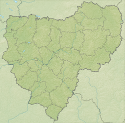
| Region | Smolensk region |
| HWR code | |
Above the confluence of Little Gzhati is called Big Gzhat [3]
The bottom is mainly sandy, the banks are dry, mostly overgrown with willow. The source is 5 kilometers south of the village of Pokrov , Gagarinsky district of the Smolensk region. Before flowing into the Vazuza River . After the construction of the Vazuz reservoir ( 1979 - 1981 ), it flows into the Vazuz reservoir at the former confluence of the Yauza [4] 46 km along the channel from the former mouth [5] . At the mouth of Gzhati a wide spill formed. A satellite view .
Currently, the river is feeding the Vazuz Hydrotechnical System, which is part of the water sources of the city of Moscow .
The current length of the river is 67 km (113-46) [5] , the former catchment area is 2370 km² [5] .
It was previously navigable from 1705 to 1870 . In Gzhatsk (now Gagarin ) there was a marina.
Notes
- ↑ Surface Water Resources of the USSR: Hydrological Understanding. T. 10. Upper Volga region / ed. V.P. Shaban. - L .: Gidrometeoizdat, 1966 .-- 528 p.
- ↑ Public Cadastral Map (inaccessible link - history ) .
- ↑ Map sheet N-36-23 Gagarin . Scale: 1: 100,000. Status of the terrain in 1980. 1984 edition
- ↑ Public Cadastral Map . Archived March 5, 2016.
- ↑ 1 2 3 State Water Register of the Russian Federation: Gzhat . Archived on October 19, 2012.