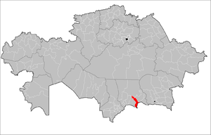
Merkensky district ( Kaz. Merkі audany ) is an administrative unit in the south of Kazakhstan in the Zhambyl region .
| Merkensky District | |||
|---|---|---|---|
| Merki Audany | |||
| |||
| A country | Kazakhstan | ||
| Included in | Zhambyl region | ||
| Includes | 14 rural districts | ||
| Adm. Centre | Merke village | ||
| Akim of the district | Umirbekov Meirkhan Azatovich | ||
| History and Geography | |||
| Date of formation | December 27, 1933 | ||
| Square | 7.1 thousand km² | ||
| Timezone | UTC + 6 | ||
| Population | |||
| Population | 74.3 thousand people ( 1998 ) | ||
 | |||
 | |||

The administrative center of the district is the village of Merke .
The area of the district is 7.1 thousand km² [1] .
Akim of the district - Umirbekov Meirkhan Azatovich.
Content
Geography
Merkensky district is located in the foothills of the Kyrgyz ridge . In the east, the region borders on Kyrgyzstan . The northern part of the district is a semi-desert semi-desert zone adjacent to the Moyynkum Sands .
The area of the district is 7620 square kilometers. The climate is sharply continental, with an average annual rainfall of 40-50 mm, sometimes rainfall reaches 70-100 mm. The main rivers are Aspara and Merke. The Great Chuysky Canal used for irrigation passes through the territory of the district.
The Lugovoye-Bishkek branch of the Kyrgyz Railway passes through the territory of the district, the highway connecting Almaty, Bishkek, Tashkent (Taraz, Shymkent).
Demographics
The rural population of the district is 63,648 people, the settlement of Granitogorsk - 1324 inhabitants, the settlement of Oytal - 3810 inhabitants and the station. Merke - 4916 inhabitants. [2]
The dynamics of the population [3] :
| Name \ year | 1999 year | year 2000 | year 2001 | 2002 year |
|---|---|---|---|---|
| Merkensky District | 77.6 thousand | 74,4 thousand | 74.5 thousand | 72.5 thousand |
| Merke village | 15.9 thousand | 14.2 thousand | 13.8 thousand | 11.9 thousand |
| town. Granitogorsk | 2 thousand | 1.4 thousand | 1.4 thousand | 1.3 thousand |
| town. Oyutal | 9.8 thousand | 8.8 thousand | 8.8 thousand | 3.8 thousand |
Representatives of more than 30 nationalities live in the region: Kazakhs, Russians, Ukrainians, Azerbaijanis, Meskhetian Turks, Uzbeks, Kyrgyz, etc.
History
The district was formed on December 27, 1933 [1] .
For the first time, Arab geographers mentioned Merck in their works in the 9th-10th centuries: "Mirki is a medium-sized city, fortified, has a citadel." And he got his name in Farsi. Mirki means "center."
Administrative device
As of the beginning of 2019, the district includes 14 rural districts [1] [4] .
Merkensky rural district
- Merke village
- health resort Merke
Akermensky rural district
- Akermen village (farm. Merkensky, center)
- Altynaryk village (1st farm)
- Akkoz-Kaynar village (3rd farm)
Aktogan Rural District
- aul Aktogan (Bolshevik)
- Kazakhdikan village
Zhambyl Rural District
- Zhambyl village
- the village of Fruits
- student Taldybulak (student of the khl. Named after Jambul)
- aul Turlybay Batyr (Krasnaya Zarya)
Zhanatogansky rural district
- Kostogan village
- Kyzylsay village
- aul Mynkazan (Voroshilova)
Kenesa Rural District
- Kenes village
- village of Zhaugash
- Kayyndysay village
- Kentai village (farm number 2 farm. Merkensky)
Andas Batyr Rural District
- Andas Batyr village (Novovoskresenovka)
- Aralkishlak village
- Granitogorsk village
- Karpyk village (kyzylkyshlak)
- village at the station of Soldavar
Oytalsky rural district
- Oytal village
- Mahanda village
- Merke Station
T.Ryskulovsky Rural District
- village T.Ryskulova (Zhdanova)
- International village
Sarymoldaevsky rural district
- Sarymoldaeva village (Kuzminka)
- village of Ekpenda
- Oital village
Surat Rural District
- village of Surat (named after Kirov)
- aul Akkaynar
- aul Teskentogan (Kyzyl-Tu)
Tatti Rural District
- Tatti village
- Akzhol village (Leninzholy)
- Belaryk village
- village of Karasu
- Tasotkel
- Tatti Station
- Chemen
Akaral Rural District
- Akaral village (Krasnooktyabrskoe)
- Sypatai village
Asparinsky Rural District
- village of Aspara
Economics
The population of the district is mainly engaged in agricultural production. Here 1435 collective farms are registered, 16 limited liability partnerships and production cooperatives operate.
Attractions
- Sanctuary of Merke . Located at an altitude of 3000 m above sea level , covers an area of 250 km². There are mounds , stone walls and stone sculptures (70 steles) [5] .
Notes
- ↑ 1 2 3 Administrative-territorial division of the Zhambyl region Archived on May 27, 2009.
- ↑ Resident Population Archived on July 1, 2007.
- ↑ Population dynamics. Archived on July 1, 2007.
- ↑ Administrative-territorial units of the Zhambyl region at the beginning of 2006. Archived on September 16, 2008.
- ↑ Sanctuary of Merck