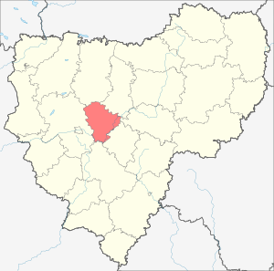
Kardymovsky district is an administrative-territorial unit ( district ) and a municipality ( municipal district ) of the Smolensk region of Russia .
| Municipal District | |||||
| Kardymovsky district | |||||
|---|---|---|---|---|---|
| |||||
| A country | |||||
| Included in | Smolensk region | ||||
| Includes | 9 municipalities | ||||
| Adm. Centre | Kardymovo | ||||
| Head of the municipality | Nikitenkov Pavel Petrovich | ||||
| History and Geography | |||||
| Date of education | 1929 | ||||
| Square | 1095.3 km² (24th place ) | ||||
Height
|
| ||||
| Timezone | MSK ( UTC + 3 ) | ||||
| Population | |||||
| Population | ↘ 12 562 [1] people ( 2018 ) | ||||
| Density | 11.4 people / km² | ||||
| Digital identifiers | |||||
| Telephone code | 48167 | ||||
| Official site | |||||
 | |||||


The administrative center is the village of Kardymovo .
Content
Geography
It borders on Glinkovsky in the southeast, Dorogobuzhsky in the east, Dukhovshchinsky in the north, Pochinkovsky in the south, Smolensky in the west and Yartsevo districts in the north-east.
The area of the district is 1095.3 km². The main rivers are the Dnieper , Khmost , Big Vopets , Small Vopets , Losmyona , Orlya .
History
Since October 1, 1929 the district has been in the Western region . November 20, 1930 became part of the Smolensk region. January 18, 1935 was restored. September 27, 1937 moved to the Smolensk region. It was disbanded on February 1, 1963 and restored on October 23, 1977 .
Population
| Population | ||||||
|---|---|---|---|---|---|---|
| 2002 [2] | 2009 [3] | 2010 [4] | 2011 [4] | 2012 [5] | 2013 [6] | 2014 [7] |
| 12 521 | ↘ 11,400 | ↗ 11 949 | ↘ 11 826 | ↗ 12 070 | ↗ 12 171 | ↗ 12 352 |
| 2015 [8] | 2016 [9] | 2017 [10] | 2018 [1] | |||
| ↗ 12 499 | ↗ 12 629 | ↗ 12 701 | ↘ 12 562 | |||
The population is 12.7 thousand people, including 4.6 thousand - urban ( 2017 ).
Administrative device
The territory of the municipal district is formed by the territories of the following settlements included in its composition:
| Municipality | Number population people | Square, km² | Administrative center |
|---|---|---|---|
| Kardymovsk urban settlement | 5.1 thousand | 31.48 | urban settlement Kardymovo |
| Berezkinskoe rural settlement | 1.54 thousand | 86.1 | Berezkino village |
| Kamensky rural settlement | 1,11 thousand | 200,4 | Kamenka village |
| Molkovskoe rural settlement | 0.98 thousand | 107.84 | village of Molkovo |
| Netrizovsky rural settlement | 0.51 thousand | 104.02 | Netrizovo village |
| May Day rural settlement | 0.89 thousand | 121.53 | village of Titkovo |
| Solovyov rural settlement | 0.55 thousand | 126.35 | Solovyovo village |
| Tyushinsky rural settlement | 1,0 thousand | 176.11 | Tyushino village |
| Shokinsky rural settlement | 1,1 thousand | 139.31 | Shokino village |
Economy
Agriculture
Agricultural production is carried out by 9 agricultural enterprises, 10 peasant (farmer) farms and 3050 personal subsidiary farms.
The total area of agricultural land in the district is 59.9 thousand hectares - 48.5% of the entire territory of the district. The share of arable land in agricultural land is 66%.
The most promising direction in the crop sector is the development of feed production, that is, an increase in the productivity of perennial grasses, the creation of cultural pastures, and an increase in the production of feed grain for the development of the livestock industry.
Communication
The largest radio broadcasting station in the region with a mast with a height of 350 meters was built in the village of Smogiri .
Transport
Culture
39 institutions are engaged in cultural services to the population of the region. They employ 96 specialists. In the cultural system, 2 people have the title of Honored Worker of Culture of the Russian Federation, 1 - Honorary Cinematographer of the Russian Federation, and 1 - Member of the Union of Designers of Russia.
Attractions
- St. Nicholas Church - Smogiri village
- Temple of the Prophet of God Elijah - Shestakovo village
- Church of St. Nicholas - the village of Nikolo-Yarovnya
- Church of the Resurrection of Christ - Vachkovo Village
- Church of the Icon of the Mother of God "Recovery of the Dead" - Solovievo Village
Notes
- ↑ 1 2 Estimation of the resident population of Smolensk region as of January 1, 2018
- ↑ 2002 All-Russian Population Census. Tom. 1, table 4. The population of Russia, federal districts, constituent entities of the Russian Federation, regions, urban settlements, rural settlements - district centers and rural settlements with a population of 3 thousand or more . Archived February 3, 2012.
- ↑ The resident population of the Russian Federation by cities, urban-type settlements and districts as of January 1, 2009 . The date of circulation is January 2, 2014. Archived January 2, 2014.
- ↑ 1 2 Estimation of the population of Smolensk region as of January 1, 2009-2015
- Population of the Russian Federation by municipalities. Table 35. Estimated resident population as of January 1, 2012 . Date of treatment May 31, 2014. Archived May 31, 2014.
- ↑ Population of the Russian Federation by municipalities as of January 1, 2013. - M.: Federal State Statistics Service of Rosstat, 2013. - 528 p. (Table 33. The population of urban districts, municipalities, urban and rural settlements, urban settlements, rural settlements) . Date of treatment November 16, 2013. Archived November 16, 2013.
- ↑ Table 33. The population of the Russian Federation by municipalities as of January 1, 2014 . Circulation date August 2, 2014. Archived August 2, 2014.
- ↑ The population of the Russian Federation by municipalities as of January 1, 2015 . Date of treatment August 6, 2015. Archived on August 6, 2015.
- Population of the Russian Federation by municipalities as of January 1, 2016
- ↑ The population of the Russian Federation by municipalities as of January 1, 2017 (July 31, 2017). Date of treatment July 31, 2017. Archived July 31, 2017.