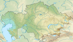
Tobol ( Kaz. Tobyl ) is a river in Kazakhstan and Russia , the left and most watery tributary of the Irtysh [2] . The length of the river is 1591 km, the catchment area is 426,000 km² [3] .
| Tobol | |
|---|---|
| kaz. Tobyl | |
 The merger of the Irtysh and Tobol. 1912 year. Photo by Prokudin-Gorsky S.M. The merger of the Irtysh and Tobol. 1912 year. Photo by Prokudin-Gorsky S.M. | |
| Characteristic | |
| Length | 1591 km |
| Swimming pool | 426,000 km² |
| Water consumption | 805 m³ / s (at the mouth) |
| Watercourse | |
| Source | river confluence: Bozbie and Kokpektysay |
| • Location | Turgai Plateau |
| • Height | > 272 m |
| • Coordinates | |
| Mouth | Irtysh |
| • Location | Tobolsk |
| • Height | 35 m |
| • Coordinates | |
| Location | |
| Water system | Irtysh → Ob → Kara Sea |
| Kazakhstan | Kostanay region |
| Russia | Kurgan region , Tyumen region |
| HWR code | |

Geography
Tobol is formed at the confluence of the Bozbie River with the Kokpektisay River [3] [4] on the border of the eastern spurs of the Southern Urals and the Turgai canteen of the country . The middle and lower reaches of the river are within the West Siberian Plain in a wide valley with a winding channel. In the Tobol basin - about 20 thousand lakes with a total area of 9000 km². The right bank rises above the left, as Tobol flows over a deep fracture of the earth's crust and delimits the Kurgan synclinorium and the Tobolo-Ubagan uplift.
Hydrology
The food is mainly snowy; the proportion of rainwater increases downstream. High water from the 1st half of April to mid-June in the upper reaches and until the beginning of August in the lower reaches. The average annual water discharge is in the upper reaches (898 km from the mouth) of 26.2 m³ / s, at the mouth of 805 m³ / s (maximum respectively 348 m³ / s and 6350 m³ / s). The average turbidity is 260 g / m³, the annual sediment runoff is 1600 thousand tons. It freezes in the lower reaches at the end of October - November, in the upper reaches in November, it opens in the 2nd half of April - the 1st half of May.
Ecology
The river is polluted. In the Kostanay region, MPC is exceeded for some heavy metals, the river was attributed to polluted water bodies [5] .
Ichthyofauna
Tobol is rich in fish. In the upper and middle reaches of the river and its elders are caught: perch, pike, roach, ide, char, gudgeon, ruff, pike perch, bream, crucian carp, carp. The lower section of Tobol from the Iset River to the mouth is most interesting for fishing. There are also here: sterlet, muksun , nelma , Siberian sturgeon, there is a chance to catch a chira [6] .
Tributaries
The largest tributaries of the river: on the left - Uy , Iset , Tura , Tavda (the last two are of navigable importance); on the right is Ubagan . (km from the mouth)
- 6.7 km: Zaimka
- 7.1 km: Suklemka
- 26 km: untitled river
- 53 km: Turba
- 63 km: Atalyk
- 85 km: Shestakovka
- 116 km: Tavda
- 123 km: Nerda
- 171 km: untitled river
- 184 km: Isca
- 190 km: Varvarinskaya
- 232 km: Yazevka
- 260 km: Tour
- 278 km: Tap
- 289 km: Yurga
- 343 km: Kulichek
- 370 km: Bochanka
- 400 km: Koktul
- 437 km: Iset
- 457 km: Long
- 457 km: Uk
- 464 km: Berezovka
- 490 km: Black
- 494 km: Uporovka
- 520 km: Niyap
- 526 km: Emurtla
- 579 km: Sure
- 667 km: Ik
- 671 km: Nizhny Utyak
- 688 km: Black
- 692 km: Middle Utyak
- 742 km: Utyak
- 746 km: Yurgamysh
- 760 km: Borovlyanka
- 768 km: Black
- 782 km: Talitsa
- 816 km: Kurtamysh
- 848 km: Lower Alabuga
- 868 km: Gorkorechenskaya
- 882 km: Alabuga
- 909 km: Ubagan
- 976 km: Kocherdyk
- 994 km: Uy
- 1257 km: Ayat
- 1418 km: Zhelkuar
- 1589 km: Kairakty
- 1591 km: Bozbie
- 1591 km: Kokpektysay
Settlements
Denisovka , Lisakovsk , Ore , Kostanay , Kurgan , Yalutorovsk , Tobolsk .
Economic Use
Tobol is navigable 437 km from the mouth. The river flow is regulated by a number of reservoirs. The rafting of the forest is carried out.
In Kazakhstan, the Karatomarskoe and Verkhnetobolskoye reservoirs were built on the river.
Notes
- ↑ Surface Water Resources of the USSR: Hydrological Understanding. T. 11. The Middle Urals and the Urals. Vol. 2. Tobol / ed. V.V. Nikolaenko. - L .: Gidrometeoizdat, 1965 .-- 240 p.
- ↑ Belyavsky P.E. Irtysh // Brockhaus and Efron Encyclopedic Dictionary : in 86 volumes (82 volumes and 4 additional). - SPb. , 1890-1907.
- ↑ 1 2 State Water Register . Tobol River . textual.ru . Ministry of Natural Resources of Russia (March 29, 2009). Date of treatment December 20, 2018. Archived March 29, 2009.
- ↑ Map sheet M-41-II . Scale: 1: 200 000. Indicate the date of issue / condition of the area .
- ↑ Tobol was classified as “polluted” . alau.kz. Date of treatment June 20, 2019.
- ↑ Natural boundary. The place where the trails converge. Tobol River . urochishe.ru . Date of treatment June 20, 2019.
Literature
- Tobol (river) // Great Soviet Encyclopedia : [in 30 vol.] / Ch. ed. A.M. Prokhorov . - 3rd ed. - M .: Soviet Encyclopedia, 1969-1978.
- Tobol // Dictionary of modern geographical names / Rus. geo about . Mosk. center; Under the total. ed. Acad. V.M. Kotlyakova . Institute of Geography RAS . - Yekaterinburg: U-Factoria, 2006.