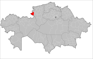
Zhitikarinsky district ( kaz. Zhіtіқara audany ) is a territorial unit in the western part of the Kostanay region , at a distance of 217 km south-west of the regional center of the city of Kostanay .
| area | |||
| Zhitikarinsky district | |||
|---|---|---|---|
| Zhіtіқara audany | |||
| |||
| A country | Kazakhstan | ||
| Included in | Kostanay region | ||
| Adm. Centre | Zhitikara city | ||
| Akim | Ibraev Abay Sarsembaevich [1] | ||
| History and Geography | |||
| Date of formation | January 17, 1928 | ||
| Square | 7,311.99 km² (3.7%, 9th place ) | ||
| Timezone | UTC + 6 | ||
| Population | |||
| Population | 49 997 [2] people ( 2016 ) | ||
| Density | 6.89 people / km² | ||
| Nationalities | Kazakhs (43.91%) | ||
| Digital identifiers | |||
| CATO Code | 394400000 [4] | ||
| Postal codes | 110702-110718 [3] | ||
| Official site | |||
 | |||

The administrative center of the district is the city of Zhitikara .
Content
Geography
In the north, the district borders with the Denisovsky district , in the east - with the Kamystinsky district , in the south the border passes with the Adamovsky and Svetlinsky regions of the Orenburg region of Russia , in the west - with the Bredinsky district of the Chelyabinsk region of Russia.
The area is located on the territory of the Trans-Ural Plateau. The highest point is Mount Zhitikara (414 m). The hydrographic network is the Tobol River and its tributaries: Bozbie, Aktastysay, Shortandy, Zhelkuar . In the territory there are deposits of building materials, including the Zhitikarinsky deposit of chrysotile asbestos [5] . Until 1960, the Zhitikarinsky gold deposit was developed [6] .
Average temperatures in January are -17 ° С, July - 20 ° С. The amount of precipitation per year from east to west is from 250 to 350 mm. Soils are black earth carbonate and dark chestnut . Steppe vegetation: feather grass , fescue , wormwood . A wild boar , a wolf , a fox , a corsac , several species of jerboas, and others inhabit the water bodies. A swan , a goose , a duck , and a gray heron nest on reservoirs [5] .
History
Dzhetygary district as an administrative-territorial unit was formed on January 17, 1928. The center of the district at the time of its formation was the Zhailma tract, from 1930 to 1936 the district center was in the village of Denisovka , from 1936 it became the village (since 1939 the city) of Dzhetygara [7] .
On April 30, 1997, by decree of the President of Kazakhstan, the transcription of the name of the Dzhetygarinsky district in Russian was changed to Zhitikarinsky district [8] .
Population
National composition (as of January 1, 2016) [2] :
- Kazakhs - 21 952 people. (43.91%)
- Russians - 19,049 people (38.10%)
- Ukrainians - 3,901 people (7.80%)
- Germans - 1,749 people (3.50%)
- Tatars - 1,116 people (2.23%)
- Belarusians - 789 people (1.58%)
- Bashkirs - 329 people. (0.66%)
- Moldovans - 160 people (0.32%)
- Koreans - 125 people (0.25%)
- Azerbaijanis - 113 people (0.23%)
- others - 714 people. (1.43%)
- In total - 49,997 people. (100.00%)
Administrative division
| Rural district / city of district significance | Settlements |
| Akkarga Village | Akkarga village |
| Bolshevik rural district | Turgenevka village, Kusakan village, Khozret village, Tasybay village |
| Village Volgogradskoe | village Volgogradskoe |
| City Zhitikara | Zhitikara city |
| Zabelovka village | Zabelovka village |
| Village Milyutinka | Milyutinka village |
| Muktikol rural district | Muktikol village, Zhaltyrkol village, Kondybay village |
| Village Prigorodnoye | Prigorodnoye village |
| Village Prirechnoe | village Prirechnoe |
| Village Stepnoye | Stepnoye village |
| Village Timiryazevo | village Timiryazevo |
| Tokhtar rural district | Tokhtarovo village, Lvivka village |
| Village Tchaikovsky | village Tchaikovsky |
| Village Shevchenko | village Shevchenkivka |
| Yrsay village | Yrsay village |
Notes
- ↑ Akim of Zhitikarinsky district . Official site of akimat of Zhitikarinsky district. Date of treatment February 20, 2016.
- ↑ 1 2 3 The population of the Republic of Kazakhstan by individual ethnic groups at the beginning of 2016 . Statistics Committee of the Ministry of National Economy of the Republic of Kazakhstan. Date of treatment February 1, 2017.
- ↑ Postcodes of Kazakhstan
- ↑ CATO base . Statistics Committee of the Ministry of National Economy of the Republic of Kazakhstan. Date of treatment February 1, 2017.
- ↑ 1 2 Zhitikarinsky district // Kazakhstan. National Encyclopedia . - Almaty: Kazakh encyclopedias , 2005. - T. II. - ISBN 9965-9746-3-2 .
- ↑ Zhitikarinsky gold deposit // Kazakhstan. National Encyclopedia . - Almaty: Kazakh encyclopedias , 2005. - T. II. - ISBN 9965-9746-3-2 .
- ↑ Historical background of the Zhitikarinsky district . Official site of akimat of Zhitikarinsky district. Date of treatment January 8, 2016.
- ↑ Decree of the President of the Republic of Kazakhstan dated April 30, 1997 No. 3475 “On changing the transcription of the names of the city of Dzhetygar and the Dzhetygarsky district of the Kustanai region and on classifying the city of Zhitikar as a category of cities of regional significance”