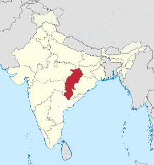
Chhattisgarh ( Hindi छत्तीसगढ , English Chhattisgarh ) - a state in central India . It was established on November 1, 2000 by allocating 16 districts from the state of Madhya Pradesh . It borders with the states of Madhya Pradesh , Maharashtra , Andhra Pradesh , Orissa , Jharkhand , Uttar Pradesh . Area - 136 034 km², population - 25 540 196 people. (2011). The capital is Raipur . Other major cities are Bhilai , Bilaspur , Korba .
| State | |
| Chhattisgarh | |
|---|---|
| hindi छत्तीसगढ English Chhattisgarh | |
| A country | India |
| Adm. Centre | Raipur |
| Governor | Balramji Dass Tandon |
| Chief Minister | Raman Singh |
| History and Geography | |
| Date of formation | |
| Square | 136 034 km² (10th place ) |
| The largest city | Raipur |
| Dr. big cities | Bhilai , Bilaspur , Korba |
| Population | |
| Population | 25 540 196 people ( 2011 ) ( 16th place ) |
| Density | 187.75 people / km² (26th place) |
| Digital identifiers | |
| ISO 3166-2 Code | |
| Official site | |
 | |
Content
Geography
The northern part of the state is located on the outskirts of the Indo-Gangetic lowland , in the central part of the state is the fertile valley of the Mahanadi River - the main rice growing area in the state; the southern part of the state lies on the Deccan Plateau , in the Godavari River Basin . Forest cover is 40%.
History
Before the formation of the state in the 1950s, Soviet specialists built the Bhilai Metallurgical Plant . At the beginning of April 2010, the Maoist movement, which was engaged in an armed struggle with the government and law enforcement agencies, continued to operate in the state. Since the 60s of the XX century, the militants of this group act under the slogan of protecting the oppressed local population, and oppose the practice of confiscating land from farmers. To fight the government, the Maoists use terrorist methods, as a result of which both the police and civilians often suffer.
Policy
Chhattisgarh is one of the states where Bharatiya Janata Party is traditionally strong. Currently (beginning of 2010), it was this party that formed the state government. In the 2018 election, the INC won.
Administrative division
The state includes 27 counties:
- Balod - created in 2012
- Balodabazar - created in 2012
- Balrampur - created in 2012
- Bastar
- Bemetara - created in 2012
- Bijapur - created in 2007
- Bilaspur
- Garyabad - created in 2012
- Dantevada - established in 1998
- Janjgir-Champa - established in 1998
- Jashpur - created in 1998
- Durg
- Dhamtari - created in 1998
- Kabirdham - created in 1998, formerly called Kavardha
- Kanker - created in 1998
- Kondagaon - created in 2012
- Korba - created in 1998
- Koria - created in 1998
- Mahasamund - created in 1998
- Mungels - created in 2012
- Narayanpur - established in 2007
- Rajnandgaon - created in 1972
- Raigarh
- Raipur
- Sukma - created in 2012
- Surajpur - created in 2012
- Surguja
Language
The main language of the state - Chhattisgarh - is close to Hindi . Dravidian languages are widespread in the mountainous areas: Telugu, Gondi, Maria, Muria, Koya, pardhan, Pardzhi, nagarchal, Kurukh.
Economics
The basis of state industry is energy, ferrous and non-ferrous metallurgy. In particular, one of the largest metallurgical plants in India (built with the help of the USSR ) is located in Bhilai. TPPs operating in Korb are one of the largest in the country. The cement and chemical industries (production of mineral fertilizers) are also developed. The basis of agriculture is rice; wheat and corn are also grown.