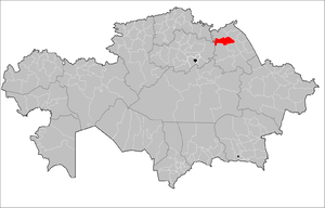
Aktogai district - located in the northwestern part of Pavlodar region .
| area | |
| Aktogay district | |
|---|---|
| Aқtoғay audany | |
| A country | Kazakhstan |
| Included in | Pavlodar region |
| Adm. Centre | Aktogay |
| Akim | Agybay Amirin [1] |
| History and Geography | |
| Date of formation | 1938 year |
| Square | 9.8 thousand km² |
| Timezone | UTC + 6 |
| Population | |
| Population | 14 030 [2] people ( 2012 ) |
| Nationalities | Kazakhs (75%) |
| Digital identifiers | |
| Postal codes | 140200-140212 [3] |
 | |
The administrative center of the district - the village of Aktogay is located 116 km north-west of the regional center , on the left bank of the Irtysh . It was founded in 1907 in connection with the development of fertile land by peasant settlers.
Content
Physico-geographical characteristics
Geographical position
The area is 9.8 thousand km² (7.69% of the region). It takes 5th place among the districts of the region. Aktogai district is located in the south of the West Siberian Plain , on the left bank of the Irtysh [4] . In the north it borders with the Irtysh region , in the south - with the rural areas of the cities of Aksu and Ekibastuz , in the west - with the Akmola and North Kazakhstan regions, in the east - with the Kachir and Pavlodar regions along the Irtysh river.
Climate
The climate is sharply continental. The average January temperature is −17 ° -19 ° C, July - + 20 ° + 21 ° C. The annual amount of precipitation is 250-300 mm [4] .
Relief and hydrography
The relief of the territory is flat (Irtysh plain). In the bowels of the explored reserves of natural building materials. Minerals: salt, sands, clays [4] . The Irtysh , Selety , Shiderty rivers flow through the territory of the region, there are lakes Zhalauly , Tobylgysor , Taykonur , Sasyksor and others. The soils are chestnut , near the lakes there are salt marshes [4] . During the development of virgin and fallow lands, a significant part of the district was plowed.
Flora and Fauna
The vegetation is steppe, grass-forged; poplar, maple, willow, meadowsweet grow in river valleys [4] . The wolf , fox , hare , corsac , badger , gopher , hamster live.
Population
Ethnic composition
National composition (as of January 1, 2012 ): [2]
- Kazakhs - 10 580 people. (75%)
- Russians - 1892 people. (13.48%)
- Ukrainians - 702 people (five %)
- Germans - 279 people (1.99%)
- Tatars - 99 people. (0.71%)
- Belarusians - 88 people (0.63%)
- others - 390 people. (2.78%)
- In total - 14,030 people. (100.00%)
Population Dynamics
The population in 1999 is 21.0 thousand people, in 2012 - 14.0 thousand. The average population density is 2.15 people per 1 km² in 1999 and 1.43 people per 1 km² in 2012.
History
It was founded in 1938 as the Kuibyshevsky district . By a decree of the Presidium of the Supreme Council of the Kazakh SSR of January 2, 1963, it was renamed the Krasnokutsky District with its center in the village of Krasnokutsk .
On May 4, 1993, by the Decree of the Presidium of the Supreme Council of Kazakhstan, the Krasnokutsky District was renamed the Aktogai District [5] . By a resolution of the Presidium of the Supreme Council of the Republic of Kazakhstan dated October 7, 1993, the village of Krasnokutsk, the center of the Aktogay region, was renamed Aktogay .
Administrative Division
The history of the administrative-territorial division of the Aktogay region dates back to 1938 . This year, the Kuybyshe district was formed as part of the Pavlodar region, the territory of which in 1963 became fully part of the newly formed Krasnokutsky region.
There are 13 rural districts in the district [6] :
| Adm. unit | Headcount in 1999, people | Headcount in 2009 people | Compared to 1999 |
|---|---|---|---|
| Aktogay S.O. | 4800 | 4000 | ↘ 83.3% |
| Auelbek S.O. | 1400 | 1009 | ↘ 72.1% |
| Barlybay S.O. (Combined with Razumovsky s.o.) | 487 | 299 | ↘ 61.4% |
| Baskamo S.O. | 669 | 293 | ↘ 43.8% |
| Zhalaulinsky S.O. | 1344 | 880 | ↘ 65.5% |
| Zholboldinsky S.O. | 957 | 547 | ↘ 60.3% |
| Karaobinsky S.O. | 1852 | 1015 | ↘ 54.8% |
| Kozhamzharsky s.o. | 1952 | 1463 | ↘ 75.2% |
| Mutkenovsky S.O. | 2836 | 2190 | ↘ 77.2% |
| Prirechensky S.O. (Combined with Aktogaysky So.) | 1545 | 1026 | ↘ 66.4% |
| Razumovsky S.O. | 852 | 755 | ↘ 88.6% |
| Kharkov So. | 989 | 665 | ↘ 67.2% |
| Sholaksor S.O. | 731 | 551 | ↘ 75.4% |
Economics
Agricultural specialization of the region: dairy farming, grain farming. Sunflower is grown, small hides (sheepskin) are produced.
Public roads of republican significance, the Leninsky-Irtyshsk-Russian Polyana, section 43–128 km (85 km), and the Aktogai-Sholaksor regional significance section, km 0–164 (164 km), pass through the district.
Social Sphere
Education and science
As of 2012, there are 2 preschool organizations in the district. In the 2001-2002 school year, there were 32 comprehensive schools in the district (4,390 students), including 16 secondary schools (3,848 students), 7 primary schools (384 students), 9 primary schools (158 students); Of these, 16 schools with the Kazakh language of instruction, 2 schools with the Russian language of instruction and 14 mixed Russian-Kazakh schools. In 2012, the district has 30 secondary schools, 1 vocational school-lyceum.
Health
The area is Aktogay central district hospital.
Culture
In sec. Zholboldy in the territory of high school to them. Yestaya is a bust of Yestai Berkimbayuly national singer, akyn, composer, honored art worker of the Kazakh SSR, in a. Kozhamzhar bust of J. Tlenshin, enlightener, dated 1967
In the area is Aktogay central district library. [7] Various newspapers were published: “Communistіk Enbek” (since 1939), “Communist Labor” (since 1955).
Famous People
Aktogaysky district is the birthplace of Hero of the Soviet Union - Mutkenov Serikbay , Heroes of Socialist Labor - A. A. Akhmedinov and Kali Kalenov .
- Berkimbaev, Estay - folk singer, akyn , composer.
- Gerlits, Irina Yakovlevna - Soviet and Kazakhstani basketball player, Honored Master of Sports of the USSR.
Notes
- ↑ Akims replaced in Aktogay and Irtysh regions
- ↑ 1 2 3 Department of Statistics of the Pavlodar Region Archived on April 6, 2013. Error in the footnotes ? : Invalid
<ref>: name “Stat2012” defined several times for different content - ↑ Postcodes of Kazakhstan
- ↑ 1 2 3 4 5 Aktogai district // Kazakhstan. National Encyclopedia . - Almaty: Kazakh encyclopedias , 2004. - T. I. - ISBN 9965-9389-9-7 .
- ↑ Resolution of the Presidium of the Supreme Council of the Republic of Kazakhstan dated May 4, 1993 No. 2001 “On streamlining the transcription of Russian toponyms in Russian, naming and renaming of certain administrative and territorial units of the Republic of Kazakhstan”
- ↑ Results of the 2009 National Census of the Republic of Kazakhstan in the Pavlodar region
- ↑ Aktogay central district library