Reut ( Mold. Răut [reut], Yiddish רעװעט [revet]) - a river in Moldova , the right tributary of the Dniester . Length - 286 km. The pool area is 7760 km².
| Reut | |
|---|---|
| mold Raut | |
 Reut in Orhei district Reut in Orhei district | |
| Characteristic | |
| Length | 286 km |
| Pool | 7 760 km² |
| Water consumption | 6.42 m³ / s (s. Zhelobok, Orhei district) |
| Watercourse | |
| Source | |
| • Coordinates | |
| Mouth | Dniester |
| • Location | with. Estuary, Dubesar district of RM |
| • Coordinates | |
| Location | |
| Water system | Dniester → Black Sea |
| A country |
|
The total fall is 168 m. The average width of the channel is 30 m. The average width of the valley is 7 km. The average water consumption is from 6 to 15 m³ / s. the absolute maximum is 135 m³ / s (09/08/1989), the absolute minimum is 0.20 m³ / s (September 19-27, 1959) [2] The annual flow rate is 189 million cubic meters. m. [3] The average annual flow rate is 9.93 m³ / s [4]
The hydrological regime of Reut is intermittent. There are spring and summer floods .
The intra-annual distribution of river runoff by season in the average year of water availability: in spring - 50%, in summer - 23%, in autumn - 14%, in winter - 13% [5] .
Reut is the largest inland river in Moldova.
Content
Geography
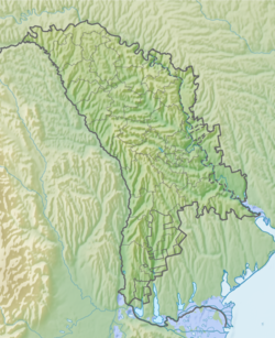
Reut originates near the village of Redu-Mare, Donduseni district , at an altitude of 146 m above sea level, flows in a southeast direction, changes its direction twice (near Balti and Florest ) and flows into the Dniester near the village of Ustye . The river valley reaches a width of 3 km near Balti to 9 km near Orheev . There are many floodplains on Reut, mostly drained. Between Floresti and Kazanesti Reut passes through limestone cliffs, forming deep and narrow gorges.
Forage crops and vegetables are grown in the river valley. Reut is used for irrigation. The cities of Balti , Marculesti , Floresti and Orhei are located on the Reut River. In the river basin are Old Orhei and a picturesque site near the village of Trebujeni .
Main tributaries: the right tributaries - Kopachanka, Reutsel, Solonets, Uligach, Bolshoi Chuluk, Vatic, Ivancha, Ryshka; left - Kubolta, Kaynar, Kamenka, Dobrush, Sagala, Ivanos, Draginich.
The river waters are heavily polluted by domestic wastewater. The average turbidity of the waters is 700 g / cm³ near Beltsy.
Near the village of Nikoryany, Drokievsky District, the riverbed is completely dry. [6]
The width of the river near Balti is about 2-4 meters [1]
History
The first hydroelectric power station in Moldova (1954) was built on Reut, in the village of Kazanesti in the Telenesti district, which did not last long and was shut down due to unprofitability with the commissioning of the Dubossary hydroelectric station in the early 1960s. However, the dam and reservoir above it have survived to this day. Very picturesque place.
In August 2017, near the village of Brynzeniy Noi (Telenesti district), water was shut off at a small hydroelectric station, which caused downstream fish to die. [7]
Notes
- ↑ http://cim.mediu.gov.md/raport2004/en/tables.htm
- ↑ Serviciul Hidrometeorologic de Stat (Inaccessible link) . www.meteo.md. Date of treatment September 25, 2017. Archived September 26, 2017.
- ↑ Water resources (inaccessible link) . Moldoveni . Date of treatment September 15, 2017. Archived December 15, 2015.
- ↑ Estimation of the load on the Dniester from the right tributaries // Mediul Ambiant. - 2013. - December ( No. 6 (72) ). - S. 26 .
- ↑ Moldavian SSR / chief editor I.K. Vartichan. - Chisinau: The main edition of the Moldavian Soviet Encyclopedia, 1979. - P. 30-31. - 496 p. - ISBN M757 (12) -79.
- ↑ What kills Reut? Expedition "SP" on the drying river. Part I . "SP" - Balti independent portal .
- ↑ People and connections behind the scenes of the Reut hydroelectric station (English) (neopr.) ? . Date accessed August 11, 2019.