Estuary [1] ( French Estuaire ) - a province in the north-west of Gabon . The administrative center is the city of Libreville , which is also the capital of Gabon.
| provinces | |
| Estuary | |
|---|---|
| fr. Estuaire | |
| A country | Gabon |
| Includes | 6 departments |
| Adm. Centre | Libreville |
| History and Geography | |
| Square | 20,740 km² (8th place ) |
| Timezone | UTC + 1 |
| Population | |
| Population | 895 689 people ( 2013 ) ( 1st place ) |
| Density | 43.19 people / km² (1st place) |
| Digital identifiers | |
| ISO 3166-2 Code | GA-1 |
Notes: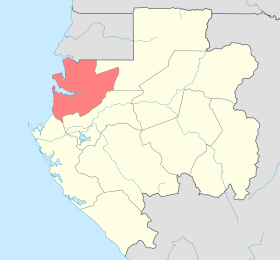  | |
Content
Geography
The area is 20 740 km² . It borders in the east with the province of Voleu Ntem , in the south with the province of Middle Ogove , in the southwest with the province of Primorsky Ogove , in the north with Equatorial Guinea . In the west of the country, the province has access to the Gulf of Guinea .
Population
According to data for 2013, the population is 895,689 people [2] [3] [4] [5] .
The dynamics of the population of the province by years:
| 1993 | 2013 |
|---|---|
| 463,187 | 895 689 |
Departments
Departments of the Estuary (old version).
- Como (adm center - Kango ) (Komo Department)
- Komo- Mondah (adm.center - Ntum ) (Komo-Mondah Department)
- Noya ( adm.center - Kokobich ) (Noya Department)
- Cap Estérias (adm center - Cap Estérias ) (Cap Estérias Department)
- Komo- Ocean (adm.center - Ndzomoe ) (Komo-Océan Department)
- Libreville (adm. Center - Libreville ) (Libreville)
Notes
- ↑ Cameroon, Equatorial Guinea, Gabon, Congo, Sao Tome and Principe // Atlas of the World / comp. and preparation. to the ed. PKO "Cartography" in 2009; ch. ed. G.V. Pozdnyak . - M .: PKO "Cartography": Onyx, 2010. - S. 149. - ISBN 978-5-85120-295-7 (Cartography). - ISBN 978-5-488-02609-4 (Onyx).
- ↑ 2013 Census (RGPL-2013)
- ↑ 2013 Census (geohive) Archived on September 6, 2011.
- ↑ 2013 Census (citypopulation)
- ↑ 2013 Census (statoids)