Agayry is a river in the Chemal district of the Altai Republic. The mouth of the river is 8 km along the left bank of the Oroktoy river. The river is 6 km long.
| Agaira | |
|---|---|
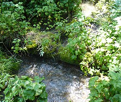 Agayra 2 km from the estuary Agayra 2 km from the estuary | |
| Characteristic | |
| Length | 6 km |
| Watercourse | |
| Source | |
| • Height | 1400 m |
| • Coordinates | |
| Mouth | Oroktoy |
| • Height | 850 m |
| • Coordinates | |
| Location | |
| Water system | Oroktoy → Katun → Ob → Kara Sea |
| A country |
|
| Region | Altai Republic |
| Area | Chemal district |


Along the river runs a country road from the village of Oroktoy to the maralnik and a power line from the village of Shebalino . On the starboard side of the valley, in the Kuldyuk log, is located the Oroktoy Ice Cave .