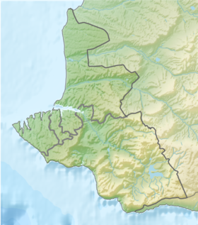
Balaklava Bay ( Ukrainian: Balaklava Bay ) - one of the bays located within the administrative territory of the city of Sevastopol . On the shores of the bay is the ancient city of Balaclava .
| Balaklava Bay | |
|---|---|
| Ukrainian Balaklava Bay | |
 | |
| Specifications | |
| Bay Type | bay |
| Deepest | 35 m |
| Location | |
| Upstream water area | Black Sea |
| A country |
|
| Region | Sevastopol |

Content
Bay Features
Balaklava Bay is a consequence of a tectonic fault, cut deep into the cleft rock massif in the north towards a distance of up to 1500 meters. The width is 200-400 meters (at the narrowest point - 45 meters), the depth is 5-10 meters in the upper reaches, up to 25 meters at the beach and up to 35 meters at the neck. The entrance to the bay is located between Cape George (aka Balaklava, east coast) and Cape Kurona (aka Western, Battery). At the entrance to the bay on the eastern shore is Mount Krepostnaya (Castron) with the ruins of the Genoese fortress Chembalo . The bay is curved, picturesque, hidden by mountains, invisible from the sea. A winding fairway protects the bay from severe storms.
A feature of Balaklava Bay is its semi-closure and limited connection with the open part of the Black Sea . The configuration of the coastline divides the bay into two parts - the southern deepwater, which communicates with the open part of the sea, and the northern shallow, almost stagnant part, more polluted, where anthropogenic effluents enter.
Balaklava Bay is the best bay for yachting on the Black Sea coast in terms of its geographical, natural and navigational features. It is closed from wind and waves from all directions. Balaklava Bay is not loaded with large vessels, which creates fewer problems and improves navigation safety .
Names and History
The ancient Greek name for the bay is Syumbolon Limen ( Symbolon , a haven of symbols). Perhaps it was she who was mentioned in Homer 's Odyssey as the Bay of Stelrigons - in this case this text is the first mention of Crimea in written sources. In the area of the coastal coastal terrace, along the Nazukin embankment , most likely in ancient times was the port of Simbolon, and in the Middle Ages - the port of Yamboli.
Until the 20th century, the bay was famous for its large catches of mullet and mackerel . The 14th submarine division of the USSR Black Sea Fleet and the 5th Separate brigade of patrol ships of the KGB of the USSR were based here; the latter, with the collapse of the USSR, was renamed the Sevastopol Maritime Guard Unit of the State Border Service of Ukraine : on March 2, 2014, the ship-boat squad was transferred to Odessa. From 1957 to 1993, one of the most secret facilities of the Black Sea Fleet (“ Object No. 825 GTS ”), a plant and a base built in 1957-1961 in Mount Tavros for repair of submarines and a torpedo storage with nuclear warheads were located in Balaklava Bay. Now it is a museum complex "Balaclava".
| View of Balaklava Bay | Bay Entrance | Maritime security boats of the State Border Service of Ukraine and yachts in Balaklava Bay |
Ecology
It has been reported that at the bottom of the bay near Cape Kayabashi, since 1941, 80 containers with chemical warfare agents ( mustard gas and lewisite ) have been buried . Allegedly, there is a potential danger of infection of the water area [2] . But neither the Crimean Emergencies Ministry, nor the divers from Yalta have confirmed these rumors [3] .
Notes
- ↑ This geographical feature is located in the waters adjacent to the Crimean peninsula , most of which is the subject of territorial disagreements between Russia , which controls the disputed territory, and Ukraine , within the borders of which the disputed territory is recognized by the international community. According to the federal structure of Russia , the subjects of the Russian Federation are located in the disputed territory of Crimea - the Republic of Crimea and the city of federal significance Sevastopol . According to the administrative division of Ukraine , the regions of Ukraine are located in the disputed territory of Crimea - the Autonomous Republic of Crimea and the city with special status Sevastopol .
- ↑ Scientists saw a catastrophe threatening Crimea: hundreds of barrels of war poison smoldering off the coast NEWSru.com October 5, 2011
- ↑ Poison barrels are again being searched in Crimea: 500 years ago, 500 containers were taken out of the sea - Crimean News - Environmentalists say the EU will pay for the neutralization of poisons: 22 million UAH are needed, but ... (inaccessible link) . Date of treatment August 18, 2013. Archived March 25, 2014.
Literature
- Balaklava Bay // Military Encyclopedia : [in 18 vol.] / Ed. V.F. Novitsky [et al.]. - SPb. ; [ M. ]: Type. t-va I. D. Sytin , 1911-1915.
- Balaclava, Cape Ayia, Cape Fiolent. Sevastopol: Biblex, 2007.P. 4. ISBN 978-966-8231-95-7
- Grinevetsky S.R., Zonn I.S., Zhiltsov S.S. Black Sea Encyclopedia. M .: International Relations, 2006. - p. 62-63. ISBN 5-7133-1273-9
Links
- 360-degree panoramas of Balaklava - Virtual tour of Crimea
- Dynamics of the waters of the Balaklava Bay and the adjacent Black Sea (Inaccessible link) . Archived on October 7, 2007.