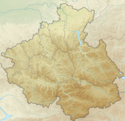
Tuzaktu [2] [3] ( South- Talt . Tuzaktu [4] , outdated. Tuzak-Tu [5] ) - a river in Russia , flows through the territory of the Matursky village council [6] of the Tashtypsky district of Khakassia and the Artybash rural settlement [7] of the Turochaksky district of the Republic Altai [8] . The left tributary of the Kokshi River, which flows into Lake Teletskoye [3] .
| Tuzaktu | |
|---|---|
| South-Alt. Tuzaktu | |
| Characteristic | |
| Length | 14 km |
| Watercourse | |
| Source | |
| • Location | Abakan Range |
| • Height | 1960-1980 m |
| • Coordinates | |
| Mouth | Kokshi |
| • Location | 10 km from the mouth |
| • Height | 640-660 m |
| • Coordinates | |
| Location | |
| Water system | Kokshi → Teletskoye → Biya → Ob → Kara Sea |
| A country |
|
| Regions | Khakassia , Altai Republic |
| Areas | Tashtypsky district , Turochaksky district |
| HWR Code | |

The name comes from the Altai tozaktu - “having loops, fetters” [4] .
The length of the river is 14 km [5] . It starts between the Chitbazhi and Kyytykol mountains of the Abakan range , flows in the general north-west direction through the cedar-fir taiga [3] , crossing the border of the republics in the upper reaches. The mouth of the river is 10 km [5] on the left bank of the Koksha River [2] .
The width of the river in the middle course - 12 meters, depth - 0.4 meters [3] . The flow velocity is 2.7 m / s [3] .
The river basin is entirely within the boundaries of the Altai and Khakassky reserves in the territory of the respective republics [9] [10] [3] .
Water Registry Data
According to the state water register of Russia, it belongs to the Upper Ob district basin , the water management section of the river is Lake Teletskoe . The river basin is the Upper Ob to the confluence of the Irtysh [5] .
The object code in the state water register is 13010100112115100001432 [5] .
Notes
- ↑ Surface water resources of the USSR: Hydrological knowledge. T. 15. Altai and Western Siberia. Issue 1. Mountain Altai and Upper Irtysh / ed. V.V. Seeberg. - L .: Gidrometeoizdat, 1966. - 216 p.
- ↑ 1 2 Tuzaktu ( No. 0154144 ) / The register of names of geographical objects for the territory of the Republic of Altai as of 12/20/2017 // The State Catalog of Geographical Names. rosreestr.ru.
- ↑ 1 2 3 4 5 6 Map sheet M-45-20 Bele . Scale: 1: 100,000. State of the area in 1980. 1985 edition
- ↑ 1 2 O. T. Molchanova . Tuzaktu // Toponymic Dictionary of Mountain Altai / ed. kf n A. T. Tybykova . - Gorno-Altaisk: Gorno-Altai Branch of the Altai Book Publishing House, 1979. - P. 316. - 5000 copies.
- ↑ 1 2 3 4 5 State Water Register . Tuzak-Tu . textual.ru . Ministry of Environment of Russia (March 29, 2009). The appeal date was December 20, 2018. Archived March 29, 2009.
- ↑ Borders of the Matursky Village Council - The data was obtained using the OpenStreetMap map service.
- ↑ Borders of Artybash rural settlement - The data was obtained using the OpenStreetMap map service.
- ↑ The data was obtained using the Yandex.Maps map service.
- ↑ Borders of the Khakassky Zapovednik - Data obtained using the OpenStreetMap map service.
- ↑ Borders of the Altai Zapovednik - Data obtained from the OpenStreetMap map service.