Labastide-Saint-Pierre ( French Labastide-Saint-Pierre [labastid sɛ̃ pjɛʁ] ) - a commune (municipality, small town) of France , part of the canton of Tarn-Tescu-Kercy ver . Tarn-Tescou-Quercy vert is part of Montauban County , located in the French department of Tarn and Garonne in the former Midi-Pyrénées region in southern France , which has been part of the Occitania region since January 1, 2016.
| Commune | |||
| Labastide-Saint-Pierre | |||
|---|---|---|---|
| Labastide-saint-pierre | |||
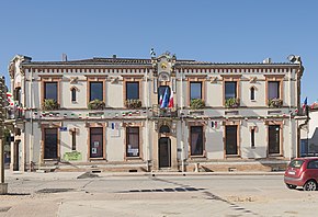 City Hall, City Hall | |||
| |||
| A country | |||
| Region | Occitania | ||
| The Department | Tarn and Garonne | ||
| County | Montoban | ||
| Canton | Tarn Tescu Quercy ver | ||
| The mayor | Jérôme beq | ||
| History and Geography | |||
| Square | 20.64 km² | ||
| Center height | 102 m | ||
| Timezone | UTC + 1 , in summer UTC + 2 | ||
| Population | |||
| Population | 3 722 people ( 2016 ) | ||
| Katoykonim | bastidians | ||
| Official language | French | ||
| Digital identifiers | |||
| Postcode | 82370 | ||
| INSEE Code | 82079 | ||
| www.labastide-st-pierre.fr/ (French) | |||
Content
Climate
The climate of the Occitania region is temperate, humid subtropical, which borders the Mediterranean climatic zone. The average air temperature is always above zero. Precipitation is distributed evenly throughout the year.
Geography
Geographical location
The municipality is located on the Tarn River on the old national road 630 , between the city of Montauban and the commune of Buzet-sur-Tarn . Labastide-Saint-Pierre is the center of the city block of Labastide-Saint-Pierre in Toulouse County .
Borders
Labastide-Saint-Pierre borders with the other six communes:
- Montauban fr. Montauban in the north
- Corbaryo fr. Corbarieu in the northeast
- Orhei (Tarn and Garonne) fr. Orgueil in the southeast
- Campas fr. Campsas in the south
- Montbartier fr. Montbartier in the West
- Bressols fr. Bressols in the northwest
Hydrography
The commune of Labastide-Saint-Pierre is built on the Tarn River, which runs through the commune in the northeast; tributaries of Tarn - the river Verne fr. ruisseau du Vergnet , Rieux Tor river Rieu Tort , River Fab ruisseau de Fabas .
Geology and Terrain
The municipality of Labastide-Saint-Pierre is located on the first terrace of Tarn on the left bank.
The area of the commune is 2064 ha; its height varies from 75 to 119 meters above sea level.
Transport
Labastide-Saint-Pierre is served by the bus line Mixed modes of transport Occitania fr. Lignes intermodales d'Occitanie . This is the line 717/717, which allows you to connect Montauban with Saint-Sulpice-la-Pointe , passing directly through the city center.
The Labastide-Saint-Pierre municipality is accessible via the A62 motorway , and also via the D930 motorway (former 630 national road ).
The commune is located near the Montbartier train station . Gare de Montbartier and Montauban-Ville-Bourbon Station Gare de Montauban-Ville-Bourbon .