Pasparta ( Jan-Pasparta ) is a river in the Ulagansky district of the Altai Republic , the right tributary of the Bashkaus .
| Passepartout | |
|---|---|
| south alt. Passeparts | |
| Characteristic | |
| Length | 16 km |
| Watercourse | |
| Source | |
| • Height | above 1720 m |
| • Coordinates | |
| Mouth | Baskaus |
| • Location | 63 km from the mouth |
| • Height | 1106 m |
| • Coordinates | |
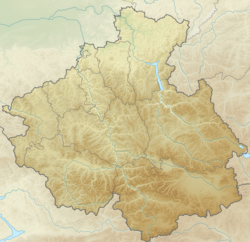
| Location | |
| Water system | Bashkaus → Chulyshman → Teletskoe → Biya → Ob → Kara Sea |
| A country |
|
| Region | Altai Republic |
| Area | Ulagan district |
| HWR code | |

Description
The length of the river is 16 km [2] (from the source of Kolbagat). It begins in the middle part of the district, 6-6.5 km north-east of the village of Pasparta [3] . It flows to the west, flows into the Baskaus 63 kilometers from its mouth.
It accepts several small tributaries: Suchikachi, Tutugem, Anayak, Karachal and others [3] .
Below the village of Pasparta, along the entire channel of the river, there is a gravel road, and in some places a stone-gravel or gravel road. The right bank of the river, where the village stands, is almost all treeless, and the left, on the contrary, is taiga (spruce, larch, cedar) [4] [3] .
Notes
- ↑ Surface Water Resources of the USSR: Hydrological Understanding. T. 15. Altai and Western Siberia. Vol. 1. Gorny Altai and Upper Irtysh / ed. V.V. Seeberg. - L .: Gidrometeoizdat, 1966 .-- 216 p.
- ↑ State Water Register . Jan Pasparta . textual.ru . Ministry of Natural Resources of Russia (March 29, 2009). Date of treatment December 20, 2018. Archived March 29, 2009.
- ↑ 1 2 3 Card sheet M-45-44 Passepartout . Scale: 1: 100,000. Status of the terrain for 1982. 1985 edition
- ↑ Passepartout . galt-auto.ru . Date of treatment March 10, 2019.