Krasnaya Gorka [1] [2] is a small mountain, administratively located in the Kosh-Agach region of the Altai Republic of the Russian Federation .
| Red hill | |
|---|---|
| south alt. Kyzyl-Tash | |
 Red Hill in the center, left | |
| Highest point | |
| Absolute height | 1910.8 [1] m |
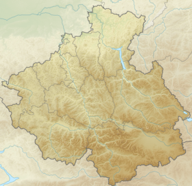
| Location | |
| A country |
|
| The subject of the Russian Federation | Altai Republic |
| Area | Kosh-Agachsky District |
| Mountain system | Altai mountains |


Content
Etymology
The national name comes from southalt. Kyzyl - red, ruddy, red, bright orange, brick red, brown; and southalt. Tash - stone, mountain, hill, hill, composed of hard rocks. Kyzyl-Tash - Red Mountain [3] .
Interestingly, in the notes of travelers of the 19th century, Krasnaya Gorka was called Chibit .
For example, P. Chikhachev described: “Chibit, called the Red Mountain by Russians, forms a magnificent serpentine formation. The shape of the mountain is also conical, with a slight slope from east to west, caused by a dip in the west and a thickening on the opposite slope ” [4] .
In the Toponymic Dictionary of Gorny Altai southalt. Chibit - ocher, yellow, yellow [5] .
Description
A small, free-standing mountain, at the foot of which passes the Chuysky Tract highway . The nearby Krasnogorsk Lake is not located directly near the mountain, but on the other side of the Chuya River.
Notes
- ↑ 1 2 Map sheet M-45-63 . Scale: 1: 100,000. Status of the terrain for 1979. 1985 edition
- ↑ Krasnaya Gorka ( No. 0605059 ) / Register of names of geographical objects on the territory of the Altai Republic as of 11/22/2016 // State catalog of geographical names. rosreestr.ru.
- ↑ Molchanova, 1979 , p. 96, 251, 256.
- ↑ > P. Chikhachev. Travel to eastern Altai. - Science, 1974. - S. 85. - 360 p.
- ↑ Molchanova, 1979 , p. 340.
Literature
Molchanova O. T. Toponymic Dictionary of the Altai Mountains . - Gorno-Altaysk : Gorno-Altai branch of the Altai Book Publishing House, 1979. - S. 96, 251,254. - 395 p. - 5,000 copies.