Sucor [2] is a mountain peak in the Kosh-Agach region of the Altai Republic.
| Sukor | |
|---|---|
| south alt. Suu-Kir | |
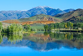 View of Mount Sucor from the banks of the Chuya River | |
| Highest point | |
| Absolute height | 2919.9 [1] m |
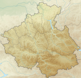
| Location | |
| A country |
|
| The subject of the Russian Federation | Altai Republic |
| Area | Kosh-Agachsky District |
| Mountain system | Altai mountains |
| Ridge or array | Sucor Array |


Etymology
Sukor, Suu-Kir from ( South Alt. Suu - water, river, water, river; Kir - mountain, peak) - water mountain, water peak [3] .
Description
Mount Sucor dominant top of the mountain range of the same name, in the area of the village of Chagan-Uzun . The Sukor massif separates the Chui steppe and the Kurai steppe and is not part of the nearby South Chui and Kurai ranges.
Notes
- ↑ Map sheet of M-45-69 . Scale: 1: 100,000. Status of the terrain for 1982. 1985 edition
- ↑ Sucor ( No. 0154710 ) / Register of names of geographical objects on the territory of the Altai Republic as of November 22, 2016 // State Catalog of Geographical Names. rosreestr.ru.
- ↑ Molchanova, 1979 , p. 295.
Literature
- Molchanova O. T. Toponymic Dictionary of the Altai Mountains . - Gorno-Altaysk : Gorno-Altai branch of the Altai Book Publishing House, 1979. - 395 p. - 5,000 copies.