Gulf of Saint Lawrence Bay ( Fr. Golfe du Saint-Laurent ; English Gulf of Saint Lawrence ) - the largest estuary on Earth, the confluence of the St. Lawrence River into the Atlantic Ocean on the eastern coast of North America .
| St. Lawrence Bay | |
|---|---|
| fr. Golfe du Saint-Laurent Gulf of saint lawrence | |
| Specifications | |
| Bay Type | The bay |
| Square | 263,000 km² |
| Volume | 35 000 km³ |
| Deepest | 572 m |
| Salinity | 32 ‰ |
| Flowing river | St. Lawrence River |
| Location | |
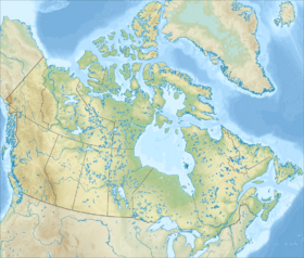
| A country |
|
| Provinces | Quebec , New Brunswick , Nova Scotia , Prince Edward Island , Newfoundland and Labrador |

It is considered to be a semi-enclosed sea in size. Washes the shores of Canada in the provinces of Quebec , New Brunswick , Nova Scotia , Prince Edward Island , Newfoundland and Labrador .
Content
Geography
In the north it is bordered by the Labrador Peninsula, in the east it is separated from the ocean by the island of Newfoundland , in the south by the island of Cape Breton and the Nova Scotia Peninsula, in the west - by the North American mainland.
Hydrography
The area of the bay is about 263 thousand km². Depth up to 572 m. The volume of water is 35 thousand km².
Straits connect the bay to the ocean:
- Kanso in the South, between Cape Breton Island and Nova Scotia Peninsula
- Cabot in the southeast, between Newfoundland and Cape Breton
- Bell Isle (Labrador) in the northeast, between the Labrador Peninsula and Newfoundland Island.
The St. Lawrence River flows into the bay.
In the water area are located:
- Anticosti island (in the north-eastern part)
- Prince Edward Island (South)
The currents form a cyclonic cycle. The average water temperature in winter is below -1 ° C, in summer up to 15 ° C. * Salinity in the north-eastern part is up to 32 ppm , in the western 12-15 ppm.
- At a depth of 100 m, the temperature is below 0 ° C, salinity 32-33 ppm
- The bottom temperature is 5 ° C, salinity is about 35 ppm
The tides are semidiurnal, their magnitude is up to 2 m. From December to May it is covered with ice. There are icebergs .
At the bottom of the bay, the course of the St. Lawrence River washed a canal reaching the eastern boundary of the shelf. Over the past century (20th century), due to the activities of mankind, the water moving along this channel completely lost dissolved oxygen, which led to significant changes in the bottom biota.
Climate
The climate is monsoon . In winter, cold north-westerly winds are mainly observed, in summer, warm south-westerly winds. The average air temperature in February is −10 ° C, in August 15 ° C.
Business Activities
The water area of the bay is a place of active shipping. The shelf, which also extends far into the Atlantic Ocean, is intensively exploited in fisheries ( haddock , sea bass , halibut , flounder , herring , etc.) and in oil production.
Ports
- Quebec (at the mouth of the St. Lawrence River),
- Seth Ile .
Ecology
Part of the shore of the bay, St. Paul’s Island and Cape Breton is a natural area protected by the Canadian Coast Guard. A number of small islands in the bay - a place of seasonal migrations of various birds, are protected by the Canadian wildlife service. On the shores of the bay are several national parks in Canada:
- the northern part of the St. Lawrence River estuary is part of the Saguenay-Saint-Laurent National Marine Park ;
- in the northern part of Prince Edward Island is the eponymous national park ;
- on the north coast of New Brunswick, Kuchibokwak National Park National Park ;
- in the northern part of Cape Breton Island, Cape Breton Highlands National Park ;
- in the northwest of the island of Newfoundland - Gros Morne National Park .
Near Cape Gaspe in the southeastern part of the province of Quebec in Forillon is the provincial park Gaspezi.
St. Lawrence Bay consists of three separate ecosystems [1] :
- The North Gulf Shelf [2] is a shallow northern part of the bay.
- (English Magdalen Shallows) [3] - shallow southern part of the bay (literal translation - “Shoal of Magdalen”, by the name of small islands in the bay).
- Laurentian Channel [4] - the deep-water central part of the bay.
See also
- Gulf of Lawrence
Notes
- ↑ National Marine Conservation Areas of Canada. Canada's National Marine Conservation Areas System Plan. Canada's Atlantic Marine Environment (Link unavailable) . Archived on June 5, 2011.
- ↑ National Marine Conservation Areas of Canada. Canada's National Marine Conservation Areas System Plan. North Gulf Shelf (link unavailable) . Archived on June 6, 2011.
- ↑ National Marine Conservation Areas of Canada. Canada's National Marine Conservation Areas System Plan. Magdalen Shallows (inaccessible link) . Archived on June 6, 2011.
- ↑ National Marine Conservation Areas of Canada. Canada's National Marine Conservation Areas System Plan. Laurentian Channel (inaccessible link) . Archived on June 6, 2011.