 |
 |
 |
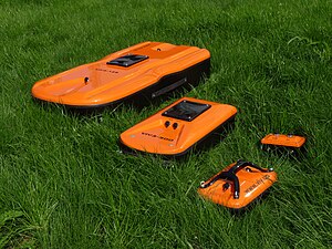
Examples of GPR |
Georadar is a radar for which the studied medium can be earth, soil (hence the most common name), fresh water, mountains.
Content
GPR Design
A modern georadar is a complex electronic device whose components perform the following functions:
- the formation of pulses emitted by the transmitting antenna;
- processing signals from the receiving antenna;
- synchronization of the entire system.
Thus, the GPR consists of three main parts: the antenna part, the registration unit and the control unit.
The antenna part includes transmitting and receiving antennas. A recording unit is a laptop or other recording device, and the role of a control unit is performed by a system of cables and optical-electrical converters.
The history of georadar development
Development of ground penetrating radars was conducted in different countries of Europe, America, Russia, the USSR. On the basis of experiments in natural conditions, methods for constructing specialized radars for sensing relatively thin, highly absorbing media were investigated. The use of shock excitation of the antenna made it possible to estimate the electrical characteristics of sea ice at different frequencies. For the first time, the radar measurement of sea ice thickness was carried out in 1971 using the method of a synthesized video-impulse signal proposed by M. I. Finkelstein in 1969 . This method is applied in the first industrial radar gauge for the thickness of sea ice "Aquamarine".
In 1973, the possibility of detecting and measuring the depth of aquifers in the desert regions of Central Asia was proved from the aircraft. A radar with shock excitation of an antenna with pulses with a duration of 50 ns and a center frequency of the spectrum of about 65 MHz, developed at RIIGA, was used. The depth of sounding turned out to be higher than 20 m with an altitude of 200 ... 400 m. The similar work was carried out for limestones in 1974 , for frozen rocks - in 1975 .
It is necessary to point out the use of the method of synthesizing an aperture in a radar system installed aboard the Apollo 17 spacecraft to study the surface of the moon. The system was tested in 1972 from the aircraft over the Greenland glaciers at a frequency of 50 MHz with a pulse duration with a linear modulation frequency of 80 µs (compression ratio 128).
Serial samples of GPR began to appear in the early 70s. In the mid-80s, interest in GPR increased due to another leap in the development of electronics and computer technology. But, as experience has shown, this development turned out to be insufficient. The effort to process materials could not pay off in full, and interest in GPR fell again. In the 90s, when the next scientific and technological revolution took place, and personal computers became more accessible, interest in GPR increased again and has not weakened until now.
Since the end of the 90s, research conferences devoted to this method have been regularly held. Special issues of magazines are published.
Principle of action
Radars of subsurface sensing are designed to study dielectric mediums by changing the dielectric constant and / or electrical conductivity. Georadars are most often used for geotechnical survey of soils and non-destructive testing of (non-metallic) building structures.
The principle of operation of most modern GPR [1] is the same as that of conventional pulsed radar . An electromagnetic wave is emitted into the studied medium, which is reflected from media sections and various inclusions. The reflected signal is received and recorded by GPR.
Currently, the majority of mass-produced radars can be grouped into several subtypes, which differ in the basic principles of operation:
- stroboscopic georadars: such radars emit mainly impulses with low energy, about 0.1-1 mJ, but such impulses emit quite a lot of 40-200 thousand pulses per second. Using the stroboscopic effect, you can get a very accurate scan - radarogram in time. In fact, averaging data from a huge number of pulses can significantly improve the signal-to-noise ratio. At the same time, a power of 0.1–1 μJ imposes serious limitations on the depth of penetration of such pulses. Typically, these radars are used for sensing depths of up to 10 meters. However, in some cases, the “penetrating” ability reaches more than 20 meters.
- weak impulse radars: such radars emit significantly less than 500-1000 pulses per second, the power of each such pulse is already significantly higher and reaches 100 μJ. Digitizing in each such pulse one point with a different shift from the beginning, you can get a radarogram in the time domain without gating. At the same time, such a device allows you to take about one radarogram per second and practically does not allow the use of averaging to improve the signal-to-noise ratio. This allows receiving radarograms from depths of tens of meters, but only specially trained specialists can interpret such radarograms.
- heavy-duty radars with separated antennas: such radars emit only a few pulses per second, but the pulse energy reaches 1-12 J. This can significantly improve the signal-to-noise ratio and the dynamic range of the GPR and receive reflections from many deep layers or work on heavy and wet soils . To process radarograms, special software is required, which manufacturers of such georadars supply with georadar. The disadvantages of powerful radar include the danger of radio emission from biological objects and a significant (up to 2-3 meters from the surface) “dead” zone. There is an alternative opinion on the issue of radio beams of biological objects by super-power GPR. Regular GPR removes one record for multiple launches (this is due to the problems of digitizing signals). Heavy duty - makes only a few starts per second (this led to the fact that for these georadars it was necessary to develop a signal digitizing system not related to the stroboscopic transformation). If you calculate the energy radiated by GPR in a second, it turns out that ordinary GPR shoots very often, but in small pulses. A heavy duty gives a large amplitude pulse, but rarely does it. The difference of the parameters is such that in the second case, the bioobject falls less than the radiated energy.
For all the types of radar listed above, it is possible to use one or several channels. In this case, it is conditionally possible to divide all these georadars into several more classes:
- single-channel georadars: there is one transmitter and one receiver in such georadars, most of the georadar manufacturers have single-channel georadars.
- multichannel paired georadars: there are several receiver-transmitter pairs in such georadars, so that the geo-profile is captured from each channel simultaneously. Such systems are common to many foreign manufacturers who specialize in the geoprofiling of pavements. Such a system actually contains several single-channel georadars and makes it possible to reduce profiling times by several times. The disadvantage of such systems is bulky (they are many times more than single-channel) and high cost.
- multichannel georadars with a synthesized receiving aperture: this is the most complex type of georadar, in which there are several receiving antennas that are synchronized with each other on one transmitting antenna. In fact, such GPR are an analogue of a phased antenna array. The main advantage of such systems is a much clearer positioning of objects underground - in fact, they work on the principle of stereo vision, as if the radar would have several eye antennas. The main disadvantage of such systems is very complex computational algorithms that need to be solved in real time, which leads to the use of expensive electronic components, usually based on FPGA and GPGPU . Typically, such systems are used only in super-power GPR with separated antennas. At the same time, such systems are more robust and provide the most accurate picture of the distribution of dielectric constant underground.
See also
- GPR
Literature
- Subsurface radar issues. Collective monograph / Ed. Grineva A. Yu. - M .: Radio engineering, 2005.-416 pp., Ill. ISBN 5-88070-070-4
- Subsurface radar / Ed. Finkelstein M. I. - Moscow: Radio and Communication, 1994
Notes
- ↑ [1] - action video
Links
- Ground Penetrating Radar (GPR) / Geology 228/378 Applied and Environmental Geophysics, Lecture 14 (Eng.)