Zheltirbas [1] [2] (Dzhiltirbas [1] ; Karakalp. Jiltirbas ko'li , Uzbek. Jiltirbos ko'li , Zhiltirbos [3] ) - artificially regulated reservoir in the Amu Darya delta , built on the spot the former Gulf of the Aral Sea of the same name [4] .
| Zhyltirbas | |
|---|---|
| Uzbek Giltirbos | |
| Morphometry | |
| Height above sea level | 52.3 m |
| Dimensions | 18.5 × 17.5 km |
| Square | 150 km² |
| Coastline | 75.8 km |
| Deepest | 4 m |
| Average depth | 1-3 m |
| Pool | |
| Flowing water | Kazakhdarya |
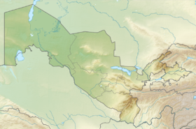
| Location | |
| A country |
|
| Autonomous Republic | Karakalpakstan |
| Area | Muynaksky district |
It is located 50 km from the Chimbay district center of Chimbay. The State Forestry and Hunting is located here, fishing and hunting are actively conducted. Zhyltirbas is relatively inaccessible, the nearest settlement - Kazakhdarya - is located 30 km, but during a period of high standing water during detours the path extends to 80–90 km. [five]
It is fed by the Kazakhdarya channel and the discharge collectors No. 1 (SK-1) and No. 3 (SK-3) [2] . In the northeast of Zhyltirbas there is a 13 km long dam [6] . The mineralization level of water is 10–15 g / l [3] .
Notes
- ↑ 1 2 Zheltirbas // Dictionary of the names of hydrographic objects of Russia and other countries - members of the CIS / ed. G.I. Donidze. - M .: Kartgeotsentr - Geodezizdat, 1999. - S. 137. - ISBN 5-86066-017-0 .
- ↑ 1 2 Map sheet K-40-VI . Scale: 1: 200 000. Indicate the date of issue / condition of the area .
- ↑ 1 2 National Encyclopedia of Uzbekistan . - Tashkent, 2000-2005. ( Uzbek )
- ↑ Kurbanbaev E., Artykov O., Kurbanbaev S. Integrated water resources management in the Amudarya River Delta. - Tashkent, 2010.
- ↑ Potential for the development of ecotourism . Source: newspaper Pravda Vostoka . The newspaper Pravda Vostoka (January 4, 2018).
- ↑ Natalia SHULEPINA. TWO YEARS AFTER DRY unopened . http://sreda.uz . The truth of the East (“The truth of the East”, 24.9, 10.10.2004.)