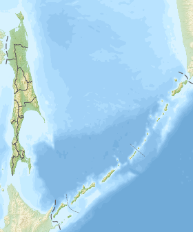
The Tonino-Aniva Range is a low-mountain meridional massif located in the extreme southeast of Fr. Sakhalin . Forms the Tonino-Aniva Peninsula . They stretch from north to south, from Cape Svobodny to Cape Aniva , for almost 90 km, the highest point - Mount Kruzenshtern - is located in the southern part (670 m). In the north stands the peak of Ayrup (504 m VUM) [1] . It is composed of Cretaceous and Jurassic sediments. The geological structure is complex and diverse. It is classified as Tonino-Aniva crustal allochthonous scales [2] . The southern and eastern shores of the ridge are avalanche hazardous, often abruptly breaking off into the sea [3] . In 1939 , the authorities of Japanese Karafuto placed Aniva lighthouse on a small rock of Sivuchya near the southern cliff of the ridge. In the northeast, the ledges are more gentle: here, at the foot of the ridge, there are many lakes and lagoons of the Muravyov Lowland , to the west of which the Korsakov Plateau rises. Monsoon climate, moderated by the influence of the oceans. The ridge is well watered: numerous rivers and streams flow into the sea from all sides. The nearest settlements to the ridge of the Sakhalin Region (Novikovo and Pikhotovy) are located on the western slope. The slopes of the ridge itself are occupied by firs .
| Tonino-Aniva Range | |
|---|---|
 | |
| Specifications | |
| Education period | chalk, jura |
| Length | 90 km |
| Highest point | |
| Highest peak | Kruzenshtern mountain |
| Absolute height | 670 m |
| Location | |
| A country |
|
| The subject of the Russian Federation | Sakhalin Oblast |

Notes
- ↑ https://geographyofrussia.com/wp-content/uploads/2014/12/316-284-640x531.jpg
- ↑ To Sakhalin seismotectonics: new approaches - the topic of a scientific article on geology read the text of a research paper in the CyberLenink electronic library for free
- ↑ https://pandia.ru/text/79/138/images/image134.png