Dzhugdyr is a mountain range in the Far East of Russia .
| Dzhugdyr | |
|---|---|
| Specifications | |
| Length | 100 km |
| Highest point | |
| Absolute height | 2107 [1] m |
| Location | |
| A country |
|
| The subject of the Russian Federation | Amur region |

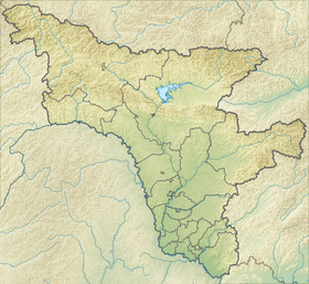
It is located in the north-east of the Amur Region on the border with the Khabarovsk Territory . It forms a jumper between the Stanovoy and May ranges . It stretches for 100 km along the watershed of the Uda and Zeya rivers. The prevailing heights are from 1000 to 1500 meters, the largest - up to 2107 m. It is a section of the southern edge raised by the latest movements and the folded border of the Aldan shield . Folded with slates. On the slopes - mountain larch taiga, above - cedar elfin and mountain tundra.
South of Stanovoy is the Dzhugdyr Range. You look at its tops from above, and it seems that there are piles of stones, long prepared for some grand construction. And the construction has already begun, but an earthquake has occurred. Part of the territory settled and overgrown with forest, while the other, on the contrary, rose high together with the walls of the begun structures, the ruins of the towers, deep excavations, littered with debris.
- Fedoseev G. A. "In the grip of Dzhugdyr" [2]
Notes
- ↑ Dzhugdyr // Great Soviet Encyclopedia : [in 30 vol.] / Ch. ed. A.M. Prokhorov . - 3rd ed. - M .: Soviet Encyclopedia, 1969-1978.
- ↑ Fedoseev G.A. In the grip of Dzhugdyr. - M .: Young Guard, 1956. - S. 11-12.
Literature
- Fedoseev G. A. In the grip of Dzhugdyr. - M .: Young Guard , 1956 .-- 324 p. - 150,000 copies.
Links
- Dzhugdyr // Great Soviet Encyclopedia : [in 30 vol.] / Ch. ed. A.M. Prokhorov . - 3rd ed. - M .: Soviet Encyclopedia, 1969-1978.
- Brief geographic encyclopedia / Ch. ed. A.A. Grigoriev . - M .: Soviet Encyclopedia , 1960. - T. 1. - S. 564.