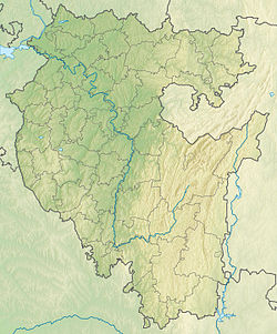
Nura is a river in the Beloretsky district of Bashkortostan . Right tributary of Belaya .
| Nura | |
|---|---|
| head off. Nura | |
| Characteristic | |
| Length | 34 km |
| Pool | 240 km² |
| Watercourse | |
| Source | |
| • Location | west of the hr. Yalangas |
| • Height | 840-860 m |
| • Coordinates | |
| Mouth | White |
| • Location | 1317 km from the estuary, Beloretsk |
| • Height | 485 m |
| • Coordinates | |
| River slope | 10.5-11 m / km |
| Location | |
| Water system | White → Kama → Volga → Caspian Sea |
| A country |
|
| Region | Bashkortostan |
| Area | Beloretsky district |
| HWR code | |
Description
The river is 34 km long, the catchment area is 240 km² [2] . The source is between Mayardak Mountain and the Yalangas Range in the territory of the South Ural Natural Reserve [3] . The general direction of the current is southeastern [4] .
It flows through mountain forests up to Beloretsk , goes around the main part of the city from the west [5] (Zarechny and Kosogorny microdistricts remain on the right) and flows into Belaya on the right bank on the southern outskirts of the city [6] (1317 km from the mouth).
The river is mainly snow fed. The bottom is sandy, stony, a bed up to 10 m wide. The flow velocity is up to 0.6 m / s. The upstream valley is swampy [7] .
The main tributaries are the Left Otnurok (10 km long, flows into the village) and the Nura stream (right, in the upper reaches).
In the middle reaches on the river are the village of Otnurok and the village of Otnurok .
Water registry data
According to the state water register of Russia, it belongs to the Kama basin district , the Belaya river water sector from the Arsky Kamen water meter post to the Yumaguzinsky hydroelectric complex , and the Belaya river sub-basin. The river basin of the river is Kama [2] .
The code of the object in the state water registry is 10010200112111100016908.
Notes
- ↑ Surface Water Resources of the USSR: Hydrological Understanding. T. 11. The Middle Urals and the Urals. Vol. 1. Kama / ed. V.V. Nikolaenko. - L .: Gidrometeoizdat, 1966 .-- 324 p.
- ↑ 1 2 State Water Register . Nura . textual.ru . Ministry of Natural Resources of Russia (March 29, 2009). Date of treatment December 20, 2018. Archived March 29, 2009.
- ↑ Map sheet N-40-69-Cb - FSUE GOSGISCENTER
- ↑ Map sheet N-40-69-Dc - FSUE GOSGISCENTER
- ↑ Map sheet N-40-81-Da - FSUE GOSGISCENTER
- ↑ Map sheet N-40-81-Db - FSUE GOSGISCENTER
- ↑ Nura . URAL. Illustrated local history encyclopedia . Publishing house "Quist".