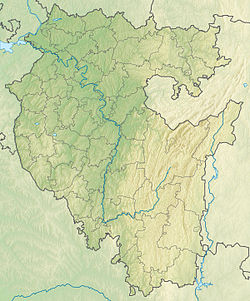
Lobovka [2] is a river in the Iglinsky district of Bashkortostan . The left tributary of Ufa .
| Lobovka | |
|---|---|
| head off. Labau | |
| Characteristic | |
| Length | 46 km |
| Pool | 374 km² |
| Watercourse | |
| Source | |
| • Location | with. Kudeevsky |
| • Height | 180-200 m |
| • Coordinates | |
| Mouth | Ufa |
| • Location | 74 km from the mouth |
| • Height | 90 m |
| • Coordinates | |
| River slope | 2.1-2.3 m / km |
| Location | |
| Water system | Ufa → Belaya → Kama → Volga → Caspian Sea |
| A country |
|
| Region | Bashkortostan |
| Area | Iglinsky District |
| HWR code | |
Description
The length of the river is 46 km, the basin area is 374 km² [3] . It flows in a suburban area of Ufa in the north-east of the city.
It originates in the village of Kudeevsky [4] . The general direction of the current is west-north-west. It flows into Ufa on the left bank 74 km from its mouth [5] .
The river flow is regulated. The channel is winding, in the mouth part the stream runs along the old town of Ufa [5] . In the lower reaches it flows through the forest, significant areas in the north and south of the basin are also covered with forest [4] .
Settlements (from the source) are located on the shores: Kudeevsky, Novotroitskoye , Tavtimanovo , Kushkul , Peschano-Lobovo , Chuvash-Kubovo , Kursaki , Sart-Lobovo , Minzitarovo and summer cottages.
Main tributaries (from the mouth):
- 30 km: Maly Bardziaul Ave. ( length 16 km)
- 33 km: Bolshoi Bardziaul Ave. ( length 19 km)
Water registry data
According to the state water register of Russia, it belongs to the Kama basin district , the water sector of the river is Ufa from the Pavlovsky hydroelectric complex to the water meter post of the urban-type settlement Shaksha , the river sub-basin of the river is Belaya. The river basin of the river is Kama [3] .
The code of the object in the state water registry is 10010201212111100023988 [3] .
Notes
- ↑ Surface Water Resources of the USSR: Hydrological Understanding. T. 11. The Middle Urals and the Urals. Vol. 1. Kama / ed. V.V. Nikolaenko. - L .: Gidrometeoizdat, 1966 .-- 324 p.
- ↑ Resolution of the Council of Ministers of the BASSR. About water protection zones of water bodies in the Bashkir Autonomous Soviet Socialist Republic (1989) . TEXEXPERT .
- ↑ 1 2 3 State Water Register . 74 km along the Ufa river . textual.ru . Ministry of Natural Resources of Russia (March 29, 2009). Date of treatment December 20, 2018. Archived March 29, 2009.
- ↑ 1 2 Map sheet N-40-42 Urman . Scale: 1: 100,000. Status of the terrain for 1982. 1984 edition
- ↑ 1 2 Map sheet N-40-41-B - FSUE GOSGISCENTER