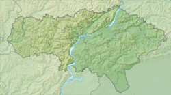
Currant is a river in the Perelyubsky district of the Saratov region . Left tributary of the Sister .
| Currant | |
|---|---|
| Characteristic | |
| Length | 14 km |
| Pool | 99.3 km² |
| Watercourse | |
| Source | |
| • Height | 90-100 m |
| • Coordinates | |
| Mouth | Sister |
| • Location | 49 km from the mouth, s. Currant |
| • Height | 46-47 m |
| • Coordinates | |
| River slope | OK. 3,5 m / km |
| Location | |
| Water system | Sister → Bolshoi Irgiz → Volga → Caspian Sea |
| A country |
|
| Region | Saratov region |
| Area | Perelyubsky district |
| HWR code | |
Description
The river is 14 km long, the catchment area is 99.3 km² [2] . The source is 4 km south of the Novokachanovsky farm [3] . It flows north past the farm and flows into the Sister in the village of Smorodinka [4] (49 km from the mouth).
There are large ponds on the river. The main tributary is the Great Taliks (right).
The pool area is treeless, indented with beams [5] .
In the lower reaches of the river the railway Pugachev - Krasnogvardeyets and the highway Pugachev - Perelyub cross.
In the pool is also located (partially) the village of Novy Perelyub station.
Water registry data
According to the state water register of Russia, it belongs to the Lower Volga Basin District , the water sector of the river is Bolshoy Irgiz from the source to the Sulak hydroelectric complex , and the river sub-basin is absent. The river basin is the Volga from the upper Kuibyshev reservoir to the confluence with the Caspian.
The code of the object in the state water registry is 11010001612112100009773 [2] .
Notes
- ↑ Surface Water Resources of the USSR: Hydrological Understanding. T. 12. Lower Volga and Western Kazakhstan. Vol. 1. Lower Volga / ed. O. M. Zubchenko. - L .: Gidrometeoizdat, 1966 .-- 287 p.
- ↑ 1 2 State Water Register . Currant . textual.ru . Ministry of Natural Resources of Russia (March 29, 2009). Date of treatment December 20, 2018. Archived March 29, 2009.
- ↑ Map sheet M-39-4-Bd - FSUE GOSGISCENTER
- ↑ Map sheet M-39-4-Bb - FSUE GOSGISCENTER
- ↑ Yandex.Maps (satellite image of the area) .