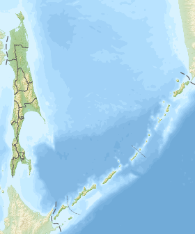
Pommer [1] is a lagoon type bay of the Sea of Okhotsk off the northern coast of Sakhalin Island . Refers to the territory of the Okhotsk urban district . On the shores of the bay are the village of Nekrasovka and the abandoned village of Kolendo [2] .
| Die | |
|---|---|
| Characteristics | |
| Bay Type | lagoon |
| The average tide | 2 m |
| Deepest | 3m |
| Location | |
| Upstream water area | Sea of Okhotsk |
| A country |
|
| The subject of the Russian Federation | Sakhalin Oblast |
| Area | City District "Okha" |

The name in translation from Ainu is “ beluga whale ” [3] .
Pomir is separated from the sea by the Kemi peninsula [4] 18 km long and is connected to the Sakhalin Gulf by a narrow strait. The shore of the bay is slightly indented, low, mostly sandy. During low tide, the bottom is exposed at a distance of up to 2 km from the coast [5] .
On the swampy shore of the bay, a sparse forest of larch grows with cedar dwarf , wild rosemary, blueberries, cloudberries. On the west coast, a mixed forest of larch, white birch, mountain ash with cedar dwarf dominates. The soils around are mainly marsh peaty and peaty-gley soils of high bogs [5] .
The bay freezes in November. The ice period lasts more than 200 days [5] .
The avifauna of the land is very diverse, some species of birds are listed in the Red Book of Russia [5] .
Recently, the Gulf of Pomr has become shallow, as a result it freezes in places and access to fish from the sea is closed here - navaga and smelt, which are the objects of fishing for the local population. The water area of the bay is subject to pollution from a household landfill in the village of Nekrasovka [6] .
Notes
- ↑ Pommer ( No. 0198958 ) / Register of names of geographical objects on the territory of the Sakhalin Region as of December 20, 2017 // State Catalog of Geographical Names. rosreestr.ru.
- ↑ Map sheet N-54-82 Colendo . Scale: 1: 100,000. Status of the terrain in 1999. 2003 Edition
- ↑ K. M. Braslavets. History in titles on a map of Sakhalin Oblast. - Yuzhno-Sakhalinsk: Far Eastern Book Publishing House, 1983. - P. 87. - 144 p. - 10,000 copies.
- ↑ Map sheet N-54-XXIII of Okha . Scale: 1: 200 000. Indicate the date of issue / condition of the area .
- ↑ 1 2 3 4 Bay Baikal and Pommer
- ↑ One of the bays of Sakhalin Becomes shallow and filled with garbage . ASTV (March 20, 2013).