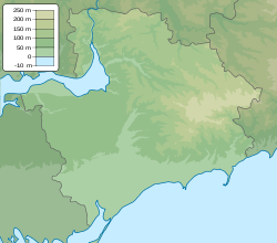
Kilticia ( ukr. Kiltychcha ) is a left tributary of the Obitochnaya River located in the territory of the Bilmak , Berdyansk and Primorsky districts ( Zaporizhia region , Ukraine ).
| Quilticia | |
|---|---|
| ukr Kiltychchya | |
 river in the village Androvka (Berdyansk district) river in the village Androvka (Berdyansk district) | |
| Characteristic | |
| Length | 70 km |
| Pool | 554 km² |
| Watercourse | |
| Source | |
| • Location | Smirnov |
| • Coordinates | |
| Mouth | Utility |
| • Location | Primorsk |
| • Coordinates | |
| River slope | 2.5 m / km |
| Location | |
| Water system | Fitting → Berdyansk Bay → Sea of Azov |
| A country |
|
| Region | Zaporozhye region |
Geography
The length is 70 km. The basin area is 554 km². The river bed (water level marks) in the lower course (Shevchenkovo village) is at an altitude of 20.6 m above sea level, in the upper course (Ivanovka village) it is 57.8 m. The current velocity is 0.1.
Trapezoid valley, up to 3 km wide, up to 40 m deep. There are patches of steep coast with a beach height of 3-6 m. the stream is straightened into a canal (canalized), 7 m wide and 1.2 m deep. Several ponds were created. The banks of the river with meadow vegetation, in the upstream - marshy with reed vegetation.
River water is used for irrigation and technical water supply.
The maximum annual river flow occurs in the spring. Power snow and rain. It freezes in the second half of December, melts in mid-February; ice mode non-permanent. The bed of the river silted and cleaned in some areas.
It takes the beginning south of the village of Smirnovo . It flows into the Obitochnaya River in the city of Primorsk .
Tributaries:
- Reed l
- Gruzskaya and Chabanskaya pr beams
- Burtichiya l
Notes
Links
- Geographic encyclopedia of Ukraine : in 3 t / Redcol .: AM Marinich and others. - K .: Ukrainian radian encyclopedia, 1989-1993. - ISBN 5-88500-015-8 . (in Ukrainian)
- Quiltic // Catalog of Ukraine / Comp.: G. І. Shvets , N. І. Drozd , S.P. Levchenko ; Ed .: V.I. Moklyak . - Kiev : View of the Academy of Sciences of the URSR , 1957. - 192 p. - 3000 copies (in Ukrainian)
- Map sheet L-37-26 Andreyevka . Scale: 1: 100,000. State of the area in 1990. 1992 edition
- Map sheet L-37-38 Berdyansk . Scale: 1: 100,000. State of the area in 1988. 1992 edition
- Map sheet L-37-37 Primorsk . Scale: 1: 100,000. State of the area in 1988. 1991 edition
- Ecological passport of the Zaporozhye region (2010)