Zhylandy ( Serikbay ) - a river in Kazakhstan , the Sarysu river basin, the right tributary of the Kara-Kengir . It flows through the territory of the Ulytau district of the Karaganda region . The length is 100 km. The pool area is 2800 km². It begins with sources on the northern slope of Zhamankotir Mountain, flows into the Kara-Kengir River. Spring flood. In the summer it splits into stretches.
| Zhelandy | |
|---|---|
| kaz. Zhelandy | |
| Characteristic | |
| Length | 100 km |
| Pool | 2800 km² |
| Watercourse | |
| Source | |
| • Location | Zhamankotir city |
| • Coordinates | |
| Mouth | Kara Kengir |
| • Height | 353 m |
| • Coordinates | |
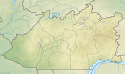
| Location | |
| Water system | Kara-Kengir → Sarysu → Telikol |
| A country |
|
| Region | Karaganda region |
| Area | Ulytau district |
On the river is the village of Satpayev .
Literature
- Jyland // Kazakhstan. National Encyclopedia . - Almaty: Kazakh encyclopedias , 2005. - T. II. - ISBN 9965-9746-3-2 .
When writing this article, material from the publication Kazakhstan. National Encyclopedia ”(1998-2007), provided by the editors of the“ Kazakh Encyclopedia ”under a Creative Commons BY-SA 3.0 Unported license .