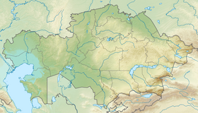
Turgai valley ( Turgay valley ) - erosion-tectonic hollow in Kazakhstan and Russia . Lozhbina can be traced in relief from the lower reaches of the Tavda River in the north, to the Northern Aral Sea region in the south [1] . Crosses the Turgai Plateau from south to north. It connects the West Siberian Plain with the northern part of the Turan Lowland in Kazakhstan [2] .
| Turgai hollow | |
|---|---|
| kaz. Torғay Kolaty | |
| Specifications | |
| Absolute height | 100-125 m |
| Dimensions | from 25 to 300 × 800 km |
| Rivers | Turgay , Ubagan , Tobol |
| Lakes | Kushmurun |
| Location | |
| Country |
|
| Regions | Aktobe region , Kostanay region , Kurgan region , Tyumen region |

The Turgai , Ubagan , Tobol rivers flow along the Turgai depression. There are many lakes in the valley. The absolute heights are 100-125 m. To the west and east of the Turgai hollow, heights increase to 200, sometimes up to 300 m. A chain of numerous lakes stretch along the hollow with a large lake Kushmurun in the north, into which the Ubagan River flows, in the south, the river flows through the hollow Turgay [3] . Length about 630 or 800 km, width from 20-75 to 300 km. The prevailing heights are up to 125 and 200-300 m.
In the north - dry steppes (the area of development of virgin and fallow lands), in the south - semi-deserts and deserts Barsuki Bolshoi and Malye . The Naurzum Reserve is located in the valley.
On the Turgai hollow in the Pliocene and Pleistocene, the Turan Sea in some periods connected with the West Siberian Sea [4] .
Relief and geological structure
As a morphologically expressed element in the relief of Western Siberia, the Turgai hollow begins to be traced slightly south of 58 ° C. w. - from the lower reaches of the Tavda river. To the north of the last bottom of the hollow merges with the surface of the Kondinsky lowland , forming a single geomorphological level with it. The eastern root slope of the hollow continues further north, up to the latitudinal segment of the Ob . It is a high (up to 40-60 m), steep ledge of a hill, the Tobolsk mainland , cutting off to the Kondinsky lowland. To the south, from the lower reaches of Tavda to the mouth of the Ubagan River, for about 400 km, its pattern of the hollow resembles a classic lineament . In this section, the contour of the hollow is perceived as a huge furrow laid in the southern part of the West Siberian Plain [1] .
In the west, between the Trans-Ural peneplain and the hollow, there is the Kustanai-Miass plain . It is inclined as a whole to the north with a slight bias in the northeast direction, towards the Kondinsky lowland and the Tobolsk continent . According to the slope of the absolute elevation of the surface of the plains are reduced from 230 to 150 m [1] .
To the east of the hollow, north of the Kazakh shield , there is a system of stepped plains, successively merging to each other. The northernmost of them is represented by the Tobolsk continent with absolute elevations of 90–130 m. The middle stage corresponds to the Ishim plain with a weak slope of the surface to the north from 180 to 150 m. The southern step, with a slope in the same direction from 220 to 200 m, is Tyutyugur the plain . In the band 52 ° c. w. she leans against the Turgay plateau . The plateau is located at the site of the closest approximation of the structures of the Urals and the Kazakh shield , between 48 ° C. w. and 52 ° c. w. In the system of the Ural-Tien Shan epigercin platform of this territory, the Turgai trough corresponds, which is the connecting link between the structures of the West Siberian and Turan plates [1] .
From the headwaters of the Ubagan River to Lake Kuyukkul , already within the Turgai Plateau, for about 150 km, the hollow has a strictly meridional extension. A relatively narrow part 22–25 km wide is confined to the same site. The transverse profile of the hollow in this section has a trough-like shape. The modern bottom of the hollow, lying on the abs. elevations of 120-130 m, limited by relatively high (60-80 m) slopes. The ancient talweg of the hollow is buried beneath 70–90 m of the thickness of the Quaternary sediments. He is here at abs. elevations of 30-40 m. The modern bottom of the hollow in this part is not currently drained by rivers. This part of the hollow is called the “ Turgai Gate ” or “the dead Ubago-Turgai hollow”. This part of the hollow corresponds to the intra-subbasin watershed separating the rivers of the Irtysh basin (Ubagan, the middle and lower reaches of Tobol ) from the rivers of the Turgai drainage basin [1] .
The intra-valvular watershed and the adjacent sections of the bottom of the hollow are abundant in morphologically weakly separated lowlands, the lowest parts of which are occupied by large lakes - Kushmurun (465 km²), Sarykopa (336 km²), Aksuat (123 km²), Saramoin (126 km²) and others. These lakes are the water inlets of small steppe rivers flowing from the sides of the trough and the ephemeral spring runoff, which is formed from melting snow in the bottom of the trough itself. South of 50 ° C. w. the hollow enters the contours of the South Turgai plain . Lozhbina here noticeably loses its “face”, characteristic of its more northern sections. The morphological manifestation of the hollow is significantly reduced. This phenomenon is associated, on the one hand, with small abs. heights (140-180 m) of the levels of Pleistocene pediplanes associated with a hollow, on the other hand, with a large width of the hollow bottom. At the latitude level of the basin of Lake Sarykop, the width of the hollow reaches about 50 km [1] .
From the mouth of the Saryozen River, the extension of the hollow changes to the southwest. Its bottom is drained here by Turgay . The hollow retains its south-western direction for almost 200 km, before merging with the Irgiz river valley. Before merging with Irgiz, Turgai forms an extensive intra-valley delta. The frontal part of the delta is cut by the latitudinal section of the lower reaches of the Irgiz , which Turgai also acquires direction before drying out in the vast, shallow lowland of the Teniz litter. The southern extension of the hollow from Irgiz to the Aral Sea is devoid of runoff. The modern bottom of this dead part of the hollow, with a length of about 200 km, is cut into the surface of the flat-top canteen remnants (Dopleistocene pediplanes) of the Northern Aral Sea to a depth of 120-150 m. The contours of the hollow here become blurry and practically not expressed in relief [5] .
Minerals
Large deposits of magnetite iron ores (Kacharskoye, Sokolovskoye, Sarbayskoye, Kurzhunkolskoye) and phosphorous brown iron ore (Ayatskoye, Lisakovskoye), as well as bauxites (the largest - Arkalykskoye deposit) were discovered in the Turgai trough; large coal reserves were discovered ( Ubagan basin ) [6] . In the western part of the hollow is the West Turgai nickel region [7] .
Interesting Facts
In the Turgai Valley, the so-called Turgai or Indrikoterium fauna was discovered for the first time - a complex of extinct animals that inhabited the temperate zone of Eurasia (from China to the Balkan Peninsula ) in the Middle Oligocene [8] .
See also
- Turn of Siberian rivers
- Turgai Plateau
- Turan lowland
- Turgay fauna
Notes
- ↑ 1 2 3 4 5 6 http://elibrary.udsu.ru/xmlui/bitstream/handle/123456789/10710/2013105.pdf?sequence=1
- ↑ Turgai trough. Paleogeographic features of modern geosystems. Past and present stock - Economic and geographical characteristics of Kazakhstan - Articles - IntoRegions .... (inaccessible link) . Date of treatment June 19, 2015. Archived June 19, 2015.
- ↑ Geography
- ↑ Karnaukhov A.V., Karnaukhov V.N. A new model of glaciation in the Northern Hemisphere (Inaccessible link) . Date of treatment December 14, 2012. Archived November 21, 2010.
- ↑ A. G. Illarionov. Turgay spillway. On the history of the formation and development of the river network of the Aral-Irtysh region. Izhevsk, 2013
- ↑ Central Kazakhstan
- ↑ West Torgai Nickel region // Kazakhstan. National Encyclopedia . - Almaty: Kazakh encyclopedias , 2005. - T. II. - ISBN 9965-9746-3-2 .
- ↑ Biological Encyclopedic Dictionary / Ch. ed. M.S. Gilyarov ; Editorial: A.A. Baev , G.G. Vinberg, G.A. Zavarzin et al. - M .: Sov. Encyclopedia , 1986. - S. 229-230. - 831 s. - 100,000 copies.
Literature
- Turgai hollow // Television tower - Ulan Bator. - M .: Big Russian Encyclopedia, 2016. - ( Big Russian Encyclopedia : [in 35 vols.] / Ch. Ed. Yu. S. Osipov ; 2004—2017, vol. 32). - ISBN 978-5-85270-369-9 .
- BDT - article from the Great Soviet Encyclopedia .