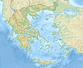
Pagasitikos [1] , Gulf of Pagasia , Pagasit Bay ( Greek Παγασητικός Κόλπος ) - a bay in Greece . Located in Magnesia in the southeastern part of the periphery of Thessaly . One of the most important bays from Greece, on the north coast is the port of Volos . It is washed by the Magnesia Peninsula in the east, and by the Tricerion in the south. The bay area is 175 square kilometers, the greatest depth is 97 meters [1] . At the exit of the bay is the island of .
| Pagasitikos | |
|---|---|
| Greek Παγασητικός Κόλπος | |
 | |
| Characteristics | |
| Deepest | 97 m |
| Flowing river | Amfrisos |
| Location | |
| Upstream water area | the Aegean sea |
| A country |
|
| Periphery | Thessaly |
| Peripheral unit | Magnesia |

Received the name from the ancient city of Pagas [2] .
On the coast of the bay in 353 BC e. the battle took place on the Crocus field , in which the Phocians were defeated by the Makemodyans and Onomarchus died.
Notes
- ↑ 1 2 Greece: Reference card: Scale 1: 1 000 000 / hl. ed. Y. A. Topchiyan ; Ed .: G. A. Skachkova , N. N. Ryumin . - M .: Roskartografiya, Omsk Cartographic Factory , 2001. - (The countries of the world "Europe"). - 2000 copies.
- ↑ Pagasae // The Real Dictionary of Classical Antiquities / ed. F. Lubker ; Edited by members of the Society of Classical Philology and Pedagogy F. Gelbke , L. Georgievsky , F. Zelinsky , V. Kansky , M. Kutorgi and P. Nikitin . - SPb. , 1885. - S. 971.