Sampalchakhl [1] (Sampal-Chakhl [2] , Sampalchakhl [3] ) is a mountain with a height of 948.4 meters on the border of the Sverdlovsk Region and the Perm Territory , and is part of the Oshnur Range.
| Sampalchahl | |
|---|---|
| mans Sampal-Syahyl | |
| Highest point | |
| Absolute height | 948.4 m |
| Location | |
| A country |
|
| The subject of the Russian Federation | Sverdlovsk region |
| Mountain system | Northern Urals |
| Ridge or array | Oshner |

Geographical position
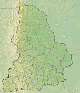
Sampalchakhl Mountain is located on the border of the municipal unit " Ivdelsky urban district " of the Sverdlovsk Region and Krasnovishersky District of the Perm Territory , as part of the Oshner Range, 46 kilometers south of Otorten Mountain. Height 948.4 meters [3] . On the southwestern slope of the mountain there is the source of the Big Niols river (the tributary of the Niols river), on the northwestern slope there is the source of the left tributary of the Vishera river, on the eastern slope there is the source of the left tributary of the Malaya Toshemka river (the tributary of the Northern Toshemka river) [2] .
Description
Up to a height of 650 meters, the forest zone is covered with fir-spruce forests with cedar, above it is meadow and tundra vegetation, stone placers, and on the top is a flat stone plateau [3] . The western part of the mountain is located on the territory of the Vishersky Reserve [2] .
Toponym
Sampal-Syakhyl from the Mansi language means one-eyed mountain, half-eyed mountain, a curved hill . The name reflects the peculiarity of the mountain's form: its small top is shifted in relation to its entire array [2] .
Notes
- ↑ Map sheet P-40-95.96 Second North . Scale: 1: 100,000. 1979 Edition.
- ↑ 1 2 3 4 Chelyshev S. R. Sampal-Chakhl, mountain // Perm encyclopedia
- ↑ 1 2 3 Rundkvist N., Zadorina O. Sverdlovsk Region. From A to Z: The Illustrated Local Lore Encyclopedia . - Ekaterinburg: Kvist, 2009. - 456 p. - ISBN 978-5-85383-392-0 .