Puramunitur (Purminsky stone, Purma-Munit-Ur) - a mountain 1075 meters high on the border of the Sverdlovsk region and the Republic of Komi , is part of the Belt Stone ridge. On the mountain there are remnant rocks.
| Puramunitur | |
|---|---|
| mans. Pura Munit-ur | |
 View of Mount Puramunitur from the slope of Mount Saklaimsorichahl | |
| Highest point | |
| Absolute height | 1075 m |
| Location | |
| A country |
|
| The subject of the Russian Federation | Sverdlovsk region |
| Mountain system | North Ural |
| Ridge or array | Belt Stone |

Content
Geographical position
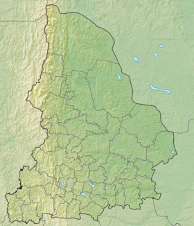
Mount Puramunitur is located on the border of the Ivdelsky City District municipality of the Sverdlovsk Region and the Komi Republic , as part of the Poyasny Kamen ridge, 22 kilometers south of Mount Otorten . The mountain is 1075 meters high and with a difficulty factor of 1A. The mountain is located 1 kilometer northeast of Mount Saklaimsorichahl [1] .
Description
On the southwestern slope of the mountain there is a snowfield from which one of the sources of the Purma River originates .
Toponym
On the maps of the middle of the 19th century, E. K. Hoffman, M. A. Kowalski, D. F. Yuryev’s mountain is called Porimongit-urr , Porre-Mongit-Ur , Purre-Mongit from the Mansi word for pori - “transverse”. Mount Pura-Moonit is stretched from west to east across the Ural Range. It is possible that over time, the Mansi pori was replaced by the Purmon hydronym or this was due to the pronunciation of something between the Pura Munit and Porimongit [2] .
On the maps of the beginning of the 20th century, the mountain is called the Purminsky stone : "The Purminsky stone (Porimongit-Ur, 3440 f.) Is covered with huge rocks (G.N. Kirilin, 1914) " [3] . In the articles of the geologist E. S. Fedorov in the Mining Journal, in the V volume of the multivolume edition of Russia (the Urals and the Urals) and the 1923 Map of the Urals and the Urals, Purminsky is also shown on the site of Pura-Munit-Ura Stone [2] .
The toponym may have the meaning “Mountain of sacrificial (feasting) rocks” (from the Mansi puri - “sacrifice”, “feast”) [2] .
Notes
- ↑ Rundqvist N., Zadorina O. Sverdlovsk Region. From A to Z: Illustrated Local History Encyclopedia . - Yekaterinburg: Quist, 2009 .-- 456 p. - ISBN 978-5-85383-392-0 .
- ↑ 1 2 3 Northern Urals from the headwaters of the Pechora to the Molebny Stone ridge //UralSky.info
- ↑ Rundqvist N.A., Zadorina O.V. Ural. Illustrated local history encyclopedia . - Yekaterinburg: Quist, 2013 .-- S. 366. - 592 p. - ISBN 978-5-85383-523-8 .