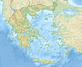
Gulf of Corinth [1] [2] ( Greek Κορινθιακός κόλπος ) is the deep narrow bay of the Ionian Sea in Greece , between Central Greece in the north and the Peloponnese Peninsula in the south.
| Gulf of corinth | |
|---|---|
| Greek Κορινθιακός κόλπος | |
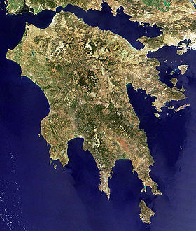 Peloponnese Peninsula , view from space | |
| Specifications | |
| Flowing river | Mornos |
| Location | |
| A country |
|
| Peripherals | Central Greece , Western Greece , Attica , Peloponnese |
In the east it is bounded by the Corinthian isthmus , through which a canal of the same name is dug into the Aegean Sea , and in the west it is separated from the Gulf of Patraikos by the Rion-Andirion gorge, connected by the Rion-Andirion bridge, the longest cable-stayed bridge in Europe. The length is about 115 kilometers, the maximum width at Kyaton is about 25 kilometers. Narrows to 4 kilometers between Drepanon and the delta of the Mornos river, and up to 2 kilometers at the narrowest point, between Rion and Andirion .
Tresnina Drepanona and Rion-Andirion gorge are formed by sediments of small rivers and streams. The northern shores of the Gulf of Corinth are steep and indented, with many bays and bays, the most important of which are the harbors of Nafpaktos , Itea and Andikira . The southern shores of the Gulf of Corinth are smoother and surrounded by a narrow strip of sediments of the Tertiary and Quaternary periods, consisting of conglomerate , marl and sandstone . In the east, the bay is divided into the large bay of Alkionides in the north and the smaller Corinthian bay in the south.
Gulf of Corinth is surrounded by mountains such as Gyona , Parnassus , Helikon , Gerania and others in Central Greece, Kilini , Aroania , Panajaikon and others in the Peloponnese. Only the southeast coast has a hilly terrain.
Between Patraikos and the Gulf of Corinth there is a tidal current similar to the current in the Strait of Evripe , but much weaker, only 3-4 kilometers per hour.
The Gulf of Corinth is considered an asymmetric tectonic basin, the faults associated with its formation are mainly almost vertical. Earthquake epicenters along the bay indicate seismic activity of faults. The bay is located in one of the most seismically dangerous areas in Europe.
The Gulf of Corinth is surrounded by: the peripheral units of Aetolia and Akarnania and Phocis in the north, Boeotia in the northeast, Western Attica in the east, Corinth in the southeast and south, and Achaeus in the southwest.
Along the southern coast runs the highway 8 "Olympia" Patras - Corinth - Athens , part of the European route E65 . Along the northern coast runs the national road 48 Nafpaktos - Levadia , which is also part of the European route E65.
Notes
- ↑ Gulf of Corinth // Dictionary of geographical names of foreign countries / ed. ed. A.M. Komkov . - 3rd ed., Revised. and add. - M .: Nedra , 1986.- S. 173.
- ↑ Greece: Reference card: Scale 1: 1,000,000 / hl ed. Y. A. Topchiyan ; Ed .: G. A. Skachkova , N. N. Ryumin . - M .: Roskartografiya, Omsk Cartographic Factory , 2001. - (The countries of the world "Europe"). - 2000 copies.