Bell Peninsula ( born Bell Peninsula ), previously known as Bell Island ( born Bell Island ) - the south-eastern part of Southampton Island in the Canadian Arctic Archipelago , is located in the Kivallik region of the Canadian territory of Nunavut .
| Bell | |
|---|---|
| English Bell peninsula | |
 Map drawn by , 1913. | |
| Specifications | |
| Highest point | 213 m |
| Location | |
| Water area | Hudson bay |
| A country |
|
| Territory | Nunavut |
| Area | Nod |

Content
Location
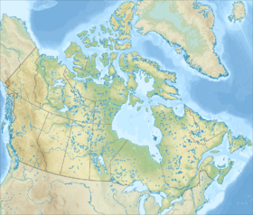
The peninsula is in close proximity to the Inuit settlement of Coral Harbor . The southern shores form the northern boundary of the Hudson Bay , while the eastern shores are washed by Fox Bay . This area is frequently visited by polar whales [1] . There are several large bays. Mountain in the north of the peninsula is its highest point - 213 meters.
History
The peninsula is named after , manager of the Hudson's Bay Company and explorer.
On the peninsula there are five archaeological monuments , ruins of settlements, representatives of the ancient Eskimo culture of Dorset . Sadlermiuts ceased to exist as a people in the winter of 1902-1903, when an infectious disease introduced by Europeans killed everyone in a few weeks. After that, settled on the island, resettled from Bay areas and .
In 1910, polar explorer renamed Southampton Island and corrected a cartographic error according to which Bell was a separate island [2] [3] .
Links
- Bell Pensula (English) . Canadian Topographic Maps . Canada map sales . The appeal date is January 25, 2018.
Notes
- An Dean WG A Report on the Physiography of the Bell Peninsula and the South Bay Region of Southampton Island (Eng.) // Geographical Branch. - Ottawa, Ont .: Ministry of Mines and Energy, 1951.
- ↑ Comer G. A Geographical Description of the Southampton Island (Notes ) // Bulletin of the American Geographical Society. - American Geographical Society , 1910. - Vol. 42 , no. 2 - P. 84-90 . - DOI : 10.2307 / 199566 .
- ↑ Comer G. Additions to the Captain Map of Southampton Island (Eng.) // Bulletin of the American Geographical Society. - American Geographical Society , 1913. - Vol. 45 , no. 7 P. 516-518 . - DOI : 10.2307 / 200062 .