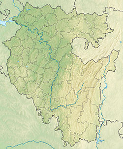
The Oka is a river in Russia , it flows through the Sverdlovsk region (source in Artinsky district ) and Bashkortostan , the right tributary of the Ik River. The length of the river is 99 km, the basin area is 1080 km² [2] . It falls into a pond near the village of Bolsheustikinsky , 7.3 km from the mouth of the Ik. The mouth height is 192.6 m above sea level [3] . On the river are the villages of Big Oka and Middle Oka, as well as other settlements. The main tributaries are the Malaya Karsya , Karsya , and Tavrushka .
| Oka | |
|---|---|
| Characteristic | |
| Length | 99 km |
| Pool | 1080 km² |
| Watercourse | |
| Source | |
| • Coordinates | |
| Mouth | Ik |
| • Height | 192.6 m |
| • Coordinates | |
| Location | |
| Water system | Ik → Ay → Ufa → White → Nizhnekamsk reservoir → Kama → Volga → Caspian Sea |
| A country |
|
| Regions | Sverdlovsk region , Bashkortostan |
| HWR Code | |
Water Registry Data
- The code of the water object - 10010201012111100022679
- Hydrological code 111102267
- GI Volume Number 11
- Graduation Issue 1
Notes
- ↑ Surface water resources of the USSR: Hydrological knowledge. T. 11. Middle Ural and Urals. Issue 1. Kama / ed. V.V. Nikolaenko. - L .: Gidrometeoizdat, 1966. - 324 p.
- ↑ State Water Register . Oka . textual.ru . Ministry of Environment of Russia (March 29, 2009). The appeal date was December 20, 2018. Archived March 29, 2009.
- ↑ Map Sheet N-40-9 Bolsteustykinsky . Scale: 1: 100,000. 1978 Edition.