Kolomensky Island is located in the Admiralty District - the historical part of St. Petersburg . It is bounded from the north by the Moika River , from the east by the Kryukov Canal , from the southeast by the Griboedov Canal , from the south by the Fontanka River , from the west by the Neva River and from the north-west by the Pryazhka River .
| Kolomensky island | |
|---|---|
| Characteristics | |
| Area | 0.93 km² |
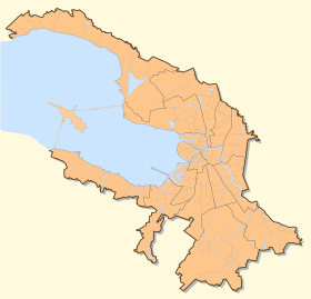
| Location | |
| Water area | Neva |
| A country |
|
| The subject of the Russian Federation | St. Petersburg |

Content
- 1 History
- 2 Bridges
- 3 Green spaces
- 4 See also
- 5 Literature
History
The island was formed artificially at the beginning of the 18th century by separating part of the Pervushin island (now Pokrovsky , Kazan , Kolomensky and Spassky islands ) by connecting the Catherine Canal with the Moika River and building the Kryukov Canal .
Until 1917, the island was part of the Spassky part.
Bridges
- The island is connected to Kazan Island through the Kryukov Canal with four bridges:
- Matveev bridge
- Decembrists Bridge
- Trade bridge
- Kashin bridge
- It is connected to the 2nd Admiralty Island by the Khrapovitsky bridge over the Moika River.
- The island is connected to Pokrovsky island through the Griboedov Canal with five bridges:
- Pikalov bridge (along the embankment of the Kryukov Canal)
- Mogilev bridge (in the alignment of Lermontov Avenue)
- Alarchin Bridge (in the English Prospect alignment)
- Kolomensky bridge (pedestrian, in the alignment of Volodya Yermak street)
- Malo-Kalinkin bridge (along the Fontanka embankment)
- It is connected to the Nameless Island by the Staro-Kalinkin Bridge over the Fontanka River .
- The island is connected to Matis Island through the Buckle River by four bridges:
- Matisov bridge .
- Bath Bridge .
- Byrd bridge .
- A spy bridge (across the Admiralty Shipyards plant).
Green spaces
- Square on Kulibin Square
See also
- Kolomna
Literature
- Leningrad. Historical and geographical atlas. - M .: Main Directorate of Geodesy and Cartography under the Council of Ministers of the USSR, 1981.
- Darinsky A.V. Geography of Leningrad. - L .: Lenizdat, 1982.
- City names today and yesterday: Petersburg toponymy / comp. S.V. Alekseeva, A.G. Vladimirovich , A.D. Erofeev et al. - 2nd ed., Revised. and add. - SPb. : Lick , 1997 .-- S. 56 .-- 288 p. - (Three centuries of Northern Palmyra). - ISBN 5-86038-023-2 .
- Gorbachevich K. S. , Khablo E. P. Why are they so named? On the origin of the names of streets, squares, islands, rivers and bridges of St. Petersburg. - SPb. : Norint , 2002 .-- 353 p. - ISBN 5-7711-0019-6 .
- St. Petersburg: Encyclopedia. - M .: Russian Political Encyclopedia, 2006.