Cahul is a river that flows into Lake Cahul , in the Cagul region of Moldova and the Odessa region of Ukraine .
| Cahul | |
|---|---|
| Ukrainian Cahul , room. Cahul | |
| Characteristic | |
| Length | 193 km |
| Water consumption | 0.3 m³ / s |
| Watercourse | |
| Source | |
| • Location | Lebedenko |
| • Coordinates | |
| Mouth | Cahul |
| • Location | New Etulia |
| • Coordinates | |
| Location | |
| Water system | 605 |
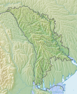
| Moldova | Cahul district |
| Ukraine | Odessa region |
Content
Geography
It originates from a stream in the Moranda beam, which is north of the village of Lebedenko ( Moldova ), flows into Lake Cahul west of the village of New Etulia . According to the topographic map, the mouth part flows along the state border of Moldova and Ukraine, on the google.com.ua/maps service, the river flows into Lake Cahul on the state border of Moldova and Ukraine. At the source it dries up; several ponds have been created. The lower course (south of Vulcanesta and to the mouth) and partially in the upper course (between the villages of Gutul and Satuk) is straightened into a canal with a two-sided dam, 8-25 m wide and 1-1.3 m deep. The right bank of the valley in the upper river indented by beams and ravines, and in the lower reaches the left bank is indented. The estuary part of the valley is occupied by floodplains.
During rains, the river fills with water .
Tributaries: (from source to mouth)
- beam Vale-Ursoy l
- beam of Havanos l
- Beam Rezyshiya l
- Flamind p beam
- Beam Humi L
- Geljagul l beam
- beam Ungurului p
- beam Karabibar l
History
The Cahul River is famous for the victory of P. A. Rumyantsev over the Turks on July 21 (August 1), 1770. The battle took place near the village of Vulcanesti during the Russo-Turkish war of 1768-1774 and ended in the defeat of the Turkish army [1] .
Notes
- ↑ Cahul // Military Encyclopedia : [in 18 vol.] / Ed. V.F. Novitsky [et al.]. - SPb. ; [ M. ]: Type. t-va I. D. Sytin , 1911-1915.
Literature
- Cahul, river // Brockhaus and Efron Encyclopedic Dictionary : in 86 volumes (82 volumes and 4 additional). - SPb. , 1890-1907.
- Surface water resources of the USSR. Description of rivers and lakes and calculations of the main characteristics of their regime. - T. 6. Ukraine and Moldova. Vol. 1. Western Ukraine and Moldova (without the basin of the Dniester River). - L., Gidrometeoizdat, 1978. - 108-109 p.
- Map sheet L-35-81 Cahul . Scale: 1: 100 000. Indicate the date of issue / condition of the area .
- Map sheet L-35-93 Galati . Scale: 1: 100 000. Indicate the date of issue / condition of the area .