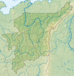
Kosya , Kosyu is a river in the Komi Republic ( Inta district ), a left tributary of the river Usa (the Pechora basin).
| Kosyu | |
|---|---|
 Pechory Pool Pechory Pool | |
| Characteristic | |
| Length | 259 km |
| Pool | 14,800 km² |
| Water flow | 120 m³ / s (45 km from the mouth) |
| Watercourse | |
| Source | |
| • Location | Subpolar Ural |
| • Height | above 785.9 m |
| • Coordinates | |
| Mouth | Usa |
| • Location | 206 km on the left bank |
| • Height | below 43 m |
| • Coordinates | |
| Location | |
| Water system | Usa → Pechora → Barents Sea |
| A country |
|
| Region | Komi Republic |
| HWR Code | |
The length is 259 km, the basin area is 14,800 km². Power rain and snow. The average consumption of 45 km from the mouth is 120 m³ / s. It freezes in late October - early November, opens in May.
The largest tributaries are the Vangyr , Bolshaya Saryuga , Malaya Saryuga (left); Kozhim , Big Inta (right).
Kosyu starts on the western slopes of the Subpolar Ural near the border with the Khanty-Mansiysk Autonomous Okrug .
In the upper reaches it flows to the north-west over an uninhabited area, quickly collecting the water of numerous small tributaries. At first it is a mountain stream, then the river expands to 50-100 meters, in the course of numerous rapids, boulders, rock clips. The current is very strong, speeding up on the rapids and rapids. In several places, the river breaks through the rock gates , narrowing in these places to 10 meters. The shores are rocky, high, overgrown with forests.
After the confluence of Wangyr turns to the north, the rapids disappear, but the flow velocity continues to remain high. The shores are lowered, the forest on the shores alternates with swamps, the width of the channel is 100-150 meters. Kosyu crosses the railway Kotlas - Pechora - Vorkuta near the village Kosyu and the station of the same name.
In the lower reaches near the village Kozymvom expands dramatically to 200-500 meters, the flow velocity drops sharply, the river begins to wind through the marshland and form islands and channels. 40 kilometers from the confluence of Usu Kosyu takes the Big Intu on the right, above which stands the town of Intu.
In the lower stream is navigable. In the upper reaches it is used by water tourists for making water trips.
Water Registry Data
According to the state water register of Russia and the geographic information system of water management zoning of the territory of the Russian Federation, prepared by the Federal Agency for Water Resources [2] :
- Basin District - Dvinsko-Pechora
- River basin - Pechora
- River sub-basin - Usa
- Water plot - Usa
- The code of the water object - 03050200112103000068637
See also
- Kosyu
Topographic maps
- Map sheet Q-40-XVII, XVIII . Scale: 1: 200 000. Specify the date of issue / state of the area .
- Map sheet Q-40-XXIII, XXIV . Scale: 1: 200 000. Specify the date of issue / state of the area .
- Map sheet Q-40-XXIX, XXX . Scale: 1: 200 000. Specify the date of issue / state of the area .
Notes
- ↑ Surface water resources of the USSR: Hydrological knowledge. Vol. 3. The Northern Territory / ed. N. M. Lived. - L .: Gidrometeoizdat, 1965. - 612 p.
- ↑ State Water Registry of the Russian Federation: Kosyu . Archived November 5, 2012.
Links
- Kosyu - an article from the Great Soviet Encyclopedia . .
- The article uses information provided by the Federal Agency for Water Resources from the list of water bodies registered in the state water register as of March 29, 2009. List (rar-archive, 3.21 MB).
