Terra do Meiu ( port. Estação Ecológica da Terra do Meio ) - ecological station in Brazil , in the state of Para .
| Terra do meu | |
|---|---|
| port. Estação Ecológica da Terra do Meio | |
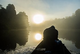 Rio Novo River | |
| IUCN Category - Ia (Strict Nature Reserve) | |
| basic information | |
| Square | 33 731 km² (3 373 133.89 ha) |
| Established | February 17, 2005 |
| Management organization | Chico Mendes Institute for Biodiversity |
| Location | |
| A country |
|
| State | Couple |
| Nearest town | Uruara |

Content
Description
Terra do Meiu Ecological Station is located in the state of Para , in the municipalities of Altamira and Sant Feliz do Xingu [1] . It covers an area of 33 731 km² (3 373 133.89 ha) [2] . Created February 17, 2005 [2] .
Terra do Meiu is located between the Xingu River and its left tributary, Iriri , which flows through the station from south to north. The full flow of rivers varies greatly depending on the season; a decrease in water level in the dry season forms waterfalls, rocks and rapids [1] .
Soils are mostly poor in nutrients [1] .
The climate type according to Köppen's classification is the equatorial monsoon . The air temperature is almost the same at any time of the year, the average annual temperature is 26.16 ° C. The absolute minimum is 19.4 ° C (in July), the absolute maximum is 33.2 ° C (in August). The average annual rainfall is about 2024 mm, monthly - from 38 mm in July to 314 mm in February and March. Rain falls about 240 days a year [3] .
| Climate Terra do Meuil | |||||||||||||
|---|---|---|---|---|---|---|---|---|---|---|---|---|---|
| Indicator | Jan | Feb | March | Apr | May | June | July | Aug | Sep | Oct | Nov | Dec | Year |
| Absolute maximum, ° C | 30.5 | 30.3 | 30,4 | 30.7 | 31,4 | 32 | 32,5 | 33,2 | 32.9 | 32,7 | 32,2 | 31.1 | 33,2 |
| Average temperature, ° C | 25.7 | 25.6 | 25.7 | 26 | 26.3 | 26 | 25.9 | 26.5 | 26.7 | 26.9 | 26.6 | 26.1 | 26.16 |
| Absolute minimum, ° C | 21.1 | 20.9 | 21.1 | 21.3 | 21,2 | 20.1 | 19,4 | 19.8 | 20.6 | 21.1 | 21,2 | 21.1 | 19,4 |
| The average number of days with precipitation | 31 | 28,2 | 31 | thirty | 27.1 | 13.9 | 12 | 4.8 | 6.3 | 11.2 | 12,4 | 30,2 | 19.8 |
| Precipitation rate, mm | 251.7 | 313.9 | 313.3 | 258.5 | 147.7 | 72.8 | 37.7 | 59.6 | 78.9 | 119.8 | 158.9 | 211.1 | 2024 |
| Source: Global Species | |||||||||||||
Biodiversity
Terra do Meiu belongs to the ecoregion of the rainforests of Tapajosa Shingu [3] . The predominant type of vegetation is open rainforests with vines, occupying 76% of the station; another 18.4% is covered by open tropical forests with forest stands . The rest of the area is occupied by dense rain forests with a uniform canopy , open rain forests with palm trees and dense alluvial forests [1] .
Migratory birds are represented by osprey ( Pandion haliaetus ), spotted carrier ( Actitis macularius ), purple forest swallow ( Progne subis ), shoregrass ( Riparia riparia ) and village swallow ( Hirundo rustica ); endemic are white-crested penelope ( Penelope pileata ), green-winged trumpeter ( Psophia viridis ), gold-faced malopaktopila ( Malacoptila rufa ), two-lane arasari ( Pteroglossus bitorquatus ), Worm Ant ( Myrmotherula sclateri ), large brook ant ( Hypocnemoides maculicauda ), Amazonian tailless ant nest ( Hylopezus berlepschi ), striped true woodpecker ( Dendrocolaptes certhia ) [1] . The endangered white-faced koata ( Ateles marginatus ) is widespread [2] .
Security
Terra do Meuil is classified as IUCN Ia (strict natural reserve) [4] . The goal of creating an ecological station is to preserve the unique Amazonian jungle and support scientific research [1] . The governing body is the Chico Mendes Institute for Biodiversity Conservation [2] .
The environmental management plan was published on December 23, 2015; while environmentalists had to deal with the interests of land speculators, settlers and traditional communities. Traditional communities with valuable knowledge of nature remained within the ecological station and were involved in the management of its territory [5] .
Terra do Meuu is part of a large conservation complex in the southern state of Para. It borders in the north with the Indian territory of Kararao (3308 km²) and the territory of sustainable nature management Iriri River (3990 km²); in the west - with the Indian territory of Kuruaia (1667 km²) and the Iriri Regional Forest (4392 km²); in the south-west - with the Native American territory of Bau (15 409 km²); in the south - with the Indian territories of Mencragnoti ( 49,142 km²) and Cayapo (32 840 km²); in the east - with the national park of Serra do Pardo (4454 km²), the conservation area of Triunfu do Xingu (16 784 km²) and the territory of sustainable nature management of the Xingu River (3030 km²) [4] .
Notes
- ↑ 1 2 3 4 5 6 Unidade de Conservação: ESTAÇÃO ECOLÓGICA DA TERRA DO MEIO (port.) (Unavailable link) . MMA: Ministério do Meio Ambiente. Date accessed July 24, 2017. Archived October 1, 2018.
- ↑ 1 2 3 4 Esec da Terra do Meio (port.) (Unavailable link) . Instituto Chico Mendes de Conservação da Biodiversidade. Date of treatment July 24, 2017. Archived on August 16, 2016.
- ↑ 1 2 Terra do Meio Ecological Station (inaccessible link) . Global Species. Date of treatment July 24, 2017. Archived March 17, 2017.
- ↑ 1 2 Estação Ecológica Da Terra Do Meio in Brazil . ProtectedPlanet. Date of treatment July 24, 2017.
- ↑ Plano de Manejo da Estação Ecológica da Terra do Meio (EETM) (port) . Nave Terra (02.22.2016). Date of treatment July 25, 2017.