Piran Bay or Piran Bay ( Slovenian Piranski zaliv [1] Croatian Piranski zaljev or Croatian Savudrijska vala , Italian Baia di Pirano [2] [3] ) - the bay located in the northern part of the Adriatic Sea is part of the southern tip of the bay Trieste .
| Piran Bay | |
|---|---|
| Slovene. Piranski zaliv , Horv. Piranski zaljev | |
 Piran Bay | |
| Characteristics | |
| Area | 19 km² |
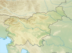
| Location | |
| Countries |
|
The bay was named after the city of Piran . The coast of the gulf is divided between Croatia and Slovenia . The Gulf of Piran is separated by a line connecting Cape Savudria in the south to Cape Madona in the north and is about 19 km². Since the 1990s, the name of the Gulf of Savudria has been used in Croatia .
The cities of Piran , Portoroz and are located on the eastern Slovenian coast of the bay. The tourist camps Crveni Vrh and Kanegra, built in the 1980s, are located on the southern coast of Croatia. The main river flowing into the bay is . Along the estuary of Dragonia are the , whose area is 650 hectares .
The Bay Area was a theater of war in a border dispute on land and at sea between Slovenia and Croatia. After World War II, the area from Trieste in the north to the Mirna River in the south was part of the Free Territory of Trieste . In 1954, the territory was conditionally divided between Italy and Yugoslavia ; the division was finally secured by a treaty in Osimo in 1975. The first delimitation project formed the basis of the proposals of both countries (Slovenia and Croatia) after independence by both in 1991. Slovenia proposed to establish borders in the Gulf of Piran based on the situation of the city of Piran . Slovenia changed the project next year, declaring the entire bay its property on June 5, 1992 . Since then, Slovenia has continued to insist on this position .
The name “Bay of Savudrii” was originally used as the name for part of the bay. In 2000, it came into use as the name for the whole gulf by local Croatian fishermen and was quickly accepted first by Croatian journalists, then by local authorities, and finally at the state level, which led to its appearance on official maps. Such actions contradict the established practice of defining geographical names and are seen by the Slovenian authorities as an attempt to establish historical ties with the bay to strengthen the position in the dispute. Another name “Dragonia Bay” was introduced in Croatia, but was not widely used [4] .
Notes
- ↑ Poimenovanja Piranskega zaliva . - Založba ZRC, 2014 .-- ISBN 9789612547011 .
- ↑ Istarska enciklopedija (inaccessible link) . istra.lzmk.hr. Date of treatment July 4, 2017. Archived on August 12, 2016.
- ↑ Parabureau, Zagreb, Croatia, www.parabureau.com, info@parabureau.com. istrapedia | Piranski zaljev . istrapedia.hr. Date of treatment July 4, 2017.
- ↑ Jure Šonje. Dictionary of the Croatian language. - year 2000. - 210 p. - ISBN 978-953-0-40009-2 . - ISBN 953-6036-64-9 .
Literature
- Kladnik, Drago; Pipan, Primož; Gašperič, Primož Poimenovanja Piranskega zaliva , Založba ZRC, 2014, ( COBISS ), ISBN 978-961-254-701-1
- Zalar, Matej Potepanja 4, Slovenska in hrvaška Istra As-Press, Ljubljana, 2011, ( COBISS ) ISBNː 978-961-92578-5-2
- Vinčec, Milan Istraː Koper, Izola, Piranː kulturno turistični vodnik Arsvideo, Koper, 2009, ( COBISS ) ISBNː 978-961-269-087-8