Konotop district ( Ukrainian: Konotop district , [konoˈtɔpsʲkɪj rɑˈjɔn̪] , pronunciation ) Is an administrative-territorial entity in the Sumy region of Ukraine .
| area | |||||
| Konotop district | |||||
|---|---|---|---|---|---|
| Ukrainian Konotop district | |||||
| |||||
| A country | Ukraine | ||||
| Included in | Sumy region | ||||
| Adm. Centre | Konotop | ||||
| History and Geography | |||||
| Date of formation | |||||
| Square | 1,667 km² | ||||
| Timezone | EET ( UTC + 2 , summer UTC + 3 ) | ||||
| Population | |||||
| Population | 27 798 [1] people ( 2018 ) | ||||
| Official language | Ukrainian | ||||
| Digital identifiers | |||||
| Telephone code | +380 5447 | ||||
| Postal codes | 41600 | ||||
| KOATUU | 5922000000 all codes | ||||
 | |||||
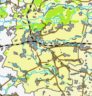 | |||||


Geographical position
Konotop district is located in the west of Sumy region . Krolevetsky , Putivlsky , Burynsky and Romensky districts of the Sumy region, Talalayevsky , Bakhmachsky and Koropsky districts of the Chernihiv region are adjacent to it.
The administrative center of the district is the city (since 1638 ) Konotop , which is not part of the district.
The Seim , Kukolka , Jezuch , Kanava Novaya Kosova , Krosna , Romen and Maly Romen rivers flow through the district.
Population
In 1979, the district population was 68.6 thousand people, in 2001 - 39 567 people (including urban - 3 016 people, rural - 36 551 people).
As of January 1, 2017, the population of the district was 28.6 thousand people (2.5 thousand urban and 26.1 thousand rural) [2] .
History
The lands on which Konotop district is located have long attracted people. This is evidenced by the numerous finds discovered during archaeological excavations. In Konotopshchina there are 272 archaeological sites: temporary sites of ancient times, settlements, hillforts, mounds. They belong to different eras - from the Stone Age to the times of Kievan Rus . The oldest villages in Konotopshchyna are the villages of Melnya - the first mention dates back to 1500 and Karabutovo - 1572 , as well as the village of Great Sambir, which has been known since the beginning of the 16th century .
In 1635, part of the land became part of the Chernihiv Voivodeship of the Commonwealth.
In the summer of 1659 in these places there was a battle of Konotop between the Russian troops of the voivode Alexei Trubetskoy , the Cossacks of the hetman Vygovsky and the Crimean Tatar troops. The battle took place on the field between the villages of Sosnovka and Shapovalovka.
On June 17, 1672, on the territory of the modern village of Kozatskoye, in the Kozatskoy oak forest on the Kozatskiy Rada, Ivan Samoilovich was elected hetman of the left-bank of Ukraine.
Over the long history of the region, its administrative borders have repeatedly changed. By order of Catherine II in 1782, these lands entered the Novgorod-Seversk governorate , and from 1802 into the Chernigov province . In the 1920s, instead of provinces, districts were created, Konotop district entered the Konotop district.
The date of creation of the Konotop district is considered to be 1923 , when it became an independent administrative-territorial unit, which included Konotop, Borznyansky and Krolevets counties. In 1932, with the transition to a three-stage administrative-territorial system: district-region-center - five regions were created, and Konotop district for a while became part of the Kiev region .
With the creation of the Sumy region on January 10, 1939, Konotop and Dubovyazovsky districts were transferred to its structure.
During the Great Patriotic War in 1941-1943. the area was occupied by German troops
After the war, the region changed its borders three times. In 1957, eight villages were added to the district, and in 1960 another 6 villages of the former Dubovyazovsky district; in 1963, the villages of Dukhanovka and Deptovka were annexed.
Administrative device
The area includes [3] :
|
|
Local councils [4]
|
|
Settlements [5]
with. Andreevskoe | with. Kalishenkovo | with. Crayfish |
Eliminated Settlements [6]
with. Nuts | with. Kut |
Famous People
Born in the area
- Bandura, Alexander Viktorovich (born 1986) - footballer Metallurg ( Donetsk ).
- Dutkin, Alexei Ivanovich (1902-1972) - Soviet military leader, Major General ( October 1, 1942 ).
- Ren, Viktor Alekseevich (born 1951 ) - test instructor in aerospace technology, parachutist - test , deputy head of the 3rd Directorate of the Cosmonaut Training Center named after Yu. A. Gagarin , Colonel , Hero of the Russian Federation ( 2005 ).
Notes
- ↑ Number of population (for estimate) on 1st Sunday of 2018 // Head of statistics department in Sumy region
- ↑ Social-economic passport of Konotop district / official site of Konotop district state administration
- ↑ According to the district’s registration card on the website of the Verkhovna Rada of Ukraine.
- ↑ Regions of Ukraine and warehouse
- ↑ Warehouse of administrative and territorial units
- ↑ Regulatory acts of the administrative and territorial administration of Ukraine (inaccessible link)
Literature
- History of cities and villages of the Ukrainian SSR. Sumy region. - p. 266-296