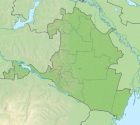
Chikirlya (also Gavryushkino [2] ) is a lake in Russia , in the Priyutnensky district of Kalmykia . Located in the central part of the Kumo-Manych depression east of the village of Quarantine [3] . Belongs to the Manych river basin . Belongs to the Manych Lake Group .
| Lake | |
| Chikirla ( Gavryushkino ) | |
|---|---|
| Morphometry | |
| Square | 1.1 km² |
| Location | |
| A country |
|
| The subject of the Russian Federation | Kalmykia |
| Area | Priyutnensky district |
| Identifiers | |
| HWR : | |
The lake is drying up. The surface area of the lake is up to 1.1 km² [4] . The lake has an oblong shape, occupies a natural lowering of the terrain, stretched from the northwest to southeast for more than 6 km. The lake reaches its maximum width in the northwestern part (up to 0.55 km). The steep banks of the lake [2]
Climate around the lake: temperate continental . Winter is mostly cloudy, moderately cold, relatively snowy. Summer is warm, cloudy. A stable manifestation of not only an arid, but also a dry-arid type of weather is characteristic of the Primanichy. The average air temperature in spring is + 7-9 ° C, in summer + 21-24 ° C, in autumn + 7-11 ° C, in winter −8-9 ° C. The average annual temperature is about + 8-9 ° С. Rainfall ranges from 300 to 400 mm. The prevailing winds are east, south-east, less often west [5] .
Notes
- ↑ Surface Water Resources of the USSR: Hydrological Understanding. T. 7. Donskoy district / ed. D. D. Mordukhai-Boltovsky. - L .: Gidrometeoizdat, 1964 .-- 267 p.
- ↑ 1 2 Topographic maps of the USSR L-38 (A) 1: 100000. The Republic of Kalmykia and the Rostov Region.
- ↑ Map of the General Staff of the Red Army of the central part of Kalmykia • 1 km.
- ↑ State Water Register . Chikirla . textual.ru . Ministry of Natural Resources of Russia (March 29, 2009). Date of treatment December 20, 2018. Archived March 29, 2009.
- ↑ Lakes Manych-Gudilo and East Manych / Volume 3 / Wetlands of Russia