Zharly [1] (obsolete. Jarly , Kara-su ) is a river in the Karaganda region of Kazakhstan . Belongs to the basin of Lake Saumalkol .
| Zharly | |
|---|---|
| kaz. Zharly | |
| Characteristic | |
| Length | 156 km |
| Swimming pool | 5660 km² |
| Water consumption | 0.32 m³ / s |
| Watercourse | |
| Source | |
| • Coordinates | |
| Mouth | Saumalkol |
| • Coordinates | |
| Location | |
| A country |
|
| Region | Karaganda region |
| Area | Karkaraly district |
Geography
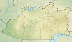
The river originates on the slopes of Mount Duactas. It flows north. In the upper reaches is called Aktas , in the middle reaches - Koktal [2] , in the lower - Zharly . It flows through the villages of Akshoky , Zharly (s.O. Nurken), Tegisshildik , Zharli (Tegisshildik s.o.), Kalinino , Koktas . The river ends in one of the irrigation canals east of the village of Novy Put [3] [4] . Previously flowed into Lake Saumalkol .
The length of the river is 156 km, the catchment area is 5660 km². The average annual water flow rate is 0.32 m³ / s. Ground, snow and rain food. It freezes in November and opens in April [5] .
Notes
- ↑ Map sheet M-43 .
- ↑ Map sheet M-43-115 Enbek . Scale: 1: 100,000. Status of the terrain for 1981. 1985 edition
- ↑ Map sheet M-43-78 Matak . Scale: 1: 100,000. State of the terrain for 1985. 1989 Edition
- ↑ Issues of geography of Kazakhstan. Volume 5 Academy of Sciences of the Kazakh SSR., 1959
- ↑ "Kazakh encyclopedias"
When writing this article, material from the publication Kazakhstan. National Encyclopedia ”(1998-2007), provided by the editors of the“ Kazakh Encyclopedia ”under a Creative Commons BY-SA 3.0 Unported license .