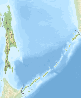
Toporkovy (previously Jap. Iwaki ; Banzio-willow [1] ; on the Russian map of 1745 , Baray [2] [3] ) is a small volcanic island of the middle group of the Great Kuril Islands with an area of about 1.0 km². On the shores of his nest hatchets , hence the modern Russian name [4] .
| Hatchet | |
|---|---|
| Specifications | |
| Square | 1 km² |
| Highest point | 70 m |
| Population | 0 people |
| Location | |
| Archipelago | Big Kuril ridge |
| Water area | Sea of Okhotsk |
| A country |
|
| The subject of the Russian Federation | Sakhalin region |

Content
Geography
It grew at the site of the eruption of several small underwater volcanoes [1] . It has an oval shape. The island is often shrouded in fog , so it is a danger to navigation [5] . From the shores of the larger and higher island of Matua, the top end separates the strait with a width of 1.3-1.8 km [6] .
History
In 1924 , around the island of Toporkovoy, the Japanese described two striking vapor columns, representing eruptions of underwater volcanoes , whose peaks are approximately 150 m below sea level [4] .
There was once a Japanese raid in a convenient bay of the strait, there were moorings [7] .
Since 1945, the island is part of the RSFSR , since 1991 as part of the Russian Federation. Administratively part of the Kuril urban district of the Sakhalin region . Uninhabited. It requires further study, since it is assumed that it is connected with Matua by underground tunnels [8] .
Flora and fauna
In 1977, the ornithologist Velizhanin established what Fr. Hatchet is the southern boundary of the seabird of the species of short-tailed skua . A repeated study of the species in June 2000 found on the island 15 individuals of this species of dark morph, including three nesting pairs and 2 downy chicks [9] . The island has only two landscape sections, so its flora is rather poor [10] .
Notable Facts
During the eruption of the Sarychev volcano on Matua in 1946 , volcanic bombs flew through the Dual Strait (1.6 km) to Toporkovy Island [4] .
See also
- Island Toporkov . Archipelago Commander Islands .
Notes
- ↑ 1 2 http://www.kuriles-history.ru/up/lib/volcano.pdf
- ↑ Russian National Library. Atlas of the Russian Empire in 1745. Atlas maps. expositions.nlr.ru. The appeal date is May 30, 2017.
- ↑ 39. The mouth of the Amur River with the southern part of Kamchatka and the various islands located on the Eastern Ocean between which one can also see a part of Japan (English) . Flickr. The appeal date is June 16, 2017.
- ↑ 1 2 3 http://analitikaru.ru/2016/05/14/rossijskaya-ekspediciya-polna-reshimosti-otkryt-tajny-kurilskogo-ostrova-matua/
- Photos http://photos.wikimapia.org/p/00/01/34/11/34_big.jpg
- ↑ The defense role of the "mysterious island" Matua
- ↑ The second Russian expedition will go to Matua in 2017 | RIA Novosti - events in Russia and the world: topics of the day, photos, videos, infographics, radio
- ↑ To the avifauna of the Kuril Islands - the topic of a scientific article on fisheries and aquaculture, read the free text of the research work in the electronic library of Cyber…
- ↑ http://www.izdatgeo.ru/pdf/gipr/2012-2/87.pdf