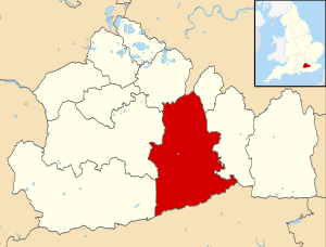
Mole Valley is a non-metropolitan district in Surrey ( England ). The administrative center is the city of Dorking .
| Mol valley | |
|---|---|
| English Mole valley | |
| A country | United Kingdom |
| Included in | Surrey |
| Adm. center | Dorking |
| History and Geography | |
| Date of formation | April 1, 1974 |
| Area | 258.3 km² |
| Population | |
| Population | 86 234 people ( 2014 ) |
 | |
Content
- 1 Geography
- 2 History
- 3 Composition
- 4 References
Geography
The area is located in the central part of Surrey , bordered in the north by the London boron Kingston upon Thames , in the south - with the county of West Sussex .
History
The district was formed on April 1, 1974 as a result of the unification of urban areas ( Eng. Urban district ) Dorking , Letterhead and rural areas ( Eng. Rural District ) Dorking and Horley .
Composition
The district includes 2 cities:
- Dorking
- Letherhead
and 13 communities ( English civil parish ).
- Abinger
- Batchworth
- Brockham
- Buckland
- Capel
- Charlwood
- Headley
- Holmwood
- Lee
- Mickham
- New digate
- Oakley
- Watton