Holbitsa ( Belor. Galbitsa ), in the upper reaches of Zarezhanka - a river in the Vitebsk region of Belarus , the right tributary of the Disna River. The length of the river is 63 km, the catchment area is 1050 km², the average annual flow rate at the mouth is 6.6 m³ / s, the average slope of the water surface is 0.97 m / km [1] .
| Holbitsa | |
|---|---|
| Belor. Galbitsa | |
| Characteristic | |
| Length | 63 km |
| Swimming pool | 1050 km² |
| Water consumption | 6.6 m³ / s |
| Watercourse | |
| Source | |
| • Coordinates | |
| Mouth | Disna |
| • Height | below 119.7 m |
| • Coordinates | |
| River slope | 0.97 m / km |
| Location | |
| Water system | Disna → Western Dvina → Baltic Sea |
| A country |
|
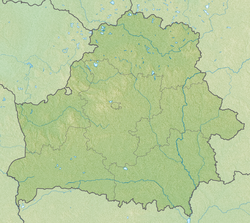
| Regions | Vitebsk region , Minsk region |
| Areas | Dokshitsy district , Postavy district , Sharkovshchinsky district , Myadelsky district |
The source of the river near the village of Glinsky, 25 km northwest of the city of Dokshitsy . The river flows mainly in the Postavy district , in the upper reaches it flows along its border with the Dokshitsy district , on a small section along the border with the Myadel district of the Minsk region , and on the last kilometers of the stream forms its border with the Sharkovshchinsky district . Up to Lake Golbeya is called Zarezhanka, after leaving this lake - Golbitsa [2] . It flows from the source to the west, at the village of Sergeevich turns to the north.
It flows in the upper reaches within the boundaries of the Sventsian Upland , in the lower - along the Polotsk Lowland . The valley is trapezoidal, its width is 200-400 m. The floodplain is 50-150 m wide. The channel in the upper reaches is canalized for 11 km, in the middle and lower reaches it is 20-30 m wide. In the middle course, there are lakes Zadnoe and Golbeya, ponds about the villages of Kezik (area 22 hectares), Dunilovichi (area 22 hectares), the urban village of Voropaevo (area 47 hectares) [1] .
The main tributaries are Amshara, Shuritsa , Polovitsa (left); Chertka, Korneevka, Lasitsa, Birch (right).
The largest settlements on the river are the urban village of Voropaevo ; agro-town Dunilovichi ; villages and villages of Sergeevich, Golbei, Guta, Voitekhi
It flows into Disna near the village of Kurilovichi.
Notes
- ↑ 1 2 Belarus Black Book: Etsyklapedyya / redkal: N. A. Dzisko i insh. - Minsk: BelEn , 1994 .-- 415 p. - 10,000 copies. - ISBN 5-85700-133-1 . (belor.)
- ↑ Map sheet N-35-31 Voropaevo . Scale: 1: 100,000. State of the terrain for 1983. 1986 edition
Literature
- Nature of Belarus: Popular Encyclopedia / Editorial: I.P. Shamyakin (Ch. Ed.) And others. - 2nd ed. - Mn. : BelSE named after P. Brovka, 1989 .-- 599 p. - 40,000 copies. - ISBN 5-85700-001-7 .
- Enceclapedia prodrody Belarusі / Redkal .: І. P. Shamyakin (gal. Red.) І інш. - Mn. : BelSE , 1983. - T. 1. Aality - Gassts. - 575 s. (belor.)