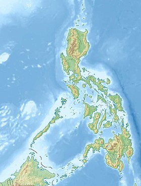
Lingayen [1] ( English Lingayen Gulf ) - a bay in the western part of the island of Luzon , Philippines . Administratively belongs to the Ilokos region, washes the shores of the provinces of Pangasinan and La Union .
| Lingaen | |
|---|---|
| English Lingayen gulf | |
 Beach. In the background are the mountains of Central Cordillera . | |
| Characteristics | |
| Bay Type | The bay |
| Area | about 2100 km² |
| Flowing river | Agno |
| Location | |
| Upstream water area | South China Sea |
| A country |
|
| Region | Ilocos |
| Provinces | Pangasinan |
- This toponym also has other meanings - see .
Content
- 1 Geography, description
- 2 History
- 3 Gallery
- 4 notes
Geography Description
The bay has a conditionally rectangular shape, has a size of 55 by 35 kilometers and an area of about 2100 km². In its water area (in the western part) there are several islands: , and the National Park " One Hundred Islands ", consisting of 124 islets.
On the shore of the bay there are several cities (in an arc from the north-east to north-west): San Fernando , , , , , , , , , , , , , , , .
Several rivers flow into the bay, the largest of which is Agno [2] .
The southern part of the bay from San Fabian to Labrador is a long gray sand beach 35 km long. The bottom of the bay is sandy, because of which the water in it is cloudy.
Since 1999, a 1294-megawatt plant has been operating on the bay in Sual. It is the largest power plant of its kind in the country; the height of the chimney is a record 226 meters [3] .
History
On December 22, 1941, the 14th Japanese Army landed on the eastern shore of Lingen Bay. Having defeated without difficulty in a few small skirmishes the poorly armed scattered groups of and American [4] defenders, the Japanese quickly captured the entire bay. He remained for more than three years. On January 6–9, 1945, Lingen Bay became the site of a major battle between the Japanese and American armies. From the US side, more than 875 ships and more than 203 thousand soldiers participated in it, their losses amounted to 24 sunken ships and 67 damaged. Japanese losses are unknown. The victory was won by the Americans [5] .
In memory of this battle, a war memorial was built on the bay in .
Historically, coral reefs were present in the bay, but all of them were destroyed during active “ dynamite fishing ”.
Gallery
Sunset over the Bay
In the National Park " One Hundred Islands "
Agno - the largest river flowing into the bay
San Fernando - the largest city on the bay
Power Station Suala
US ships enter Lingen Bay, January 1945
The War Memorial in , erected in memory of a
Notes
- ↑ Map sheet E-51-XXXI .
- ↑ McManus, edited by Liana T. The Coastal Environmental Profile of Lingayen Gulf, Philippines / edited by Liana T. McManus, Chua Thia-Eng. - Manila, Philippines: Published by International Center for Living Aquatic Resources Management on behalf of the Association of Southeast Asian Nations / United States Coastal Resources Management Project, 1990. - P. 2. - ISBN 9789711022495 .
- ↑ Coal-Fired Power Plants in the Philippines - Sual on industcards.com
- ↑ Between 1898 and 1946, the Philippines belonged to the United States.
- ↑ Lingayen Gulf on pacificwrecks.com