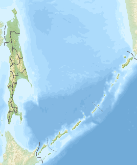
Baikal is an inland bay of the Sakhalin Bay of the Sea of Okhotsk off the northern coast of Sakhalin Island .
| Baykal Bay | |
|---|---|
| Specifications | |
| Bay type | Bay |
| Average tide | 2 m |
| Deepest | 25 m |
| Average depth | 15 m |
| Salinity | 21.24 ‰ |
| Flowing rivers | Big Nelma , Lupus , Cobzak , Big , Polishchuk |
| Location | |
| Upstream water area | Sakhalin Bay |
| A country |
|
| The subject of the Russian Federation | Sakhalin region |
| Area | City District "Ohinsky" |

On the shores of the bay is the village Moskalvo [1] .
Hydronim
Opened in 1846 by the commander of the ship "Konstantin" A. M. Gavrilov, who called him Cheating , as the bay was initially adopted in the fog as an entrance to the Amur Liman [2] . Subsequently, it was named after the Russian military transport " Baikal ", which in 1849 under the command of G. I. Nevelskoy conducted research at the mouth of the Amur [3] .
General data
Baykal Bay is a predominantly shallow water (depth from 0.5 to 25 m [4] ) reservoir, jutting into the coast south of the Bay of Pomry . The width of the bay at the entrance is 20 km. Most of the Baykal Bay is a vast littoral , exposed during low tides. Tides irregular daily allowance, their value is about 2 m.
From the north, Baykal Bay is separated from the Sakhalin Bay by the low sandy island of Ush , which divides the entrance to the Eastern and Western passages. The fairway leading to the port of Moskalvo runs along the Eastern Passage, the maximum depth of which is 21 m. Along the coast of the gulf a drying is stretched in a wide strip [5] .
In the Bay of Baikal there is the Gryaznaya Bay and several small bays without a name.
In November, the bay freezes. The ice period is not less than 200 days [6] .
On the shores of the Baikal Bay, swampy peat and peat-gley soils of lowland and high bogs and dry-peaty illuvially multi-humus soils dominate [6] .
Notes
- ↑ Map sheet N-54-82 Kolendo . Scale: 1: 100,000. State of the area in 1999. 2003 edition
- ↑ K. M. Braslavets. History in the names on the map of the Sakhalin region. - Yuzhno-Sakhalinsk: Far Eastern book publishing house, 1983. - p. 15. - 144 p. - 10 000 copies
- ↑ Toponymic Dictionary of Sakhalin Region . www.balonline.ru . The appeal date is May 3, 2019.
- ↑ "O. N. Mukhametova. Some features of the formation of the ichthyoplankton complex in Baykal Bay (North-West Sakhalin) ”. Readings in memory of Vladimir Yakovlevich Levanidov. 2011. Vol. 5. P.386 . biosoil.ru . The appeal date is May 3, 2019.
- ↑ "T. A. Mogilnikova, E. M. Latkovskaya, T. G. Koreneva. Hydrochemical conditions for the development of summer phytoplankton hall. Baikal (Northwest Sakhalin) ”. Readings in memory of Vladimir Yakovlevich Levanidov. 2011. Vol. 5. P.360 . www.biosoil.ru . The appeal date is May 3, 2019.
- ↑ 1 2 Baykal Bay and Die. Brief information about the wetland . www.fesk.ru. The appeal date is May 3, 2019.