Ashibibak [2] - a river in the Sol-Iletsky district of the Orenburg region , the left tributary of the Donguz ( Ural basin).
| Ashibutak | |
|---|---|
| Characteristic | |
| Length | 15 km |
| Watercourse | |
| Source | |
| • Height | OK. 200 m |
| • Coordinates | |
| Mouth | Donguz |
| • Coordinates | |
| River slope | 4-4.5 m / km |
| Location | |
| Water system | Donguz → Ural → Caspian Sea |
| A country |
|
| Region | Orenburg region |
| Area | Sol-Iletsky district |
| HWR code | |
Geography
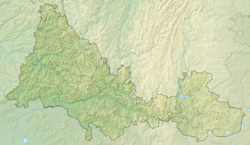
The length of the watercourse is 15 km [3] . It originates about 5 km south of the village of Mayakskoye [4] . It flows north through the village, as well as through Maloprudnoye and the village of Aschebutak [5] . It flows into Donguz along the left bank 73 km from its mouth. The drain is regulated.
Water registry data
According to the state water register of Russia, it belongs to the Ural basin district , the water sector of the river is the Russian part of the Ural basin below the confluence of the river. Sakmara without r. Ilek. The river basin is the Urals (the Russian part of the basin) [3] .
The code of the object in the state water registry is 120100010121121200007207 [3] .
Notes
- ↑ Surface Water Resources of the USSR: Hydrological Understanding. T. 12. Lower Volga and Western Kazakhstan. Vol. 2. Ural-Emba region / ed. Z. G. Markova. - L .: Gidrometeoizdat, 1966 .-- 152 p.
- ↑ Register of names of geographical objects on the territory of the Orenburg Region as of December 20, 2017
- ↑ 1 2 3 State Water Register . Ashibibak . textual.ru . Ministry of Natural Resources of Russia (March 29, 2009). Date of treatment December 20, 2018. Archived March 29, 2009.
- ↑ Map sheet M-40-27-Aa - FSUE GOSGISCENTER
- ↑ Map sheet M-40-15-C - FSUE GOSGISCENTER