Kuklyanka is a river in the Far East of Russia . It flows through the territory of the Chaunsky district of the Chukotka Autonomous Region . The length of the river is 26 km, its catchment area is 73.6 km² [2] .
| Pupa | |
|---|---|
| Characteristic | |
| Length | 26 km |
| Pool | 73.6 km² |
| Watercourse | |
| Source | |
| • Location | Chukchi Highlands |
| • Height | > 476 m |
| • Coordinates | |
| Mouth | Konewam |
| • Height | 163 m |
| • Coordinates | |
| Location | |
| Water system | Konewam → Rauchua → East Siberian Sea |
| A country |
|
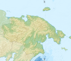
| Region | Chukotka Autonomous Region |
| Area | Chaunsky district |
| HWR Code | |
The name comes from itelm. kavelyu , transformed into Russian. A “ kukhlyanka ” is a special type of top fur clothing of northern peoples [3] .
It takes sources on the northern slopes of the Central Mountain, smoothly bending the arc, flows in the northeast direction through the territory of the Chaun lowland (in the lower reaches surrounded by marshes) [4] , flows into Konevam on the left. The Mink creek flows into the Kuklyanka.
Near the river is the mining village of Baraniha . In the upper reaches, an alluvial gold deposit is being actively developed [5] .
Notes
- ↑ Surface water resources of the USSR: Hydrological knowledge. T. 19. Northeast / ed. Yu. N. Komarnitskaya. - L .: Gidrometeoizdat, 1966. - 602 p.
- ↑ State Water Register . Kuklyanka . textual.ru . Ministry of Environment of Russia (March 29, 2009). The appeal date was December 20, 2018. Archived March 29, 2009.
- Ть Leontyev V. V. , Novikova K. A. Toponymic Dictionary of the North-East of the USSR / scientific. ed. G. A. Menovshchikov ; Far East Academy of Sciences of the USSR . North-East. complex. SRI. Lab archeology, history and ethnography. - Magadan: Magad. Prince publishing house , 1989. - p. 211. - 456 p. - 15 000 copies - ISBN 5-7581-0044-7 .
- ↑ Map sheet R-59-B, Pevek G. Scale: 1: 500,000. Edition 1986.
- ↑ Nedra DV